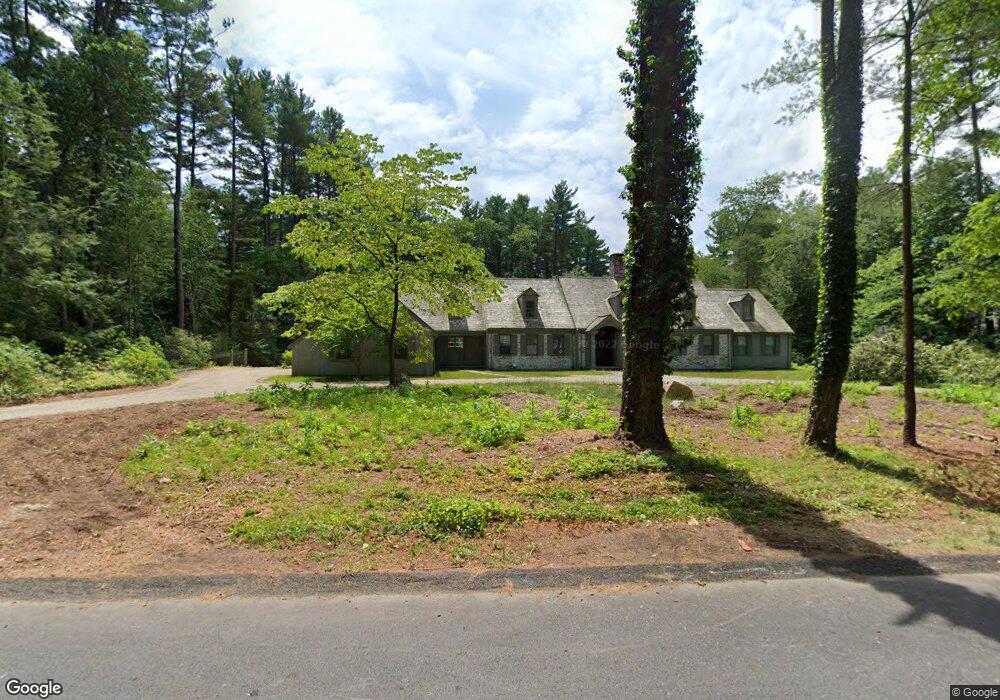
39 Sylvan Ln Weston, MA 02493
Estimated Value: $3,164,040 - $4,272,000
4
Beds
4
Baths
4,863
Sq Ft
$711/Sq Ft
Est. Value
About This Home
This home is located at 39 Sylvan Ln, Weston, MA 02493 and is currently estimated at $3,459,760, approximately $711 per square foot. 39 Sylvan Ln is a home located in Middlesex County with nearby schools including Country Elementary School, Woodland Elementary School, and Weston Middle School.
Ownership History
Date
Name
Owned For
Owner Type
Purchase Details
Closed on
May 28, 2021
Sold by
Shapiro Robin L and Shapiro Donald R
Bought by
Betts Robert and Betts Jayme
Current Estimated Value
Home Financials for this Owner
Home Financials are based on the most recent Mortgage that was taken out on this home.
Original Mortgage
$1,990,400
Outstanding Balance
$1,804,859
Interest Rate
3%
Mortgage Type
Purchase Money Mortgage
Estimated Equity
$1,654,901
Create a Home Valuation Report for This Property
The Home Valuation Report is an in-depth analysis detailing your home's value as well as a comparison with similar homes in the area
Home Values in the Area
Average Home Value in this Area
Purchase History
| Date | Buyer | Sale Price | Title Company |
|---|---|---|---|
| Betts Robert | $2,488,000 | None Available |
Source: Public Records
Mortgage History
| Date | Status | Borrower | Loan Amount |
|---|---|---|---|
| Open | Betts Robert | $1,990,400 |
Source: Public Records
Tax History Compared to Growth
Tax History
| Year | Tax Paid | Tax Assessment Tax Assessment Total Assessment is a certain percentage of the fair market value that is determined by local assessors to be the total taxable value of land and additions on the property. | Land | Improvement |
|---|---|---|---|---|
| 2025 | $29,219 | $2,632,300 | $1,063,800 | $1,568,500 |
| 2024 | $28,195 | $2,535,500 | $1,063,800 | $1,471,700 |
| 2023 | $26,976 | $2,278,400 | $1,063,800 | $1,214,600 |
| 2022 | $25,219 | $1,968,700 | $1,014,300 | $954,400 |
| 2021 | $21,446 | $1,652,200 | $966,900 | $685,300 |
| 2020 | $20,728 | $1,615,600 | $966,900 | $648,700 |
| 2019 | $20,289 | $1,611,500 | $966,900 | $644,600 |
| 2018 | $20,241 | $1,618,000 | $966,900 | $651,100 |
| 2017 | $20,063 | $1,618,000 | $966,900 | $651,100 |
| 2016 | $19,784 | $1,627,000 | $966,900 | $660,100 |
| 2015 | $19,169 | $1,561,000 | $921,300 | $639,700 |
Source: Public Records
Map
Nearby Homes
- 5 Upham Way Unit 5
- 169 Hickory Rd
- 168 Beaver Rd
- 120 Rockport Rd
- 620 South Ave
- 19 Northgate Rd
- 19 Louis Dr
- 100 Westcliff Rd
- 46 Royalston Rd
- 51 Boulder Brook Rd
- 6 Steepletree Ln
- 33 Royalston Rd
- 0 Wellesley St
- 45 Mayo Rd
- 428 Weston Rd
- 22 Fox Hill Dr
- 50 Upson Rd
- 12 Cutting Cross Way
- 17 Smokey Hill Rd
- 106 Willow Brook Dr Unit 106