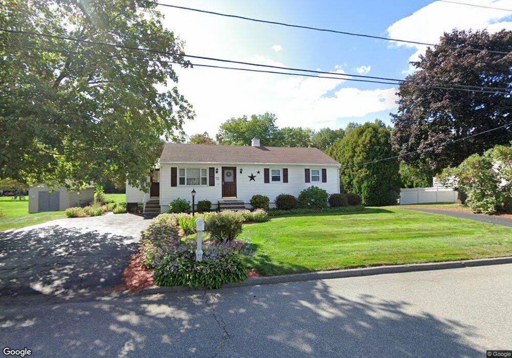
39 Temple Dr Methuen, MA 01844
The West End NeighborhoodEstimated Value: $663,152 - $765,000
2
Beds
3
Baths
2,693
Sq Ft
$269/Sq Ft
Est. Value
About This Home
This home is located at 39 Temple Dr, Methuen, MA 01844 and is currently estimated at $725,288, approximately $269 per square foot. 39 Temple Dr is a home located in Essex County with nearby schools including Marsh Grammar School, Methuen High School, and Fellowship Christian Academy.
Ownership History
Date
Name
Owned For
Owner Type
Purchase Details
Closed on
Jul 8, 2021
Sold by
Zembruski Catherine A
Bought by
Catherine Zembruski T and Catherine Zembruski
Current Estimated Value
Purchase Details
Closed on
Apr 2, 2008
Sold by
Zembruski Allan J and Zembruski Catherine A
Bought by
Zembruski Catherine A
Home Financials for this Owner
Home Financials are based on the most recent Mortgage that was taken out on this home.
Original Mortgage
$150,000
Interest Rate
6.06%
Mortgage Type
Purchase Money Mortgage
Create a Home Valuation Report for This Property
The Home Valuation Report is an in-depth analysis detailing your home's value as well as a comparison with similar homes in the area
Home Values in the Area
Average Home Value in this Area
Purchase History
| Date | Buyer | Sale Price | Title Company |
|---|---|---|---|
| Catherine Zembruski T | -- | None Available | |
| Catherine Zembruski T | -- | None Available | |
| Catherine Zembruski T | -- | None Available | |
| Zembruski Catherine A | -- | -- | |
| Zembruski Catherine A | -- | -- | |
| Zembruski Catherine A | -- | -- |
Source: Public Records
Mortgage History
| Date | Status | Borrower | Loan Amount |
|---|---|---|---|
| Previous Owner | Zembruski Catherine A | $137,000 | |
| Previous Owner | Zembruski Catherine A | $142,913 | |
| Previous Owner | Zembruski Catherine A | $150,000 |
Source: Public Records
Tax History
| Year | Tax Paid | Tax Assessment Tax Assessment Total Assessment is a certain percentage of the fair market value that is determined by local assessors to be the total taxable value of land and additions on the property. | Land | Improvement |
|---|---|---|---|---|
| 2025 | $5,720 | $540,600 | $236,800 | $303,800 |
| 2024 | $5,745 | $529,000 | $216,000 | $313,000 |
| 2023 | $5,414 | $462,700 | $192,000 | $270,700 |
| 2022 | $5,215 | $399,600 | $160,000 | $239,600 |
| 2021 | $4,899 | $371,400 | $152,000 | $219,400 |
| 2020 | $4,888 | $363,700 | $152,000 | $211,700 |
| 2019 | $4,625 | $325,900 | $136,000 | $189,900 |
| 2018 | $4,516 | $316,500 | $136,000 | $180,500 |
| 2017 | $4,379 | $298,900 | $136,000 | $162,900 |
| 2016 | $4,188 | $282,800 | $128,000 | $154,800 |
| 2015 | $4,059 | $278,000 | $128,000 | $150,000 |
Source: Public Records
Map
Nearby Homes
- 296 Pelham St
- 9 Quail Run Dr
- 220 Pelham St
- 42 Perley St
- 10 Piedmont St
- 65 Pinehurst Ave
- 2 Westwind Dr
- 14 Tedesco Rd
- 35 Cross St
- 146 Hampshire Rd
- 37 Maplewood Ave
- 20 Ruskin Ave
- 290 Salem Rd
- 7 Mystic St
- 8-10 Elsmere Ave
- 21 Hampshire Rd Unit 412
- 19 Hampshire Rd Unit 304
- 351 Peters Pond Dr
- 514 Lowell St
- 46 Pelham St