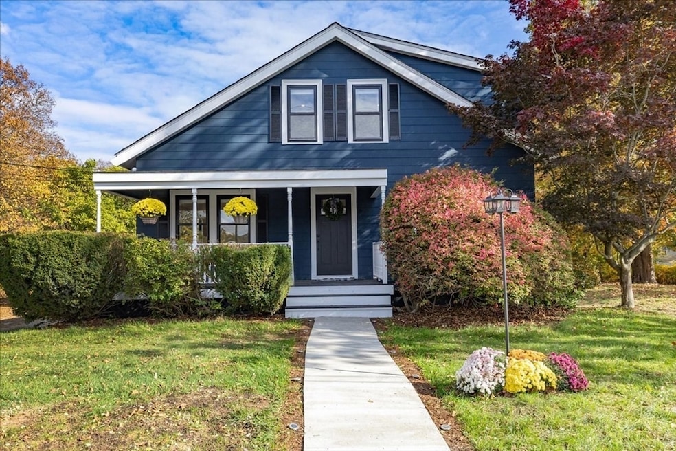
39 Trask St Beverly, MA 01915
North Beverly NeighborhoodEstimated payment $6,770/month
Highlights
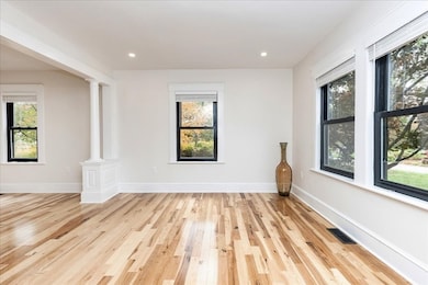
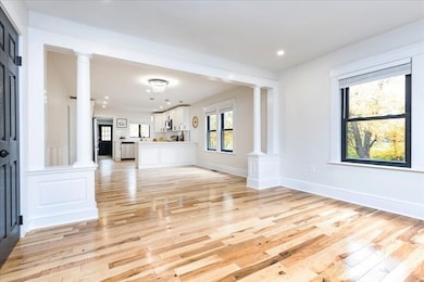
- Open Floorplan
- Wood Flooring
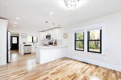
- Solid Surface Countertops
- Deck
- Mud Room
- Home Office
About This Home
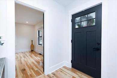
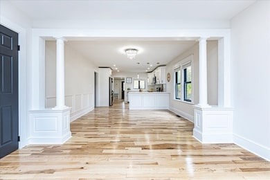
Spacious Multi-Family Gem in North Beverly – 3 Finished Levels, Energy-Efficient Upgrades, and Rental Opportunity.Welcome to 39 Trask Street, a beautifully remodeled multi-family home in desirable North Beverly. With 3 finished levels and 3,637 sq. ft., this home offers 6 bedrooms, 3 full baths, and multiple living areas, ideal for multigenerational living, guests, or rental income. Enjoy modern upgrades including new electric, plumbing, heating, roof, hardwood floors, efficient heat pumps, and energy-efficient appliances. Set on a generous, scenic, tree-lined lot with a wrap-around driveway, this home combines space, style, and North Beverly charm. Endless possibilities await!Seller will cover up to $10,000 for closing cost credit ***
Property Details
Home Type
- Multi-Family
Est. Annual Taxes
- $7,336
Year Built
- Built in 1946
Home Design
- Duplex
- Frame Construction
- Concrete Perimeter Foundation
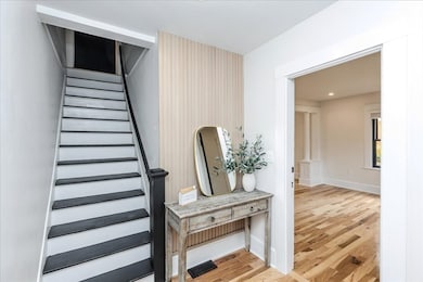
Interior Spaces
- Property has 2 Levels
- Open Floorplan
- Crown Molding
- Mud Room
- Family Room
- Combination Dining and Living Room
- Home Office
- Washer and Dryer
- Finished Basement
Kitchen
- Cooktop
- Microwave
- ENERGY STAR Qualified Refrigerator
- Plumbed For Ice Maker
- ENERGY STAR Qualified Dishwasher
- Solid Surface Countertops
- Disposal
Flooring
- Wood
- Tile
Bedrooms and Bathrooms
- 6 Bedrooms
- Walk-In Closet
- 3 Full Bathrooms
Parking
- 13 Car Parking Spaces
- Driveway
- 13 Open Parking Spaces
- Off-Street Parking
Outdoor Features
- Balcony
- Deck
- Covered Patio or Porch
Utilities
- Forced Air Heating and Cooling System
- 2 Cooling Zones
- Heat Pump System
- 200+ Amp Service
Community Details
- 2 Units
Listing and Financial Details
- Assessor Parcel Number 4189809
Map
Home Values in the Area
Average Home Value in this Area
Tax History
| Year | Tax Paid | Tax Assessment Tax Assessment Total Assessment is a certain percentage of the fair market value that is determined by local assessors to be the total taxable value of land and additions on the property. | Land | Improvement |
|---|---|---|---|---|
| 2025 | $7,336 | $667,500 | $416,100 | $251,400 |
| 2024 | $7,017 | $624,800 | $373,400 | $251,400 |
| 2023 | $6,426 | $570,700 | $328,600 | $242,100 |
| 2022 | $6,453 | $530,200 | $288,100 | $242,100 |
| 2021 | $6,015 | $473,600 | $253,900 | $219,700 |
| 2020 | $5,508 | $429,300 | $213,200 | $216,100 |
| 2019 | $5,165 | $391,000 | $195,900 | $195,100 |
| 2018 | $4,755 | $349,600 | $178,600 | $171,000 |
| 2017 | $4,710 | $329,800 | $153,600 | $176,200 |
| 2016 | $4,167 | $289,600 | $134,400 | $155,200 |
| 2015 | $4,086 | $289,600 | $134,400 | $155,200 |
Property History
| Date | Event | Price | List to Sale | Price per Sq Ft |
|---|---|---|---|---|
| 01/08/2026 01/08/26 | Pending | -- | -- | -- |
| 01/02/2026 01/02/26 | Price Changed | $1,199,000 | -6.3% | $330 / Sq Ft |
| 12/17/2025 12/17/25 | Price Changed | $1,279,000 | -5.3% | $352 / Sq Ft |
| 12/12/2025 12/12/25 | Price Changed | $1,350,000 | -5.4% | $371 / Sq Ft |
| 11/30/2025 11/30/25 | Price Changed | $1,427,000 | -1.6% | $392 / Sq Ft |
| 10/29/2025 10/29/25 | For Sale | $1,450,000 | -- | $399 / Sq Ft |
Purchase History
| Date | Type | Sale Price | Title Company |
|---|---|---|---|
| Quit Claim Deed | $620,000 | None Available | |
| Quit Claim Deed | $620,000 | None Available | |
| Quit Claim Deed | $360,000 | -- | |
| Deed | $192,500 | -- | |
| Deed | $192,500 | -- | |
| Deed | $15,000 | -- |
Mortgage History
| Date | Status | Loan Amount | Loan Type |
|---|---|---|---|
| Open | $785,000 | New Conventional | |
| Closed | $785,000 | New Conventional | |
| Previous Owner | $227,500 | No Value Available | |
| Previous Owner | $159,600 | No Value Available | |
| Previous Owner | $154,000 | Purchase Money Mortgage |
Source: MLS Property Information Network (MLS PIN)
MLS Number: 73449339
APN: BEVE M:0078 B:0010 L:
Disclaimer: Certain information contained herein is derived from information provided by parties other than Homes.com. All information provided is deemed reliable, but is not guaranteed to be accurate and should be independently verified.
![]() The property listing data and information, or the Images, set forth herein were provided to MLS Property Information Network, Inc. from third party sources, including sellers, lessors and public records, and were compiled by MLS Property Information Network, Inc. The property listing data and information, and the Images, are for the personal, non-commercial use of consumers having a good faith interest in purchasing or leasing listed properties of the type displayed to them and may not be used for any purpose other than to identify prospective properties which such consumers may have a good faith interest in purchasing or leasing. MLS Property Information Network, Inc. and its subscribers disclaim any and all representations and warranties as to the accuracy of the property listing data and information, or as to the accuracy of any of the Images, set forth herein.
The property listing data and information, or the Images, set forth herein were provided to MLS Property Information Network, Inc. from third party sources, including sellers, lessors and public records, and were compiled by MLS Property Information Network, Inc. The property listing data and information, and the Images, are for the personal, non-commercial use of consumers having a good faith interest in purchasing or leasing listed properties of the type displayed to them and may not be used for any purpose other than to identify prospective properties which such consumers may have a good faith interest in purchasing or leasing. MLS Property Information Network, Inc. and its subscribers disclaim any and all representations and warranties as to the accuracy of the property listing data and information, or as to the accuracy of any of the Images, set forth herein.

Ask me questions while you tour the home.