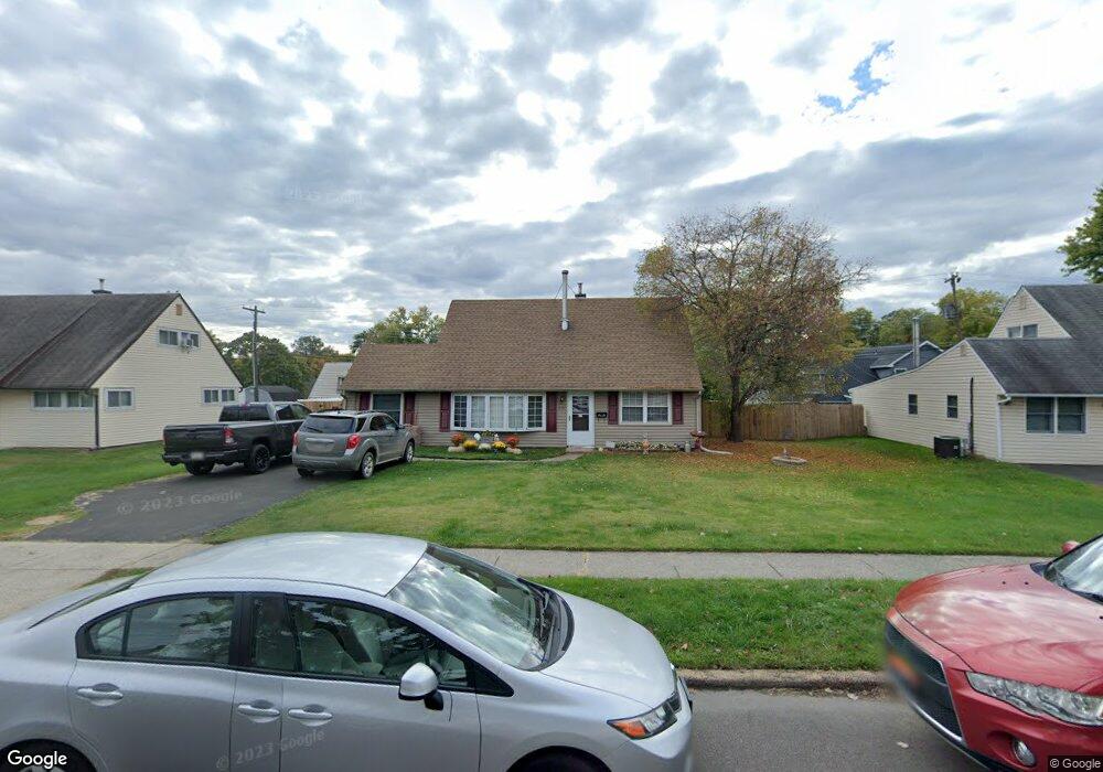
39 Tulip Tree Rd Levittown, PA 19056
Estimated Value: $405,244 - $440,000
4
Beds
2
Baths
1,594
Sq Ft
$262/Sq Ft
Est. Value
About This Home
This home is located at 39 Tulip Tree Rd, Levittown, PA 19056 and is currently estimated at $417,061, approximately $261 per square foot. 39 Tulip Tree Rd is a home located in Bucks County with nearby schools including Pearl S. Buck Elementary School, Maple Point Middle School, and Neshaminy High School.
Ownership History
Date
Name
Owned For
Owner Type
Purchase Details
Closed on
Jun 26, 1998
Sold by
Dugan Mark D and Dugan Phyllis D
Bought by
Bissonnette Norman and Bissonnette Tammy L
Current Estimated Value
Home Financials for this Owner
Home Financials are based on the most recent Mortgage that was taken out on this home.
Original Mortgage
$119,200
Outstanding Balance
$24,478
Interest Rate
7.04%
Estimated Equity
$392,583
Purchase Details
Closed on
Apr 6, 1989
Bought by
Dugan Mark D
Create a Home Valuation Report for This Property
The Home Valuation Report is an in-depth analysis detailing your home's value as well as a comparison with similar homes in the area
Home Values in the Area
Average Home Value in this Area
Purchase History
| Date | Buyer | Sale Price | Title Company |
|---|---|---|---|
| Bissonnette Norman | $125,500 | -- | |
| Dugan Mark D | $115,900 | -- |
Source: Public Records
Mortgage History
| Date | Status | Borrower | Loan Amount |
|---|---|---|---|
| Open | Bissonnette Norman | $119,200 |
Source: Public Records
Tax History Compared to Growth
Tax History
| Year | Tax Paid | Tax Assessment Tax Assessment Total Assessment is a certain percentage of the fair market value that is determined by local assessors to be the total taxable value of land and additions on the property. | Land | Improvement |
|---|---|---|---|---|
| 2025 | $4,267 | $19,600 | $4,320 | $15,280 |
| 2024 | $4,267 | $19,600 | $4,320 | $15,280 |
| 2023 | $4,199 | $19,600 | $4,320 | $15,280 |
| 2022 | $4,089 | $19,600 | $4,320 | $15,280 |
| 2021 | $4,089 | $19,600 | $4,320 | $15,280 |
| 2020 | $4,040 | $19,600 | $4,320 | $15,280 |
| 2019 | $3,950 | $19,600 | $4,320 | $15,280 |
| 2018 | $3,877 | $19,600 | $4,320 | $15,280 |
| 2017 | $3,778 | $19,600 | $4,320 | $15,280 |
| 2016 | $3,778 | $19,600 | $4,320 | $15,280 |
| 2015 | $4,174 | $19,600 | $4,320 | $15,280 |
| 2014 | $4,174 | $19,600 | $4,320 | $15,280 |
Source: Public Records
Map
Nearby Homes
- 20 Trellis Rd
- 212 Apple St
- 01 Kyle Ln
- 000 Kyle Ln
- 6 Handy Rd
- 114 Nursery Ave
- 59 Liberty Dr
- 107 Hollow Rd
- 8 Haven Rd
- 75 Flamehill Rd
- 208 Suffolk Rd
- 225 Yorkshire Rd Unit HIII
- 180 Andover Rd Unit A
- 88 Forsythia Dr N
- 1977 4th St
- 245 Trenton Rd
- 134 Lincoln Hwy Unit 11
- 479 Stanford Rd
- 53 Crestwood Rd
- 14 Harp Rd
- 37 Tulip Tree Rd
- 43 Tulip Tree Rd
- 112 Twin Oak Dr
- 110 Twin Oak Dr
- 116 Twin Oak Dr
- 33 Tulip Tree Rd
- 40 Tulip Tree Rd
- 47 Tulip Tree Rd
- 106 Twin Oak Dr
- 38 Tulip Tree Rd
- 46 Tulip Tree Rd
- 34 Tulip Tree Rd
- 120 Twin Oak Dr
- 29 Tulip Tree Rd
- 102 Twin Oak Dr
- 51 Tulip Tree Rd
- 20 Tinsel Rd
- 29 Thistle Rd
- 28 Tulip Tree Rd
- 124 Twin Oak Dr
