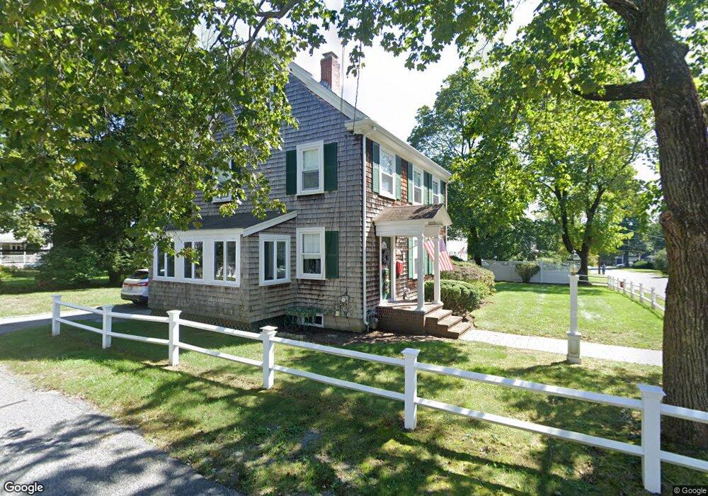
39 Vinald Rd Medfield, MA 02052
Estimated Value: $604,000 - $675,000
3
Beds
1
Bath
1,488
Sq Ft
$438/Sq Ft
Est. Value
About This Home
This home is located at 39 Vinald Rd, Medfield, MA 02052 and is currently estimated at $652,025, approximately $438 per square foot. 39 Vinald Rd is a home located in Norfolk County with nearby schools including Memorial School, Ralph Wheelock School, and Dale Street School.
Ownership History
Date
Name
Owned For
Owner Type
Purchase Details
Closed on
Apr 29, 2025
Sold by
Mcgoldrick Sheila L
Bought by
Walsh Conor and Walsh Dennis Anna
Current Estimated Value
Create a Home Valuation Report for This Property
The Home Valuation Report is an in-depth analysis detailing your home's value as well as a comparison with similar homes in the area
Home Values in the Area
Average Home Value in this Area
Purchase History
| Date | Buyer | Sale Price | Title Company |
|---|---|---|---|
| Walsh Conor | $670,000 | None Available | |
| Walsh Conor | $670,000 | None Available | |
| Walsh Conor | $670,000 | None Available |
Source: Public Records
Tax History
| Year | Tax Paid | Tax Assessment Tax Assessment Total Assessment is a certain percentage of the fair market value that is determined by local assessors to be the total taxable value of land and additions on the property. | Land | Improvement |
|---|---|---|---|---|
| 2025 | $8,134 | $589,400 | $352,800 | $236,600 |
| 2024 | $8,084 | $552,200 | $324,200 | $228,000 |
| 2023 | $8,008 | $519,000 | $308,000 | $211,000 |
| 2022 | $7,640 | $438,600 | $291,800 | $146,800 |
| 2021 | $7,470 | $420,600 | $283,700 | $136,900 |
| 2020 | $7,294 | $409,100 | $280,500 | $128,600 |
| 2019 | $7,110 | $397,900 | $272,300 | $125,600 |
| 2018 | $6,439 | $378,100 | $255,500 | $122,600 |
| 2017 | $6,288 | $372,300 | $249,700 | $122,600 |
| 2016 | $6,208 | $370,600 | $248,000 | $122,600 |
| 2015 | $5,731 | $357,300 | $241,100 | $116,200 |
| 2014 | $5,125 | $317,900 | $201,700 | $116,200 |
Source: Public Records
Map
Nearby Homes
Your Personal Tour Guide
Ask me questions while you tour the home.