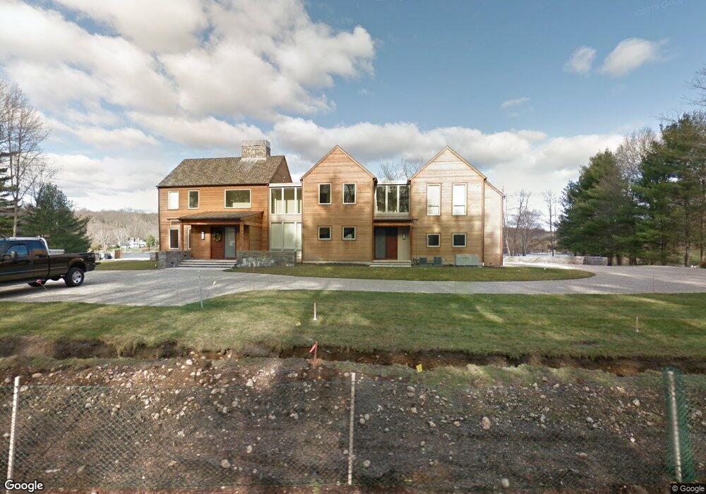
39 W Branch Rd Weston, CT 06883
Estimated Value: $2,332,000 - $3,712,000
6
Beds
6
Baths
6,020
Sq Ft
$529/Sq Ft
Est. Value
About This Home
This home is located at 39 W Branch Rd, Weston, CT 06883 and is currently estimated at $3,185,052, approximately $529 per square foot. 39 W Branch Rd is a home located in Fairfield County with nearby schools including Hurlbutt Elementary School, Weston Intermediate School, and Weston Middle School.
Ownership History
Date
Name
Owned For
Owner Type
Purchase Details
Closed on
Jul 1, 2003
Sold by
Franzoni Angela
Bought by
Bertasi Richard and Bertasi Sarah
Current Estimated Value
Home Financials for this Owner
Home Financials are based on the most recent Mortgage that was taken out on this home.
Original Mortgage
$1,450,000
Interest Rate
4.25%
Purchase Details
Closed on
Jul 6, 1988
Sold by
Vernilli N Richard
Bought by
Franzoni Augustus
Create a Home Valuation Report for This Property
The Home Valuation Report is an in-depth analysis detailing your home's value as well as a comparison with similar homes in the area
Home Values in the Area
Average Home Value in this Area
Purchase History
| Date | Buyer | Sale Price | Title Company |
|---|---|---|---|
| Bertasi Richard | $1,875,000 | -- | |
| Franzoni Augustus | $1,025,000 | -- |
Source: Public Records
Mortgage History
| Date | Status | Borrower | Loan Amount |
|---|---|---|---|
| Open | Franzoni Augustus | $2,360,000 | |
| Closed | Franzoni Augustus | $1,450,000 | |
| Previous Owner | Franzoni Augustus | $990,000 | |
| Previous Owner | Franzoni Augustus | $600,000 |
Source: Public Records
Tax History
| Year | Tax Paid | Tax Assessment Tax Assessment Total Assessment is a certain percentage of the fair market value that is determined by local assessors to be the total taxable value of land and additions on the property. | Land | Improvement |
|---|---|---|---|---|
| 2025 | $53,856 | $2,253,370 | $785,400 | $1,467,970 |
| 2024 | $52,887 | $2,253,370 | $785,400 | $1,467,970 |
| 2023 | $51,614 | $1,561,230 | $785,410 | $775,820 |
| 2022 | $51,474 | $1,561,230 | $785,410 | $775,820 |
| 2021 | $4,456 | $1,561,230 | $785,410 | $775,820 |
| 2020 | $50,537 | $1,561,230 | $785,410 | $775,820 |
| 2019 | $50,537 | $1,561,230 | $785,410 | $775,820 |
| 2018 | $45,249 | $1,539,600 | $678,300 | $861,300 |
| 2017 | $43,856 | $1,517,000 | $678,300 | $838,700 |
| 2016 | $43,326 | $1,517,000 | $678,300 | $838,700 |
| 2015 | $21,202 | $737,200 | $678,300 | $58,900 |
| 2014 | $33,721 | $1,194,100 | $678,300 | $515,800 |
Source: Public Records
Map
Nearby Homes
Your Personal Tour Guide
Ask me questions while you tour the home.