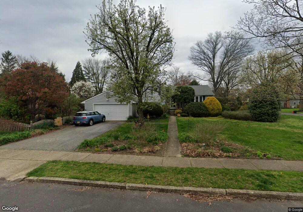
39 Wagon Bridge Run Moorestown, NJ 08057
Estimated Value: $534,000 - $702,514
--
Bed
--
Bath
2,336
Sq Ft
$279/Sq Ft
Est. Value
About This Home
This home is located at 39 Wagon Bridge Run, Moorestown, NJ 08057 and is currently estimated at $652,129, approximately $279 per square foot. 39 Wagon Bridge Run is a home located in Burlington County with nearby schools including Mary E. Roberts Elementary School, Moorestown Upper Elementary School, and William Allen Middle School.
Ownership History
Date
Name
Owned For
Owner Type
Purchase Details
Closed on
Apr 18, 2002
Current Estimated Value
Purchase Details
Closed on
Apr 18, 2001
Sold by
Wiseman Elizabeth A
Bought by
Schwartz Alix I and Wapner Karen E
Home Financials for this Owner
Home Financials are based on the most recent Mortgage that was taken out on this home.
Original Mortgage
$205,600
Interest Rate
6.88%
Create a Home Valuation Report for This Property
The Home Valuation Report is an in-depth analysis detailing your home's value as well as a comparison with similar homes in the area
Home Values in the Area
Average Home Value in this Area
Purchase History
| Date | Buyer | Sale Price | Title Company |
|---|---|---|---|
| -- | $257,000 | -- | |
| Schwartz Alix I | $257,000 | Weichert Title Agency |
Source: Public Records
Mortgage History
| Date | Status | Borrower | Loan Amount |
|---|---|---|---|
| Previous Owner | Schwartz Alix I | $205,600 |
Source: Public Records
Tax History Compared to Growth
Tax History
| Year | Tax Paid | Tax Assessment Tax Assessment Total Assessment is a certain percentage of the fair market value that is determined by local assessors to be the total taxable value of land and additions on the property. | Land | Improvement |
|---|---|---|---|---|
| 2025 | $10,318 | $363,700 | $191,000 | $172,700 |
| 2024 | $10,005 | $363,700 | $191,000 | $172,700 |
| 2023 | $10,005 | $363,700 | $191,000 | $172,700 |
| 2022 | $9,904 | $363,700 | $191,000 | $172,700 |
| 2021 | $9,773 | $363,700 | $191,000 | $172,700 |
| 2020 | $9,711 | $363,700 | $191,000 | $172,700 |
| 2019 | $9,540 | $363,700 | $191,000 | $172,700 |
| 2018 | $9,282 | $363,700 | $191,000 | $172,700 |
| 2017 | $9,362 | $363,700 | $191,000 | $172,700 |
| 2016 | $9,329 | $363,700 | $191,000 | $172,700 |
| 2015 | $9,216 | $363,700 | $191,000 | $172,700 |
| 2014 | $8,751 | $363,700 | $191,000 | $172,700 |
Source: Public Records
Map
Nearby Homes
- 11 E Sutton Ave
- 4 E Sutton Ave
- 310 S Washington Ave
- 32 Michaelson Dr
- 217 Hooton Rd
- 601 S Church St
- 5 E Coach Ln
- 129 S Church St
- 308 Kenwood Dr
- 4 W Close
- 35 Sisters Farmstead Dr
- 15 E 2nd St
- 167 Canterbury Rd
- 120 Canterbury Rd
- 66 E 3rd St
- 50 E 3rd St
- 82 E 3rd St
- 80 E 3rd St
- 133 Plum St Unit 6
- 660 S Church St
- 420 Toll House Ln
- 421 Parry Dr
- 417 Parry Dr
- 416 Toll House Ln
- 36 Wagon Bridge Run
- 421 Toll House Ln
- 28 Wagon Bridge Run
- 40 Wagon Bridge Run
- 417 Toll House Ln
- 413 Parry Dr
- 24 Wagon Bridge Run
- 413 Toll House Ln
- 44 Wagon Bridge Run
- 412 Toll House Ln
- 409 Parry Dr
- 20 Wagon Bridge Run
- 48 Wagon Bridge Run
- 409 Toll House Ln
- 436 Paul Dr
- 432 Paul Dr