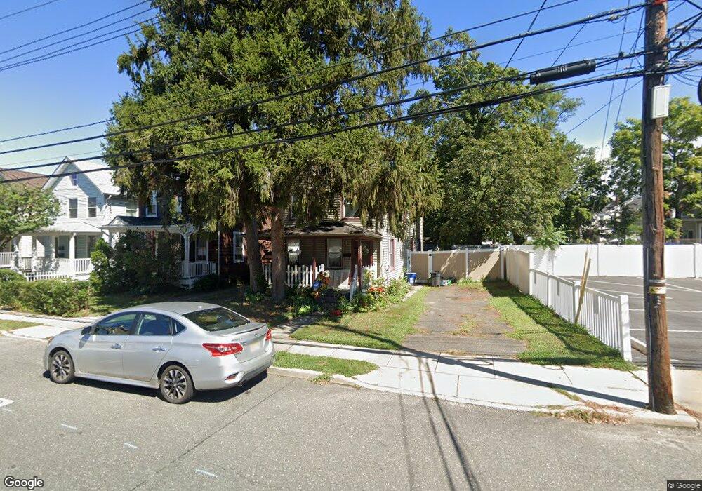
39 West St Red Bank, NJ 07701
Estimated Value: $570,146 - $652,000
2
Beds
2
Baths
1,368
Sq Ft
$457/Sq Ft
Est. Value
About This Home
This home is located at 39 West St, Red Bank, NJ 07701 and is currently estimated at $624,537, approximately $456 per square foot. 39 West St is a home located in Monmouth County with nearby schools including Red Bank Primary School, Red Bank Middle School, and Red Bank Reg High School.
Ownership History
Date
Name
Owned For
Owner Type
Purchase Details
Closed on
Jan 12, 2018
Sold by
Murtha Damon
Bought by
Murtha Damon and Urbont Nicole
Current Estimated Value
Home Financials for this Owner
Home Financials are based on the most recent Mortgage that was taken out on this home.
Original Mortgage
$247,000
Outstanding Balance
$138,827
Interest Rate
3.93%
Mortgage Type
New Conventional
Estimated Equity
$485,710
Purchase Details
Closed on
Feb 9, 2007
Sold by
Ernst Kathleen M
Bought by
Murtha Damon
Home Financials for this Owner
Home Financials are based on the most recent Mortgage that was taken out on this home.
Original Mortgage
$293,000
Interest Rate
6.23%
Mortgage Type
New Conventional
Create a Home Valuation Report for This Property
The Home Valuation Report is an in-depth analysis detailing your home's value as well as a comparison with similar homes in the area
Home Values in the Area
Average Home Value in this Area
Purchase History
| Date | Buyer | Sale Price | Title Company |
|---|---|---|---|
| Murtha Damon | -- | All Pro Title Group Llc | |
| Murtha Damon | $293,000 | -- |
Source: Public Records
Mortgage History
| Date | Status | Borrower | Loan Amount |
|---|---|---|---|
| Open | Murtha Damon | $247,000 | |
| Closed | Murtha Damon | $293,000 |
Source: Public Records
Tax History Compared to Growth
Tax History
| Year | Tax Paid | Tax Assessment Tax Assessment Total Assessment is a certain percentage of the fair market value that is determined by local assessors to be the total taxable value of land and additions on the property. | Land | Improvement |
|---|---|---|---|---|
| 2025 | $7,809 | $453,500 | $264,200 | $189,300 |
| 2024 | $7,805 | $413,400 | $231,700 | $181,700 |
| 2023 | $7,805 | $408,400 | $231,700 | $176,700 |
| 2022 | $8,154 | $400,800 | $231,700 | $169,100 |
| 2021 | $8,154 | $364,500 | $210,600 | $153,900 |
| 2020 | $7,977 | $351,100 | $210,600 | $140,500 |
| 2019 | $7,670 | $346,900 | $210,600 | $136,300 |
| 2018 | $7,475 | $341,800 | $210,600 | $131,200 |
| 2017 | $7,195 | $341,000 | $210,600 | $130,400 |
| 2016 | $7,113 | $337,600 | $210,600 | $127,000 |
| 2015 | $6,042 | $297,200 | $219,000 | $78,200 |
| 2014 | $5,685 | $297,200 | $219,000 | $78,200 |
Source: Public Records
Map
Nearby Homes
- 28 Riverside Ave Unit 2G
- 28 Riverside Ave Unit 2F
- 28 Riverside Ave Unit 1H
- 28 Riverside Ave Unit 9 G
- 42 Chestnut St
- 130 Bodman Place Unit 15
- 32 Earl St
- 24 River St
- 4 Boat Club Ct Unit 3E
- 195 Bridge Ave
- 24 Cedar Crossing
- 44 Waverly Place
- 17 Leroy Place Unit 3B
- 17 Leroy Place Unit 1C
- 23 Wallace St Unit 207
- 11 Wharf Ave Unit 3
- 205 Maple Ave
- 23 Cedar Crossing
- 3 Cedar Crossing
- 244 S Bridge Ave
- 37 West St
- 35 West St
- 33 West St
- 148 Monmouth St Unit 150
- 156 Monmouth St
- 33 Wall St Unit 35
- 144 Monmouth St Unit 146
- 42 West St
- 160 Monmouth St
- 162 Monmouth St
- 34 West St Unit 36
- 138 Monmouth St
- 166 Monmouth St
- 25 Wall St Unit 27
- 50 West St
- 28 West St Unit 30
- 29 Wall St
- 168 Monmouth St
- 22 West St
- 170 Monmouth St Unit 450