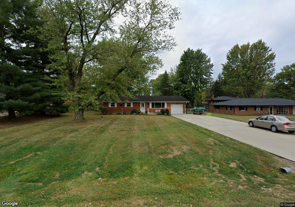
39 Williams Dr Georgetown, OH 45121
Estimated Value: $163,000 - $214,000
3
Beds
2
Baths
1,170
Sq Ft
$161/Sq Ft
Est. Value
About This Home
This home is located at 39 Williams Dr, Georgetown, OH 45121 and is currently estimated at $188,618, approximately $161 per square foot. 39 Williams Dr is a home located in Brown County with nearby schools including Georgetown Elementary School and Georgetown Jr/Sr High School.
Ownership History
Date
Name
Owned For
Owner Type
Purchase Details
Closed on
Sep 10, 2009
Sold by
The National Bank & Trust Co
Bought by
Taylor Jennifer D
Current Estimated Value
Home Financials for this Owner
Home Financials are based on the most recent Mortgage that was taken out on this home.
Original Mortgage
$63,186
Outstanding Balance
$41,720
Interest Rate
5.38%
Mortgage Type
FHA
Estimated Equity
$146,898
Purchase Details
Closed on
Jun 10, 2009
Sold by
Blevins Rhoda C
Bought by
The National Bank & Trust Co
Purchase Details
Closed on
Aug 21, 1996
Sold by
Richey Robert W
Bought by
Blevins Rhoda C
Home Financials for this Owner
Home Financials are based on the most recent Mortgage that was taken out on this home.
Original Mortgage
$65,000
Interest Rate
8.47%
Mortgage Type
New Conventional
Create a Home Valuation Report for This Property
The Home Valuation Report is an in-depth analysis detailing your home's value as well as a comparison with similar homes in the area
Home Values in the Area
Average Home Value in this Area
Purchase History
| Date | Buyer | Sale Price | Title Company |
|---|---|---|---|
| Taylor Jennifer D | $67,500 | 360 Settlement & Title Servi | |
| The National Bank & Trust Co | $60,000 | Attorney | |
| Blevins Rhoda C | $85,000 | -- |
Source: Public Records
Mortgage History
| Date | Status | Borrower | Loan Amount |
|---|---|---|---|
| Open | Taylor Jennifer D | $63,186 | |
| Previous Owner | Blevins Rhoda C | $65,000 |
Source: Public Records
Tax History
| Year | Tax Paid | Tax Assessment Tax Assessment Total Assessment is a certain percentage of the fair market value that is determined by local assessors to be the total taxable value of land and additions on the property. | Land | Improvement |
|---|---|---|---|---|
| 2024 | $1,602 | $45,250 | $8,270 | $36,980 |
| 2023 | $1,603 | $35,180 | $6,350 | $28,830 |
| 2022 | $1,357 | $35,180 | $6,350 | $28,830 |
| 2021 | $1,344 | $35,180 | $6,350 | $28,830 |
| 2020 | $1,190 | $29,320 | $5,290 | $24,030 |
| 2019 | $1,181 | $29,320 | $5,290 | $24,030 |
| 2018 | $1,173 | $29,320 | $5,290 | $24,030 |
| 2017 | $889 | $26,380 | $5,390 | $20,990 |
| 2016 | $889 | $26,380 | $5,390 | $20,990 |
| 2015 | $921 | $26,380 | $5,390 | $20,990 |
| 2014 | $921 | $25,890 | $4,900 | $20,990 |
| 2013 | $918 | $25,890 | $4,900 | $20,990 |
Source: Public Records
Map
Nearby Homes
- 20 Heritage Hill Dr
- 155 Free Soil Rd
- 470 Free Soil Rd
- 175 Douglas Cir
- 7480 Old Us Highway 68
- 25 Douglas Ln
- 505 S Water St
- 0 St Rt 221 & Footbridge Unit 1826509
- 510 W State St
- 666 E State St
- 708 E State St
- 406 E North St
- 405 N Main St
- 7029 Free Soil Rd
- 60 New St
- 399 Elmwood Ct
- 508 Mount Orab Pike
- 427 Kenwood Ave
- 1 N Kenwood Ave
- 2 N Kenwood Ave
- 29 Williams Dr
- 49 Williams Dr
- 59 Williams Dr
- 40 Curry Ridge Rd
- 40 Williams Dr
- 30 Curry Ridge Rd
- 312 Free Soil Rd
- 324 Free Soil Rd
- 60 Williams Dr
- 60 Curry Ridge Rd
- 334 Free Soil Rd
- 75 Williams Dr
- 21 Amy Dr
- 278 Free Soil Rd
- 70 Williams Dr
- 24 Amy Dr
- 266 Free Soil Rd
- 41 Curry Ridge Rd
- 31 Curry Ridge Rd
- 82 Williams Dr
Your Personal Tour Guide
Ask me questions while you tour the home.