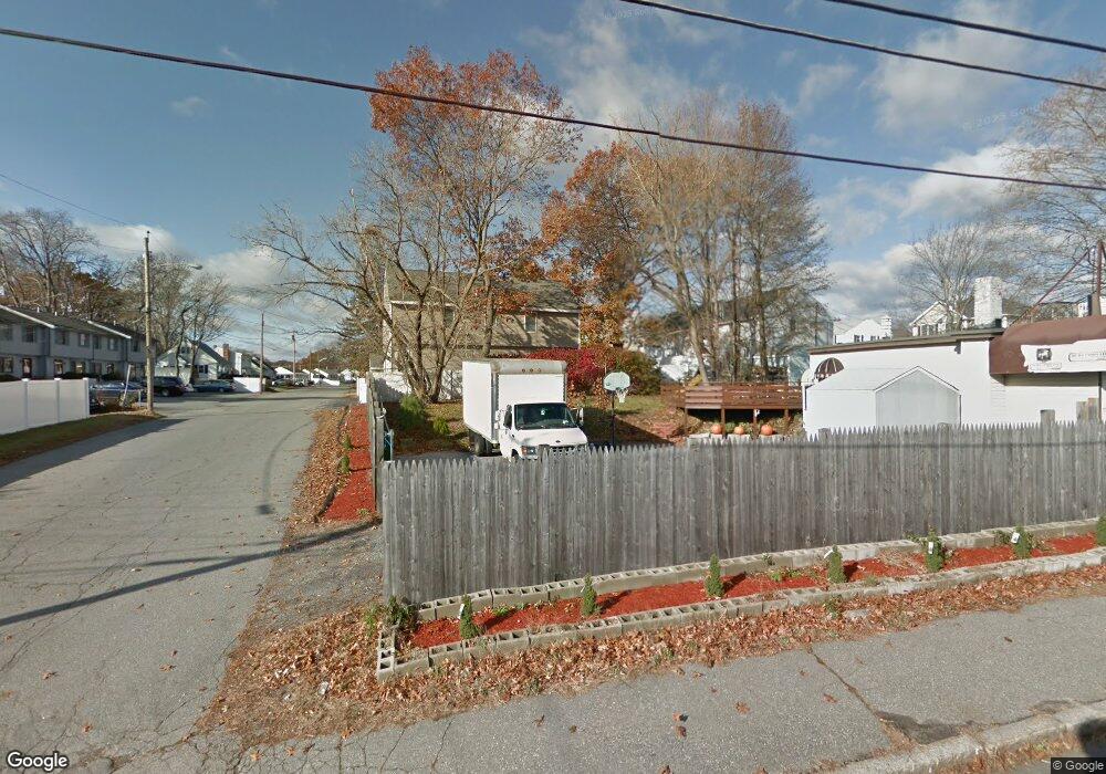
390 & 396 Riverside St Lowell, MA 01854
Pawtucketville Neighborhood
--
Bed
2
Baths
651
Sq Ft
7,405
Sq Ft Lot
About This Home
This home is located at 390 & 396 Riverside St, Lowell, MA 01854. 390 & 396 Riverside St is a home located in Middlesex County with nearby schools including Joseph McAvinnue Elementary School, Charlotte M. Murkland Elementary School, and Charles W. Morey Elementary School.
Ownership History
Date
Name
Owned For
Owner Type
Purchase Details
Closed on
Jan 13, 2012
Sold by
Langan John P and Langan Teresa G
Bought by
Tran Rick S
Home Financials for this Owner
Home Financials are based on the most recent Mortgage that was taken out on this home.
Original Mortgage
$103,200
Outstanding Balance
$70,819
Interest Rate
4%
Mortgage Type
Commercial
Create a Home Valuation Report for This Property
The Home Valuation Report is an in-depth analysis detailing your home's value as well as a comparison with similar homes in the area
Home Values in the Area
Average Home Value in this Area
Purchase History
| Date | Buyer | Sale Price | Title Company |
|---|---|---|---|
| Tran Rick S | $133,200 | -- | |
| Tran Rick S | $133,200 | -- |
Source: Public Records
Mortgage History
| Date | Status | Borrower | Loan Amount |
|---|---|---|---|
| Open | Tran Rick S | $103,200 | |
| Closed | Tran Rick S | $103,200 | |
| Previous Owner | Tran Rick S | $25,000 | |
| Previous Owner | Tran Rick S | $746,610 |
Source: Public Records
Tax History Compared to Growth
Tax History
| Year | Tax Paid | Tax Assessment Tax Assessment Total Assessment is a certain percentage of the fair market value that is determined by local assessors to be the total taxable value of land and additions on the property. | Land | Improvement |
|---|---|---|---|---|
| 2025 | $3,812 | $170,400 | $55,400 | $115,000 |
| 2024 | $3,851 | $165,500 | $55,400 | $110,100 |
| 2023 | $3,912 | $160,600 | $55,400 | $105,200 |
| 2022 | $3,983 | $158,200 | $55,400 | $102,800 |
| 2021 | $4,177 | $155,700 | $55,400 | $100,300 |
| 2020 | $4,168 | $155,700 | $55,400 | $100,300 |
| 2019 | $4,311 | $150,800 | $55,400 | $95,400 |
| 2018 | $4,319 | $147,200 | $55,400 | $91,800 |
| 2017 | $4,434 | $144,700 | $55,400 | $89,300 |
| 2016 | $4,405 | $141,100 | $55,400 | $85,700 |
| 2015 | $4,580 | $141,100 | $55,400 | $85,700 |
| 2013 | $2,656 | $84,800 | $55,400 | $29,400 |
Source: Public Records
Map
Nearby Homes
- 1820 Skyline Dr Unit 18
- 1410 Skyline Dr Unit 9
- 1710 Skyline Dr Unit 10
- 1600 Skyline Dr Unit 2
- 2200 Skyline Dr Unit 5
- 49 Tolman Ave
- 33 W Meadow Rd
- 25 W 5th Ave
- 61 7th Ave W
- 307 Pawtucket Blvd Unit 13
- 70 Pawtucket Dr
- 30 4th Ave
- 89 Mammoth Rd
- 295 Pawtucket Blvd Unit 7
- 10 3rd Ave
- 107 7th Ave
- 81 5th Ave
- 101 Laurie Ln
- 10 Clinton Ave
- 69 Coburn Dr
- Lot 2 Rosemont Aka 87 Lafayette St
- 51 & 65 Austin St
- 55 Mary Theresa Terrace
- 21 Independence Dr
- 49 Mary Theresa Terrace
- 10 Independence Dr
- 17 Freedom Way
- 50 Mary Theresa Terrace
- 41 Mary Theresa Terrace
- 24 Independence Dr
- 7 Freedom Way
- 69 Mary Theresa Terrace
- 25 Freedom Way
- 42 Mary Theresa Terrace
- 33 Mary Theresa Terrace
- 36 Patriot Way
- 12 Patriot Way
- 82 Mary Theresa Terrace
- 26 Patriot Way
- 50 Patriot Way