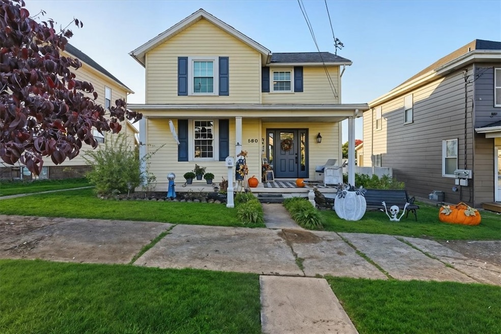
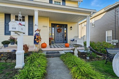
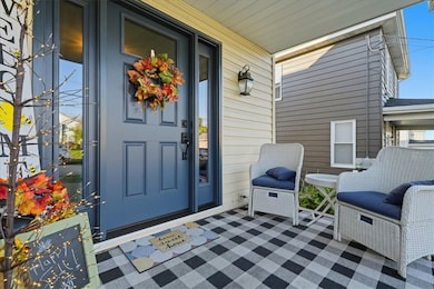
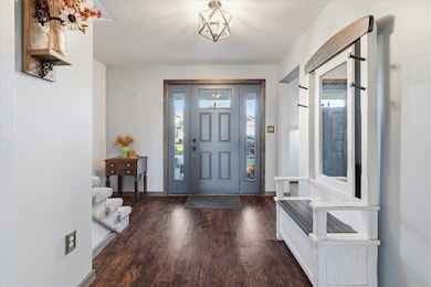
390 Braddock Ave Uniontown, PA 15401
Estimated payment $1,058/month
Highlights
- Forced Air Heating and Cooling System
- 2 Car Garage
- Carpet
About This Home
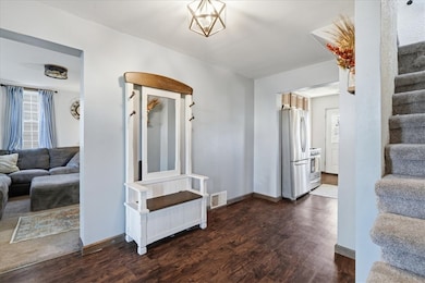
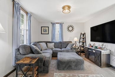
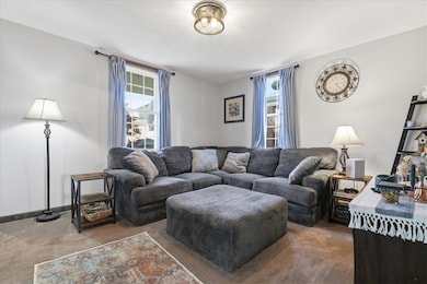
Welcome to 390 Braddock Avenue in Uniontown — a beautifully updated 3-bedroom, 1-bath home that combines modern touches with classic charm! Step inside to find generous-sized rooms throughout, featuring a spacious living room and dining room with built-in storage that adds both character and functionality. The kitchen shines with granite countertops, included appliances, and a must-see coffee bar nook perfect for your morning routine! Enjoy relaxing on the cozy covered front porch or entertaining on the back deck overlooking the fenced-in yard. A newer detached garage offers convenient off-street parking, while the clean, painted unfinished basement provides ample storage space.
Conveniently located near local shops, dining, and major routes, this move-in ready home is a must-see in the Uniontown area. Don’t miss your chance to call this one home! Seller is providing an HSA home warranty to buyer at closing! This property qualifies for grants!
Home Details
Home Type
- Single Family
Est. Annual Taxes
- $2,239
Year Built
- Built in 1920
Lot Details
- 5,663 Sq Ft Lot
- Lot Dimensions are 136x42
Home Design
- Asphalt Roof
- Vinyl Siding
Interior Spaces
- 1,496 Sq Ft Home
- 2-Story Property
- Unfinished Basement
Kitchen
- Stove
- Microwave
Flooring
- Carpet
- Vinyl
Bedrooms and Bathrooms
- 3 Bedrooms
- 1 Full Bathroom
Laundry
- Dryer
- Washer
Parking
- 2 Car Garage
- Garage Door Opener
Utilities
- Forced Air Heating and Cooling System
- Heating System Uses Gas
Listing and Financial Details
- Home warranty included in the sale of the property
Map
Home Values in the Area
Average Home Value in this Area
Tax History
| Year | Tax Paid | Tax Assessment Tax Assessment Total Assessment is a certain percentage of the fair market value that is determined by local assessors to be the total taxable value of land and additions on the property. | Land | Improvement |
|---|---|---|---|---|
| 2025 | $1,071 | $28,500 | $7,325 | $21,175 |
| 2024 | $1,038 | $28,500 | $7,325 | $21,175 |
| 2023 | $2,075 | $28,500 | $7,325 | $21,175 |
| 2022 | $2,031 | $28,500 | $7,325 | $21,175 |
| 2021 | $2,031 | $28,500 | $7,325 | $21,175 |
| 2020 | $2,000 | $28,500 | $7,325 | $21,175 |
| 2019 | $1,901 | $28,500 | $7,325 | $21,175 |
| 2018 | $1,834 | $28,500 | $7,325 | $21,175 |
| 2017 | $1,834 | $28,500 | $7,325 | $21,175 |
| 2016 | -- | $28,500 | $7,325 | $21,175 |
| 2015 | -- | $28,500 | $7,325 | $21,175 |
| 2014 | -- | $57,000 | $14,650 | $42,350 |
Property History
| Date | Event | Price | List to Sale | Price per Sq Ft |
|---|---|---|---|---|
| 10/22/2025 10/22/25 | For Sale | $164,900 | -- | $110 / Sq Ft |
Purchase History
| Date | Type | Sale Price | Title Company |
|---|---|---|---|
| Deed | $79,800 | None Available | |
| Deed | $50,800 | -- |
Mortgage History
| Date | Status | Loan Amount | Loan Type |
|---|---|---|---|
| Open | $78,354 | FHA |
Source: West Penn Multi-List
MLS Number: 1726696
APN: 38-11-0033
Disclaimer: Certain information contained herein is derived from information provided by parties other than Homes.com. All information provided is deemed reliable, but is not guaranteed to be accurate and should be independently verified.
![]() IDX information is provided exclusively for personal, non-commercial use, and may not be used for any purpose other than to identify prospective properties consumers may be interested in purchasing.
IDX information is provided exclusively for personal, non-commercial use, and may not be used for any purpose other than to identify prospective properties consumers may be interested in purchasing.
Information is deemed reliable but not guaranteed.
- 372 Braddock Ave
- 158 Clarendon Ave
- 354 Braddock Ave
- 220 Clarendon Ave
- 114 Clarendon Ave
- 71 Lebanon Ave
- 72 W Craig St
- 40 Miller Ave
- 54 W Craig St
- 39 Dunkard Ave
- 51 E Highland Ave
- 34 Chestnut St
- 120 Shaffer St
- 122 Shaffer St
- 17 Summit Ave
- 113 Washington Ave
- 348 1st St
- 0 Foreman Ave Derrick Ave Unit 1730532
- 33 Mccormick Ave
- 2 Mccormick Ave
- 114 W Berkeley St Unit 114
- 37 Kay St
- 92 W Main St Unit 210
- 41 Morgantown St Unit 7
- 41 Morgantown St Unit 5
- 15 W Church St Unit C
- 51 W Main St Unit 2
- 16 N Beeson Ave
- 36 Wilson Ave
- 131 Stockton Ave
- 105 Pittsburgh St Unit 2C
- 105 Pittsburgh St Unit 2D
- 9 Jacob St Unit 9 Rear
- 22 Lemon St
- 62 W Askren St
- 112 Confer Dr
- 66 Birch Rd
- 1013 Residence Dr
- 931 1st St
- 578 Filbert Orient Rd Unit A
