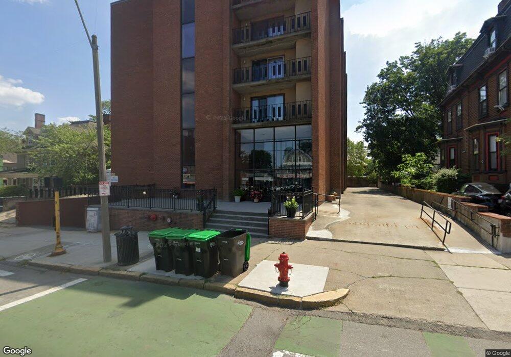
390 Broadway Unit 41 Somerville, MA 02145
Winter Hill NeighborhoodEstimated Value: $492,000 - $738,000
2
Beds
2
Baths
938
Sq Ft
$653/Sq Ft
Est. Value
About This Home
This home is located at 390 Broadway Unit 41, Somerville, MA 02145 and is currently estimated at $612,879, approximately $653 per square foot. 390 Broadway Unit 41 is a home located in Middlesex County with nearby schools including Somerville High School and Bright Future Educare Center.
Ownership History
Date
Name
Owned For
Owner Type
Purchase Details
Closed on
May 5, 2010
Sold by
Ravasoni Frank and Ravasoni Giorgio
Bought by
Ravasini Maria Lisa
Current Estimated Value
Home Financials for this Owner
Home Financials are based on the most recent Mortgage that was taken out on this home.
Original Mortgage
$220,924
Outstanding Balance
$147,931
Interest Rate
5.03%
Mortgage Type
Purchase Money Mortgage
Estimated Equity
$464,948
Purchase Details
Closed on
Dec 2, 1987
Sold by
Havens John H
Bought by
Ravasini Iolanda
Create a Home Valuation Report for This Property
The Home Valuation Report is an in-depth analysis detailing your home's value as well as a comparison with similar homes in the area
Home Values in the Area
Average Home Value in this Area
Purchase History
| Date | Buyer | Sale Price | Title Company |
|---|---|---|---|
| Ravasini Maria Lisa | $225,000 | -- | |
| Ravasini Iolanda | $149,000 | -- |
Source: Public Records
Mortgage History
| Date | Status | Borrower | Loan Amount |
|---|---|---|---|
| Open | Ravasini Maria Lisa | $220,924 | |
| Closed | Ravasini Iolanda | $0 |
Source: Public Records
Tax History
| Year | Tax Paid | Tax Assessment Tax Assessment Total Assessment is a certain percentage of the fair market value that is determined by local assessors to be the total taxable value of land and additions on the property. | Land | Improvement |
|---|---|---|---|---|
| 2025 | $5,086 | $466,200 | $0 | $466,200 |
| 2024 | $4,789 | $455,200 | $0 | $455,200 |
| 2023 | $4,838 | $467,900 | $0 | $467,900 |
| 2022 | $4,585 | $450,400 | $0 | $450,400 |
| 2021 | $4,590 | $450,400 | $0 | $450,400 |
| 2020 | $4,406 | $436,700 | $0 | $436,700 |
| 2019 | $4,461 | $414,600 | $0 | $414,600 |
| 2018 | $4,259 | $376,600 | $0 | $376,600 |
| 2017 | $4,023 | $344,700 | $0 | $344,700 |
| 2016 | $3,967 | $316,600 | $0 | $316,600 |
| 2015 | $3,579 | $283,800 | $0 | $283,800 |
Source: Public Records
Map
Nearby Homes
- 178 Central St
- 89 Heath St
- 115 Thurston St Unit I
- 19 Fenwick St Unit 4
- 51 Edgar Ave
- 52 Thurston St Unit 3
- 84 Partridge Ave
- 9 Norwood Ave
- 35 Henry St
- 0 Norwood Ave
- 79 Moreland St
- 496 Medford St
- 474 Broadway Unit 26
- 13 Leyden St
- 10 Bartlett St Unit 2
- 9 Dartmouth St
- 48 Ash Ave Unit B
- 658 Mystic Ave Unit B
- 658 Mystic Ave Unit A
- 185 School St
- 390 Broadway Unit C
- 390 Broadway Unit L3
- 390 Broadway Unit L2
- 390 Broadway Unit L1
- 390 Broadway Unit 65
- 390 Broadway Unit 64
- 390 Broadway Unit 63
- 390 Broadway Unit 62
- 390 Broadway Unit 61
- 390 Broadway Unit 55
- 390 Broadway Unit 54
- 390 Broadway Unit 53
- 390 Broadway Unit 52
- 390 Broadway Unit 51
- 390 Broadway Unit 45
- 390 Broadway Unit 44
- 390 Broadway Unit 43
- 390 Broadway Unit 42
- 390 Broadway Unit 35
- 390 Broadway Unit 34
Your Personal Tour Guide
Ask me questions while you tour the home.