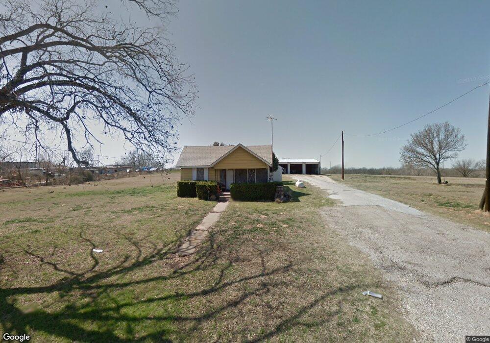
390 College St Poolville, TX 76487
Estimated Value: $227,894 - $393,000
--
Bed
--
Bath
1,212
Sq Ft
$236/Sq Ft
Est. Value
About This Home
This home is located at 390 College St, Poolville, TX 76487 and is currently estimated at $285,474, approximately $235 per square foot. 390 College St is a home located in Parker County with nearby schools including Poolville Elementary School, Poolville J High School, and Poolville High School.
Ownership History
Date
Name
Owned For
Owner Type
Purchase Details
Closed on
Nov 21, 2024
Sold by
Vick Rodney and Vick Pamela
Bought by
Vick Property Management & Leasing Llc
Current Estimated Value
Purchase Details
Closed on
Oct 13, 2023
Sold by
Rowney Brian and Rowney Emily
Bought by
Vick Rodney and Vick Pamela
Purchase Details
Closed on
Apr 13, 1977
Bought by
Rowney Billy
Create a Home Valuation Report for This Property
The Home Valuation Report is an in-depth analysis detailing your home's value as well as a comparison with similar homes in the area
Home Values in the Area
Average Home Value in this Area
Purchase History
| Date | Buyer | Sale Price | Title Company |
|---|---|---|---|
| Vick Property Management & Leasing Llc | -- | None Listed On Document | |
| Vick Rodney | -- | None Listed On Document | |
| Rowney Billy | -- | -- |
Source: Public Records
Tax History Compared to Growth
Tax History
| Year | Tax Paid | Tax Assessment Tax Assessment Total Assessment is a certain percentage of the fair market value that is determined by local assessors to be the total taxable value of land and additions on the property. | Land | Improvement |
|---|---|---|---|---|
| 2025 | $1,758 | $68,850 | $68,850 | -- |
| 2024 | $1,758 | $130,030 | $52,510 | $77,520 |
| 2023 | $1,758 | $130,030 | $52,510 | $77,520 |
| 2022 | $1,819 | $102,050 | $49,350 | $52,700 |
| 2021 | $1,866 | $102,050 | $49,350 | $52,700 |
| 2020 | $1,300 | $68,000 | $21,710 | $46,290 |
| 2019 | $1,401 | $68,000 | $21,710 | $46,290 |
| 2018 | $1,201 | $57,440 | $15,690 | $41,750 |
| 2017 | $1,224 | $57,360 | $15,610 | $41,750 |
| 2016 | $1,124 | $52,660 | $14,690 | $37,970 |
| 2015 | $707 | $52,660 | $14,690 | $37,970 |
| 2014 | $800 | $49,820 | $16,260 | $33,560 |
Source: Public Records
Map
Nearby Homes
- 140 Pine Rd
- 1021 Carnagie Rd
- 1033 Carnagie Rd
- 1029 Carnagie Rd
- 1045 Carnagie Rd
- 101 Lone Star Rd
- 13010 W 199 Highwat
- 304 Zion Forest Trail
- 399 Erwin Rd Unit 393,395,397,399
- 269 Zebrastone Way
- 506 Pecan Tree Ct
- 509 Pecan Tree Ct
- 408 Pecan Tree Ct
- 2007 Brown Loop
- 957 Erwin Rd
- 112 Sedona Creek Ct
- Lot 57 Paradise Oaks Ranch
- Lot 18 Dubois Rd
- Lot 47 Paradise Oaks Ranch
- Lot 103 Arlow Rd
- 402 College St
- 302 College St
- 202 S Church St
- 108 Lone Ct
- 408 College St
- 298 College St
- TBD Lone Star Rd Unit 60.31 COM
- TBD Lone Star Rd Unit 31.837 COM
- TBD Lone Star Rd Unit 60.31 F/R
- TBD Lone Star Rd Unit 31.837 F/R
- 351 Lone Star Rd
- 202 College St
- 289 W Baggett Ave
- 503 College St
- 159 Judd Ave
- 408 Lone Star Rd
- 389 S Church St
- 190 Lone Star Rd
- 198 S Church St
- 15793 Fm 920