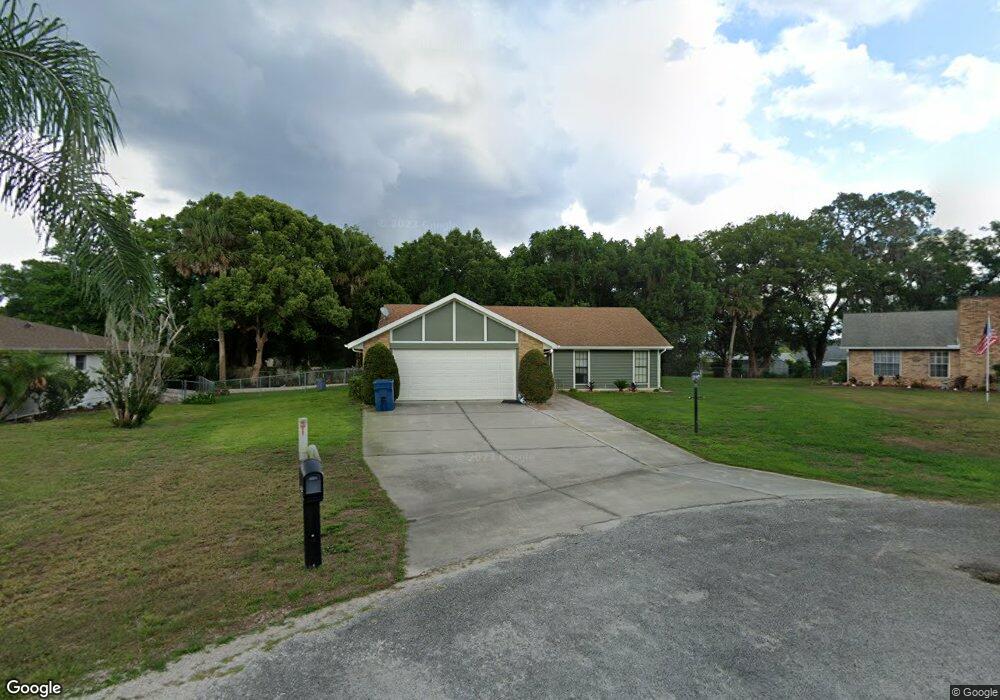
390 Ferrin Ct Orange City, FL 32763
Estimated Value: $279,693 - $309,000
3
Beds
2
Baths
1,317
Sq Ft
$225/Sq Ft
Est. Value
About This Home
This home is located at 390 Ferrin Ct, Orange City, FL 32763 and is currently estimated at $296,673, approximately $225 per square foot. 390 Ferrin Ct is a home located in Volusia County with nearby schools including Manatee Cove Elementary School, River Springs Middle School, and University High School.
Ownership History
Date
Name
Owned For
Owner Type
Purchase Details
Closed on
Apr 25, 2023
Sold by
Schlaefer Helen
Bought by
Helen Marie Schlaefer Revocable Trust
Current Estimated Value
Purchase Details
Closed on
Jan 16, 2006
Sold by
Anderson Daniel R and Anderson Claire M
Bought by
Schlaefer Donald and Schlaefer Helen
Purchase Details
Closed on
Feb 15, 1986
Bought by
Schlaefer Donald and Schlaefer Helen
Purchase Details
Closed on
Feb 15, 1984
Bought by
Schlaefer Donald and Schlaefer Helen
Create a Home Valuation Report for This Property
The Home Valuation Report is an in-depth analysis detailing your home's value as well as a comparison with similar homes in the area
Home Values in the Area
Average Home Value in this Area
Purchase History
| Date | Buyer | Sale Price | Title Company |
|---|---|---|---|
| Helen Marie Schlaefer Revocable Trust | $100 | None Listed On Document | |
| Schlaefer Donald | $209,900 | Watson Title Services Inc | |
| Schlaefer Donald | $65,000 | -- | |
| Schlaefer Donald | $56,000 | -- |
Source: Public Records
Tax History Compared to Growth
Tax History
| Year | Tax Paid | Tax Assessment Tax Assessment Total Assessment is a certain percentage of the fair market value that is determined by local assessors to be the total taxable value of land and additions on the property. | Land | Improvement |
|---|---|---|---|---|
| 2025 | $3,956 | $253,058 | $46,198 | $206,860 |
| 2024 | $3,956 | $252,723 | $49,138 | $203,585 |
| 2023 | $3,956 | $249,517 | $40,332 | $209,185 |
| 2022 | $3,417 | $208,947 | $26,568 | $182,379 |
| 2021 | $3,212 | $164,860 | $25,240 | $139,620 |
| 2020 | $2,953 | $149,748 | $22,140 | $127,608 |
| 2019 | $2,895 | $139,832 | $14,311 | $125,521 |
| 2018 | $2,698 | $125,074 | $14,311 | $110,763 |
| 2017 | $2,454 | $100,941 | $10,450 | $90,491 |
| 2016 | $2,284 | $103,719 | $0 | $0 |
| 2015 | $2,040 | $77,996 | $0 | $0 |
| 2014 | $1,987 | $75,825 | $0 | $0 |
Source: Public Records
Map
Nearby Homes
- 143 W French Ave
- 564 W Central Ave
- 912 Sylva Ave
- 403 W French Ave
- 990 W French Ave
- 0 N Carpenter Ave
- 571 James St
- 711 Sunset Ave
- 409 S Sparkman Ave
- 990 Liskeard Ave
- 312 May St
- 782 Valencia Ave
- 0 Valencia Ave
- 0 Hamilton Ave Unit MFRO6290651
- 525 W Blue Springs Ave
- 341 W Lansdowne Ave
- 900 N Carpenter Ave
- 225 White Dove Ave
- 0 N Volusia Ave Unit MFRV4939726
- 1135 Woodchuck Ct
- 410 Ferrin Ct
- 370 Ferrin Ct
- 360 Ferrin Ct
- 221 N Sparkman Ave
- 217 N Sparkman Ave
- 411 Ferrin Ct
- 391 Ferrin Ct
- 371 Ferrin Ct
- 229 N Sparkman Ave
- 450 Ferrin Ct
- 225 N Sparkman Ave
- 431 Ferrin Ct
- 148 Pearl Ave
- 885 Crittenden Ave
- 883 Crittenden Ave
- 451 Ferrin Ct
- 215 N Sparkman Ave
- 470 Ferrin Ct
- 891 Crittenden Ave
- 751 Crittenden Ave