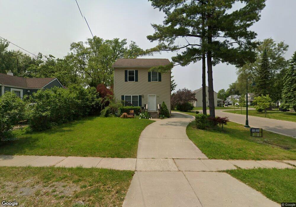
390 Newton Dr Unit 4 Lake Orion, MI 48362
Estimated Value: $349,974 - $405,000
3
Beds
2
Baths
1,450
Sq Ft
$256/Sq Ft
Est. Value
About This Home
This home is located at 390 Newton Dr Unit 4, Lake Orion, MI 48362 and is currently estimated at $371,494, approximately $256 per square foot. 390 Newton Dr Unit 4 is a home located in Oakland County with nearby schools including Blanche Sims Elementary School, Oakview Middle School, and Lake Orion Community High School.
Ownership History
Date
Name
Owned For
Owner Type
Purchase Details
Closed on
Nov 30, 2011
Sold by
Village Of Lake Orion
Bought by
Arnott Jason R
Current Estimated Value
Home Financials for this Owner
Home Financials are based on the most recent Mortgage that was taken out on this home.
Original Mortgage
$61,105
Interest Rate
3.62%
Mortgage Type
FHA
Purchase Details
Closed on
Dec 24, 2009
Sold by
Secretary Of Housing & Urban Development
Bought by
Village Of Lake Orion
Purchase Details
Closed on
Aug 6, 2007
Sold by
Mortgage Electronic Registration Systems
Bought by
Hud
Purchase Details
Closed on
Feb 2, 1999
Sold by
Ring Diane C
Bought by
Ring Ii Joseph M
Home Financials for this Owner
Home Financials are based on the most recent Mortgage that was taken out on this home.
Original Mortgage
$79,000
Interest Rate
6.89%
Create a Home Valuation Report for This Property
The Home Valuation Report is an in-depth analysis detailing your home's value as well as a comparison with similar homes in the area
Home Values in the Area
Average Home Value in this Area
Purchase History
| Date | Buyer | Sale Price | Title Company |
|---|---|---|---|
| Arnott Jason R | $110,000 | Reputation First Title Agenc | |
| Village Of Lake Orion | -- | None Available | |
| Hud | -- | None Available | |
| Ring Ii Joseph M | -- | -- |
Source: Public Records
Mortgage History
| Date | Status | Borrower | Loan Amount |
|---|---|---|---|
| Previous Owner | Arnott Jason R | $61,105 | |
| Previous Owner | Ring Ii Joseph M | $79,000 |
Source: Public Records
Tax History Compared to Growth
Tax History
| Year | Tax Paid | Tax Assessment Tax Assessment Total Assessment is a certain percentage of the fair market value that is determined by local assessors to be the total taxable value of land and additions on the property. | Land | Improvement |
|---|---|---|---|---|
| 2024 | $3,234 | $176,300 | $0 | $0 |
| 2023 | $3,087 | $160,810 | $0 | $0 |
| 2022 | $3,590 | $143,460 | $0 | $0 |
| 2021 | $3,434 | $138,640 | $0 | $0 |
| 2020 | $2,835 | $132,410 | $0 | $0 |
| 2019 | $2,300 | $118,590 | $0 | $0 |
| 2018 | $3,258 | $110,400 | $0 | $0 |
| 2017 | $3,128 | $110,400 | $0 | $0 |
| 2016 | $3,110 | $100,620 | $0 | $0 |
| 2015 | -- | $91,540 | $0 | $0 |
| 2014 | -- | $80,520 | $0 | $0 |
| 2011 | -- | $0 | $0 | $0 |
Source: Public Records
Map
Nearby Homes
- 332 Newton Dr
- 418 Converse Ct
- 00 Heights Rd
- 328 S Broadway St
- 216 E Flint St
- 305 Goldengate St
- 225 E Shadbolt St
- 769 Markdale St
- 471 Algene St
- 160 Darling Dr
- 0000 Garden Dr
- 229 W Flint St
- 34 N Andrews St
- 0000 S Lapeer Rd
- 0 Susan Marie St
- 957 Miller Rd
- 293 Clairemont Dr
- 800 Kimberly
- 1160 Miller Rd
- 411 Heights Rd
- 396 Newton Dr
- 387 Newton Ct
- 374 Newton Dr Unit 3
- 403 Newton Ct
- 411 Newton Ct
- 418 Newton Dr Unit 6
- 413 Newton Dr
- 395 Newton Ct
- 419 Newton Ct
- 397 Newton Dr
- 360 Newton Dr
- 401 Newton Dr
- 393 Newton Dr
- 407 Newton Dr
- 426 Newton Dr
- 366 Newton Ct Unit 1
- 427 Newton Ct
- 356 Newton Dr Unit 1
- 369 Newton Dr
- 432 Newton Dr Unit 8