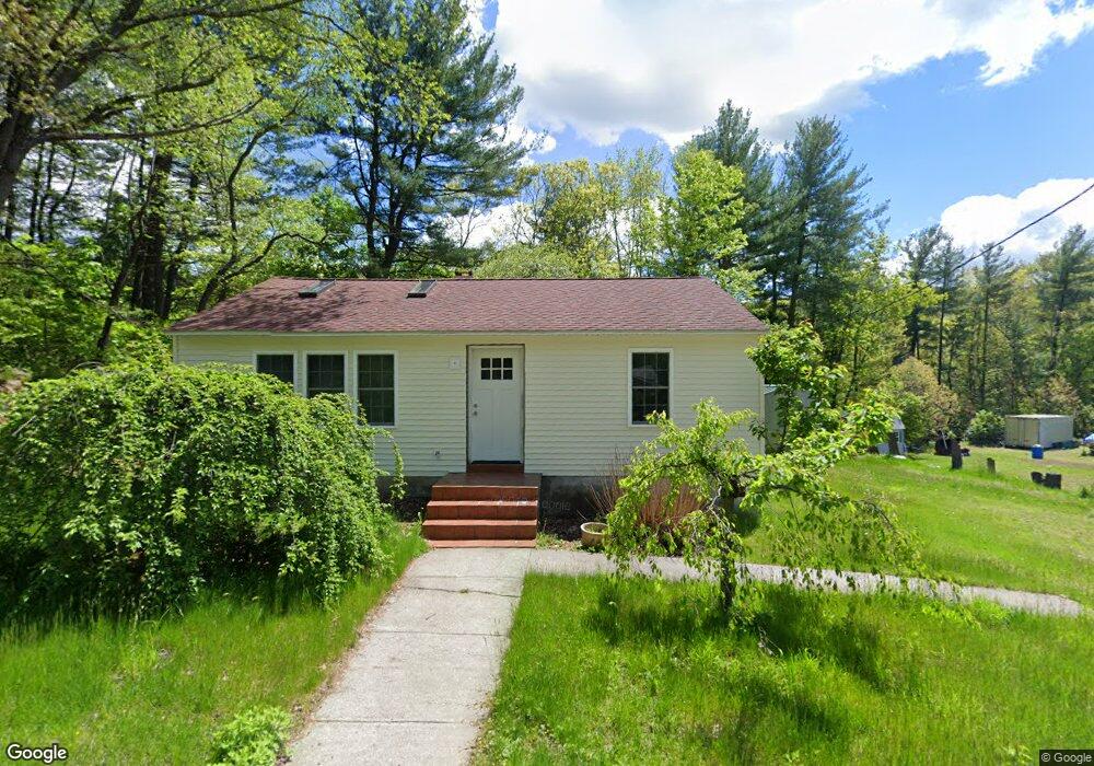
390 Reynolds Bridge Rd Thomaston, CT 06787
Estimated Value: $241,000 - $313,000
2
Beds
1
Bath
816
Sq Ft
$329/Sq Ft
Est. Value
About This Home
This home is located at 390 Reynolds Bridge Rd, Thomaston, CT 06787 and is currently estimated at $268,069, approximately $328 per square foot. 390 Reynolds Bridge Rd is a home located in Litchfield County with nearby schools including Black Rock School, Thomaston Center School, and Thomaston High School.
Ownership History
Date
Name
Owned For
Owner Type
Purchase Details
Closed on
Feb 1, 2001
Sold by
Est Knox Marjorie and Pecco Lois
Bought by
Demers Ray
Current Estimated Value
Home Financials for this Owner
Home Financials are based on the most recent Mortgage that was taken out on this home.
Original Mortgage
$66,400
Interest Rate
7.14%
Create a Home Valuation Report for This Property
The Home Valuation Report is an in-depth analysis detailing your home's value as well as a comparison with similar homes in the area
Home Values in the Area
Average Home Value in this Area
Purchase History
| Date | Buyer | Sale Price | Title Company |
|---|---|---|---|
| Demers Ray | $83,000 | -- |
Source: Public Records
Mortgage History
| Date | Status | Borrower | Loan Amount |
|---|---|---|---|
| Open | Demers Ray | $83,850 | |
| Closed | Demers Ray | $66,400 |
Source: Public Records
Tax History Compared to Growth
Tax History
| Year | Tax Paid | Tax Assessment Tax Assessment Total Assessment is a certain percentage of the fair market value that is determined by local assessors to be the total taxable value of land and additions on the property. | Land | Improvement |
|---|---|---|---|---|
| 2025 | $3,587 | $100,170 | $43,400 | $56,770 |
| 2024 | $3,442 | $100,170 | $43,400 | $56,770 |
| 2023 | $3,369 | $100,170 | $43,400 | $56,770 |
| 2022 | $3,216 | $100,170 | $43,400 | $56,770 |
| 2021 | $3,141 | $86,940 | $43,400 | $43,540 |
| 2020 | $3,141 | $86,940 | $43,400 | $43,540 |
| 2019 | $2,818 | $77,140 | $43,400 | $33,740 |
| 2018 | $2,761 | $77,140 | $43,400 | $33,740 |
| 2017 | $2,704 | $77,140 | $43,400 | $33,740 |
| 2016 | $2,683 | $78,750 | $41,370 | $37,380 |
| 2015 | $2,648 | $78,750 | $41,370 | $37,380 |
| 2014 | $2,648 | $78,750 | $41,370 | $37,380 |
Source: Public Records
Map
Nearby Homes
- 143 Pine Hill Rd Unit 15F
- 43 Pine Hill Rd
- 197 Pine Hill Rd Unit 2D
- 34 Warner Ln
- 147 Cedar Mountain Rd
- 60 Cedar Mountain Rd
- 203 Branch Rd Unit 5C
- 212 Branch Rd
- 49 Center St
- 96 Elm St
- 24 W Lakeview Rd
- 42 Litchfield St
- 17 Lake Plymouth Blvd
- 22 Park St
- 174 Litchfield St
- 56 Hillside Ave
- 211 Pine Hill Blvd Unit 211
- 214 Pine Hill Blvd Unit 214
- 785 Main St
- 104 Judson St
- 380 Reynolds Bridge Rd
- 80 Old Waterbury Rd
- 68 Old Waterbury Rd
- 395 Reynolds Bridge Rd
- 383 Reynolds Bridge Rd
- 94 Old Waterbury Rd
- 403 Reynolds Bridge Rd
- 79 Old Waterbury Rd
- 71 Old Waterbury Rd
- 409 Reynolds Bridge Rd
- 303 Reynolds Bridge Rd
- 93 W Hill Rd
- 0 W Hill Rd Unit 170061840
- 0 W Hill Rd Unit 170010177
- 0 W Hill Rd Unit L128690
- 0 W Hill Rd Unit L135422
- 0 W Hill Rd Unit L137116
- 0 W Hill Rd Unit L141728
- 0 W Hill Rd Unit W1068685
- 0 W Hill Rd Unit W1071315