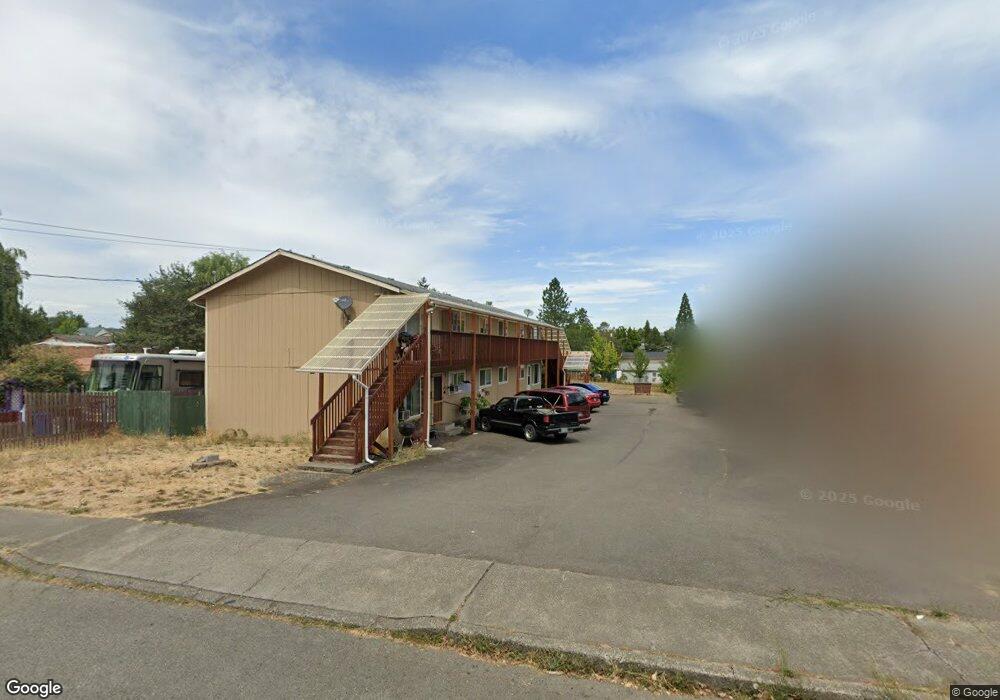
390 SE Carrol St Winston, OR 97496
Estimated Value: $355,000 - $397,000
--
Bed
1
Bath
3,952
Sq Ft
$95/Sq Ft
Est. Value
About This Home
This home is located at 390 SE Carrol St, Winston, OR 97496 and is currently estimated at $373,607, approximately $94 per square foot. 390 SE Carrol St is a home located in Douglas County with nearby schools including Douglas High School.
Ownership History
Date
Name
Owned For
Owner Type
Purchase Details
Closed on
May 29, 2014
Sold by
Williams David M and Williams Joanne A
Bought by
Singer James A and Singer Ursula L
Current Estimated Value
Home Financials for this Owner
Home Financials are based on the most recent Mortgage that was taken out on this home.
Original Mortgage
$127,500
Outstanding Balance
$96,521
Interest Rate
4.23%
Mortgage Type
New Conventional
Estimated Equity
$277,086
Create a Home Valuation Report for This Property
The Home Valuation Report is an in-depth analysis detailing your home's value as well as a comparison with similar homes in the area
Home Values in the Area
Average Home Value in this Area
Purchase History
| Date | Buyer | Sale Price | Title Company |
|---|---|---|---|
| Singer James A | $170,000 | Amerititle |
Source: Public Records
Mortgage History
| Date | Status | Borrower | Loan Amount |
|---|---|---|---|
| Open | Singer James A | $127,500 |
Source: Public Records
Tax History Compared to Growth
Tax History
| Year | Tax Paid | Tax Assessment Tax Assessment Total Assessment is a certain percentage of the fair market value that is determined by local assessors to be the total taxable value of land and additions on the property. | Land | Improvement |
|---|---|---|---|---|
| 2025 | $3,165 | $190,455 | -- | -- |
| 2024 | $3,076 | $184,908 | -- | -- |
| 2023 | $2,989 | $179,523 | $0 | $0 |
| 2022 | $2,900 | $174,295 | $0 | $0 |
| 2021 | $2,822 | $169,219 | $0 | $0 |
| 2020 | $2,599 | $155,834 | $0 | $0 |
| 2019 | $2,538 | $151,296 | $0 | $0 |
| 2018 | $2,470 | $146,890 | $0 | $0 |
| 2017 | $2,405 | $142,612 | $0 | $0 |
| 2016 | $2,340 | $138,459 | $0 | $0 |
| 2015 | $2,283 | $134,427 | $0 | $0 |
| 2014 | $2,232 | $130,512 | $0 | $0 |
| 2013 | -- | $126,711 | $0 | $0 |
Source: Public Records
Map
Nearby Homes
- 600 SE Carrol St
- 291 SE Shigley St
- 380 Sunnyside Dr
- 350 SE Park St
- 271 SE Robinson St
- 180 Twin Oaks Loop
- 241 Twin Oaks Loop
- 110 SE Darrell Ave
- 350 View Point Terrace
- 700 SE Tokay St
- 90 SE Darrell Ave
- 112 Twin Oaks Loop
- 631 SE Rose Ridge Dr
- 120 SE Edwards Ave
- 0 SE Gregory Dr
- 890 SE Thompson Ave
- 124 Country Side Ln
- 125 SE Estate Loop
- 10 SE Kegler Ave
- 360 NE Rose Ridge Dr
- 390 SE Carroll St
- 380 SE Carrol St
- 400 SE Carrol St
- 400 SE Carroll St
- 370 SE Carrol St
- 360 SE Carrol St
- 360 SE Carrol St
- 410 SE Carrol St
- 331 SE Shigley St
- 361 Caroll
- 361 SE Carrol St
- 361 SE Carroll St
- 391 SE Carrol St
- 430 SE Carrol St
- 391 SE Carroll St
- 371 SE Carrol St
- 340 SE Carrol St
- 351 SE Carrol St
- 351 SE Carroll St
- 311 SE Shigley St