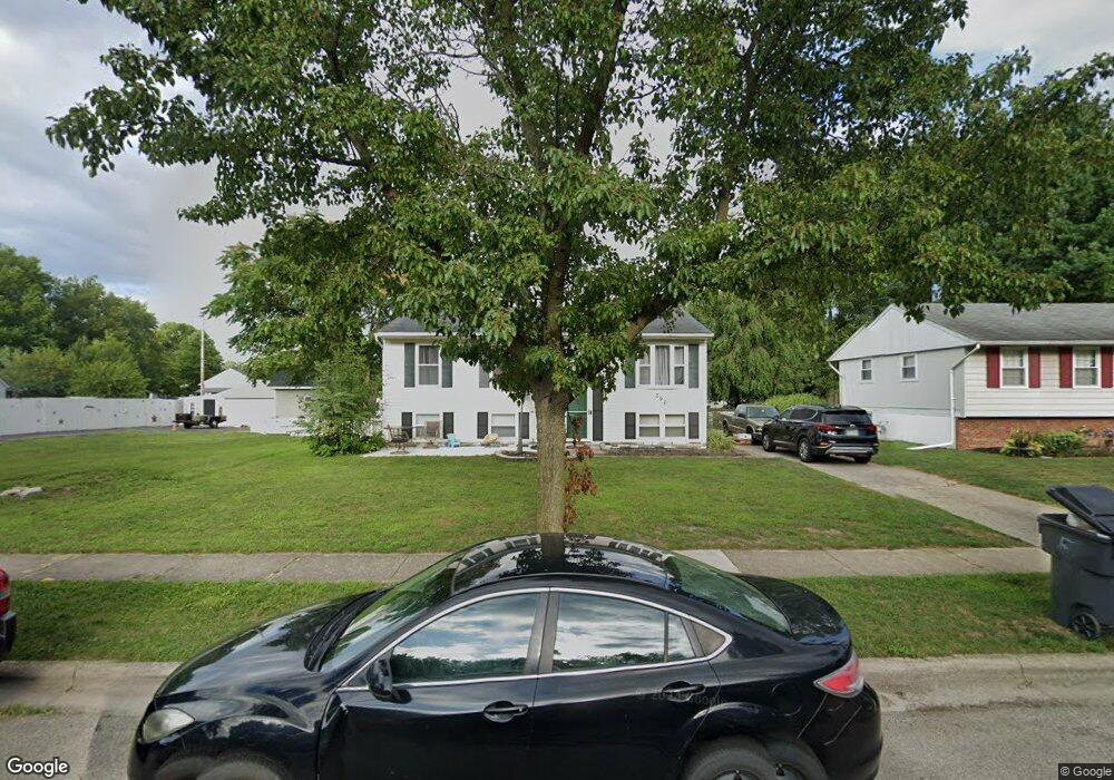
390 Westport Dr Groveport, OH 43125
Estimated Value: $252,000 - $262,000
3
Beds
1
Bath
1,989
Sq Ft
$129/Sq Ft
Est. Value
About This Home
This home is located at 390 Westport Dr, Groveport, OH 43125 and is currently estimated at $257,359, approximately $129 per square foot. 390 Westport Dr is a home located in Franklin County with nearby schools including Groveport Madison High School, Groveport Community School, and Madison Christian School.
Ownership History
Date
Name
Owned For
Owner Type
Purchase Details
Closed on
Jun 6, 2022
Sold by
Rjr Phoenix Construction Group Llc
Bought by
Hartson Kaitlyn
Current Estimated Value
Home Financials for this Owner
Home Financials are based on the most recent Mortgage that was taken out on this home.
Original Mortgage
$147,000
Outstanding Balance
$139,650
Interest Rate
5.09%
Mortgage Type
New Conventional
Estimated Equity
$117,709
Purchase Details
Closed on
Jan 18, 2012
Sold by
Adams Andrew B
Bought by
Durant Stephine L
Home Financials for this Owner
Home Financials are based on the most recent Mortgage that was taken out on this home.
Original Mortgage
$100,848
Interest Rate
3.93%
Mortgage Type
FHA
Purchase Details
Closed on
Jun 28, 2002
Sold by
Adams Roger W and Adams Patricia A
Bought by
Adams Andrew B
Home Financials for this Owner
Home Financials are based on the most recent Mortgage that was taken out on this home.
Original Mortgage
$104,000
Interest Rate
6.82%
Mortgage Type
Balloon
Purchase Details
Closed on
Aug 14, 1976
Bought by
Adams Roger W
Create a Home Valuation Report for This Property
The Home Valuation Report is an in-depth analysis detailing your home's value as well as a comparison with similar homes in the area
Home Values in the Area
Average Home Value in this Area
Purchase History
| Date | Buyer | Sale Price | Title Company |
|---|---|---|---|
| Hartson Kaitlyn | $210,000 | New Title Company Name | |
| Durant Stephine L | $103,500 | Valmer Land | |
| Adams Andrew B | $130,000 | -- | |
| Adams Roger W | -- | -- |
Source: Public Records
Mortgage History
| Date | Status | Borrower | Loan Amount |
|---|---|---|---|
| Open | Hartson Kaitlyn | $147,000 | |
| Previous Owner | Durant Stephine L | $100,848 | |
| Previous Owner | Adams Andrew B | $104,000 |
Source: Public Records
Tax History Compared to Growth
Tax History
| Year | Tax Paid | Tax Assessment Tax Assessment Total Assessment is a certain percentage of the fair market value that is determined by local assessors to be the total taxable value of land and additions on the property. | Land | Improvement |
|---|---|---|---|---|
| 2024 | $3,594 | $73,500 | $22,190 | $51,310 |
| 2023 | $4,246 | $82,600 | $22,190 | $60,410 |
| 2022 | $3,118 | $51,320 | $9,140 | $42,180 |
| 2021 | $3,130 | $51,320 | $9,140 | $42,180 |
| 2020 | $3,137 | $51,320 | $9,140 | $42,180 |
| 2019 | $2,964 | $42,740 | $7,630 | $35,110 |
| 2018 | $2,956 | $42,740 | $7,630 | $35,110 |
| 2017 | $2,987 | $42,740 | $7,630 | $35,110 |
| 2016 | $2,907 | $37,770 | $7,350 | $30,420 |
| 2015 | $2,932 | $37,770 | $7,350 | $30,420 |
| 2014 | $2,760 | $37,770 | $7,350 | $30,420 |
| 2013 | $1,239 | $39,760 | $7,735 | $32,025 |
Source: Public Records
Map
Nearby Homes
- 396 Westport Dr
- 384 Westport Dr
- 400 Westport Dr
- 376 Westport Dr
- 375 Sheryl Dr
- 381 Sheryl Dr
- 369 Sheryl Dr
- 406 Westport Dr
- 393 Westport Dr
- 387 Westport Dr
- 401 Westport Dr
- 393 Sheryl Dr
- 49 Cherry St
- 381 Westport Dr
- 412 Westport Dr
- 405 Westport Dr
- 375 Westport Dr
- 399 Sheryl Dr
- 411 Westport Dr
- 32 Cherry St