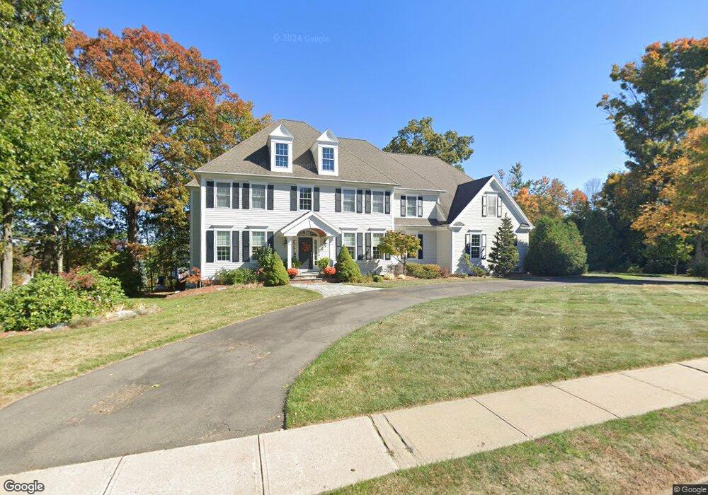
390 Westwood Rd Bristol, CT 06010
North Bristol NeighborhoodEstimated Value: $705,000 - $843,000
5
Beds
4
Baths
4,300
Sq Ft
$181/Sq Ft
Est. Value
About This Home
This home is located at 390 Westwood Rd, Bristol, CT 06010 and is currently estimated at $778,663, approximately $181 per square foot. 390 Westwood Rd is a home located in Hartford County with nearby schools including Edgewood School, Chippens Hill Middle School, and Bristol Central High School.
Ownership History
Date
Name
Owned For
Owner Type
Purchase Details
Closed on
Oct 27, 2017
Sold by
Miller Karen L
Bought by
Miller Karen L and Miller Gregory M
Current Estimated Value
Create a Home Valuation Report for This Property
The Home Valuation Report is an in-depth analysis detailing your home's value as well as a comparison with similar homes in the area
Home Values in the Area
Average Home Value in this Area
Purchase History
| Date | Buyer | Sale Price | Title Company |
|---|---|---|---|
| Miller Karen L | -- | -- |
Source: Public Records
Mortgage History
| Date | Status | Borrower | Loan Amount |
|---|---|---|---|
| Previous Owner | Miller Karen L | $200,000 | |
| Previous Owner | Miller Karen L | $197,800 | |
| Previous Owner | Miller Karen L | $450,000 |
Source: Public Records
Tax History Compared to Growth
Tax History
| Year | Tax Paid | Tax Assessment Tax Assessment Total Assessment is a certain percentage of the fair market value that is determined by local assessors to be the total taxable value of land and additions on the property. | Land | Improvement |
|---|---|---|---|---|
| 2025 | $15,585 | $461,790 | $84,770 | $377,020 |
| 2024 | $14,708 | $461,790 | $84,770 | $377,020 |
| 2023 | $14,007 | $461,510 | $84,770 | $376,740 |
| 2022 | $12,918 | $336,840 | $61,810 | $275,030 |
| 2021 | $12,918 | $336,840 | $61,810 | $275,030 |
| 2020 | $12,918 | $336,840 | $61,810 | $275,030 |
| 2019 | $12,817 | $336,840 | $61,810 | $275,030 |
| 2018 | $12,423 | $336,840 | $61,810 | $275,030 |
| 2017 | $12,378 | $343,560 | $88,340 | $255,220 |
| 2016 | $12,378 | $343,560 | $88,340 | $255,220 |
| 2015 | $11,891 | $343,560 | $88,340 | $255,220 |
| 2014 | $11,891 | $343,560 | $88,340 | $255,220 |
Source: Public Records
Map
Nearby Homes
- 116 Larkspur Ln
- 276 Hart St
- 68 Hart St
- 8 Briar Cliff
- 126 Harvard Place
- 114 El Toro Dr
- 0 Hart St Unit 170255530
- 15 Bittersweet Ln
- 62 (Lot 13-1) James P Casey Rd
- 6 El Toro Dr
- 1970 Perkins St
- 39 Pine Meadow Dr
- 51 Pine Meadow Dr
- 90 Battle St
- 66 Intervale Rd
- 35 James P Casey Rd
- 439 James P Casey Rd
- 15 Jan Rd
- 335 Pennwood Place
- 120 Round Hill Rd
- 367 Westwood Rd
- 364 Westwood Rd
- 353 Westwood Rd
- 79 Southdown Dr
- 60 Southdown Dr
- 344 Westwood Rd
- 37 Southdown Dr
- 341 Westwood Rd
- 19 Southdown Dr
- 82 Southdown Dr
- 325 Westwood Rd
- 318 Westwood Rd
- 99 Southdown Dr
- 44 Southdown Dr
- 125 Southdown Dr
- 71 Suffolk Place
- 32 Southdown Dr
- 10 Southdown Dr
- 16 Great Pyrenees Way
- 110 Southdown Dr