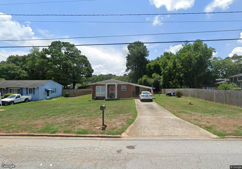
3902 Brookcrest Cir Unit 1 Decatur, GA 30032
Estimated Value: $183,190 - $246,000
3
Beds
2
Baths
1,066
Sq Ft
$196/Sq Ft
Est. Value
About This Home
This home is located at 3902 Brookcrest Cir Unit 1, Decatur, GA 30032 and is currently estimated at $208,798, approximately $195 per square foot. 3902 Brookcrest Cir Unit 1 is a home located in DeKalb County with nearby schools including Snapfinger Elementary School, Columbia Middle School, and Columbia High School.
Ownership History
Date
Name
Owned For
Owner Type
Purchase Details
Closed on
Feb 12, 2002
Sold by
Elberbouchi Pamela S
Bought by
Youngblood Velma
Current Estimated Value
Home Financials for this Owner
Home Financials are based on the most recent Mortgage that was taken out on this home.
Original Mortgage
$95,917
Interest Rate
6.8%
Mortgage Type
New Conventional
Create a Home Valuation Report for This Property
The Home Valuation Report is an in-depth analysis detailing your home's value as well as a comparison with similar homes in the area
Home Values in the Area
Average Home Value in this Area
Purchase History
| Date | Buyer | Sale Price | Title Company |
|---|---|---|---|
| Youngblood Velma | $97,000 | -- |
Source: Public Records
Mortgage History
| Date | Status | Borrower | Loan Amount |
|---|---|---|---|
| Previous Owner | Youngblood Velma | $95,917 |
Source: Public Records
Tax History Compared to Growth
Tax History
| Year | Tax Paid | Tax Assessment Tax Assessment Total Assessment is a certain percentage of the fair market value that is determined by local assessors to be the total taxable value of land and additions on the property. | Land | Improvement |
|---|---|---|---|---|
| 2025 | $507 | $84,440 | $52,000 | $32,440 |
| 2024 | $502 | $72,480 | $52,000 | $20,480 |
| 2023 | $502 | $65,720 | $31,720 | $34,000 |
| 2022 | $394 | $53,640 | $16,000 | $37,640 |
| 2021 | $394 | $49,280 | $16,000 | $33,280 |
| 2020 | $394 | $45,000 | $16,000 | $29,000 |
| 2019 | $392 | $38,320 | $16,000 | $22,320 |
| 2018 | $487 | $28,800 | $4,080 | $24,720 |
| 2017 | $397 | $24,440 | $4,080 | $20,360 |
| 2016 | $393 | $22,800 | $4,080 | $18,720 |
| 2014 | $393 | $12,600 | $4,080 | $8,520 |
Source: Public Records
Map
Nearby Homes
- 3842 Brookcrest Cir
- 1669 Freedom Valley
- 1674 Freedom Valley
- 1729 W Austin Rd
- 1467 Thompson Place
- 4045 Fireoak Dr
- 1688 Danrich Dr
- 1447 Austin Dr
- 3693 Aldea Dr
- 3625 Aldea Dr
- 1701 Corey Blvd
- 3651 Tulip Dr
- 1485 Janmar Dr
- 1433 Dennis Dr
- 1603 Hollyhock Terrace
- 3645 Aldea Dr
- 3401 Tulip Dr
- 1733 Hollyhock Terrace
- 3682 Daisy Dr
- 3513 Larkspur Terrace
- 3896 Brookcrest Cir
- 1580 W Austin Rd
- 1597 Gilston Ct
- 1588 W Austin Rd
- 3888 Brookcrest Cir
- 1605 Gilston Ct
- 1596 Gilston Ct
- 1596 W Austin Rd
- 3872 Brookcrest Cir
- 1602 Gilston Ct
- 1602 W Austin Rd Unit 2
- 1583 W Austin Rd
- 1595 W Austin Rd Unit 2
- 1610 Gilston Ct
- 3848 Brookcrest Cir
- 1608 W Austin Rd
- 1621 Gilston Ct
- 1601 W Austin Rd
- 1618 Gilston Ct
- 1616 W Austin Rd