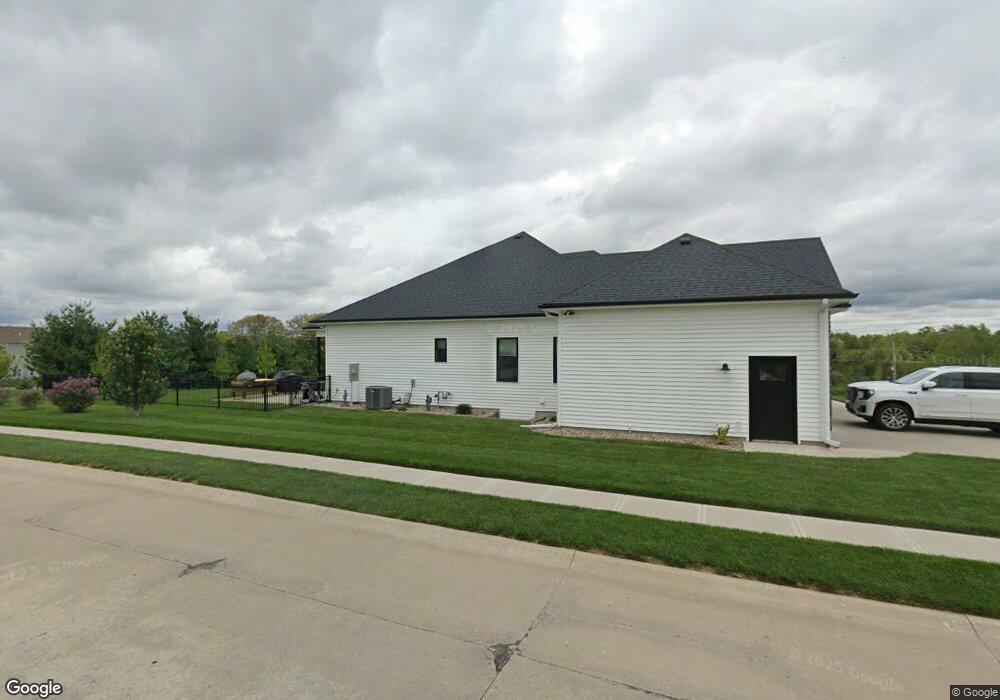
3902 Damascus Dr Saint Joseph, MO 64506
East Saint Joseph NeighborhoodEstimated Value: $413,000 - $570,000
Studio
--
Bath
2,538
Sq Ft
$200/Sq Ft
Est. Value
About This Home
This home is located at 3902 Damascus Dr, Saint Joseph, MO 64506 and is currently estimated at $507,828, approximately $200 per square foot. 3902 Damascus Dr is a home located in Buchanan County with nearby schools including Oak Grove Elementary School, Bode Middle School, and Central High School.
Ownership History
Date
Name
Owned For
Owner Type
Purchase Details
Closed on
Apr 30, 2010
Sold by
Carter Jimmie D and Carter Luana S
Bought by
Clark Heather Elise and Heather Elise Clark Living Trust
Current Estimated Value
Home Financials for this Owner
Home Financials are based on the most recent Mortgage that was taken out on this home.
Original Mortgage
$51,860
Interest Rate
4.91%
Mortgage Type
FHA
Purchase Details
Closed on
Aug 28, 2006
Sold by
Ts Jimmie D Carter Revocable Trust and Ts Luana S Carter Revocable Trust
Bought by
Carter Jimmie D and Carter Luana S
Create a Home Valuation Report for This Property
The Home Valuation Report is an in-depth analysis detailing your home's value as well as a comparison with similar homes in the area
Home Values in the Area
Average Home Value in this Area
Purchase History
| Date | Buyer | Sale Price | Title Company |
|---|---|---|---|
| Clark Heather Elise | -- | First American Title | |
| Carter Jimmie D | -- | Hall Abstract & Title Co Inc |
Source: Public Records
Mortgage History
| Date | Status | Borrower | Loan Amount |
|---|---|---|---|
| Closed | Clark Heather Elise | $51,860 |
Source: Public Records
Tax History
| Year | Tax Paid | Tax Assessment Tax Assessment Total Assessment is a certain percentage of the fair market value that is determined by local assessors to be the total taxable value of land and additions on the property. | Land | Improvement |
|---|---|---|---|---|
| 2025 | $5,543 | $79,230 | $8,080 | $71,150 |
| 2024 | $5,209 | $74,270 | $8,080 | $66,190 |
| 2023 | $5,209 | $74,270 | $8,080 | $66,190 |
| 2022 | $4,823 | $74,270 | $8,080 | $66,190 |
| 2021 | $4,845 | $74,270 | $8,080 | $66,190 |
| 2020 | $574 | $8,080 | $8,080 | $0 |
| 2019 | $555 | $8,080 | $8,080 | $0 |
| 2018 | $505 | $8,080 | $8,080 | $0 |
| 2017 | $501 | $8,080 | $0 | $0 |
| 2015 | $1 | $8,080 | $0 | $0 |
Source: Public Records
Map
Nearby Homes
- 4704 Donnelly Dr
- 4802 Corinth Dr
- 4912 Corinth Dr
- 4600 Greystone Dr
- 0 N Pointe Dr
- 5411 N Pointe Dr
- 5408 N Pointe Dr
- 2 N Pointe Dr
- 5415 N Pointe Dr
- 5418 N Pointe Dr
- 4303 Leighton Ct
- 4733 Woodland Ct
- 4732 Woodland Ct
- 4730 Woodland Ct
- 4601 Valley Ridge Dr
- 4506 Valley Ridge Dr
- 4508 Valley Ridge Dr
- 4602 Valley Ridge Dr
- 4504 Valley Ridge Dr
- 5201 Cook Rd
- 3904 Damascus Dr
- 39 Aegean Terrace
- 44 Aegean Terrace
- 40 Aegean Terrace
- 4804 Aegean Terrace
- 4806 Aegean Terrace
- 3906 Damascus Dr
- 4715 Aegean Terrace
- 4807 Aegean Terrace
- 4802 Aegean Terrace
- 4808 Aegean Terrace
- 3908 Damascus Dr
- 4713 Aegean Terrace
- 3907 Damascus Dr
- 4809 Aegean Terrace
- 3909 Damascus Dr
- 4712 Aegean Terrace
- 4810 Aegean Terrace
- 4711 Aegean Terrace
- 4710 Donnelly Dr
Your Personal Tour Guide
Ask me questions while you tour the home.