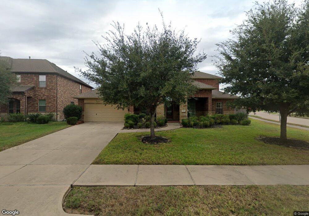
3902 Randle Ridge Ct Fulshear, TX 77441
Estimated Value: $577,000 - $636,389
4
Beds
4
Baths
3,907
Sq Ft
$156/Sq Ft
Est. Value
About This Home
This home is located at 3902 Randle Ridge Ct, Fulshear, TX 77441 and is currently estimated at $610,097, approximately $156 per square foot. 3902 Randle Ridge Ct is a home with nearby schools including Campbell Elementary School, Joe M. Adams Junior High, and Sugar Creek Montessori - Fulshear/West Katy.
Ownership History
Date
Name
Owned For
Owner Type
Purchase Details
Closed on
Jun 30, 2014
Sold by
Taylor Morrison Of Texas Inc
Bought by
Alonzo Francisco J and Alonzo Mary A
Current Estimated Value
Home Financials for this Owner
Home Financials are based on the most recent Mortgage that was taken out on this home.
Original Mortgage
$299,640
Outstanding Balance
$228,493
Interest Rate
4.19%
Mortgage Type
New Conventional
Estimated Equity
$381,604
Purchase Details
Closed on
Dec 19, 2011
Sold by
Beazer Homes Texas Lp
Bought by
Alonzo Francisco J and Alonzo Mary A
Create a Home Valuation Report for This Property
The Home Valuation Report is an in-depth analysis detailing your home's value as well as a comparison with similar homes in the area
Home Values in the Area
Average Home Value in this Area
Purchase History
| Date | Buyer | Sale Price | Title Company |
|---|---|---|---|
| Alonzo Francisco J | -- | Advantage Title Of Ft Bend | |
| Alonzo Francisco J | -- | Advantage Title Of Ft Bend | |
| Alonzo Francisco J | -- | -- |
Source: Public Records
Mortgage History
| Date | Status | Borrower | Loan Amount |
|---|---|---|---|
| Open | Alonzo Francisco J | $299,640 | |
| Closed | Alonzo Francisco J | $299,640 |
Source: Public Records
Tax History Compared to Growth
Tax History
| Year | Tax Paid | Tax Assessment Tax Assessment Total Assessment is a certain percentage of the fair market value that is determined by local assessors to be the total taxable value of land and additions on the property. | Land | Improvement |
|---|---|---|---|---|
| 2025 | $10,741 | $556,637 | $98,894 | $519,398 |
| 2024 | $10,741 | $506,034 | -- | $562,382 |
| 2023 | $9,950 | $460,031 | $0 | $541,131 |
| 2022 | $10,739 | $418,210 | $0 | $451,470 |
| 2021 | $10,929 | $380,190 | $76,070 | $304,120 |
| 2020 | $11,319 | $386,050 | $72,770 | $313,280 |
| 2019 | $12,124 | $387,260 | $72,770 | $314,490 |
| 2018 | $11,781 | $375,730 | $72,770 | $302,960 |
| 2017 | $11,730 | $373,490 | $72,770 | $300,720 |
| 2016 | $12,406 | $395,030 | $72,770 | $322,260 |
| 2015 | $7,431 | $389,460 | $72,770 | $316,690 |
| 2014 | $6,142 | $290,900 | $59,540 | $231,360 |
Source: Public Records
Map
Nearby Homes
- 27603 Huggins Crest Ct
- 27514 Wilson Run Ln
- 28131 Twin Knolls Ln
- 4110 Addison Ranch Ln
- 3422 Walker Falls Ln
- 27419 Canyon Reach Dr
- 27414 Wooded Canyon Dr
- 27423 Sunrise Ranch Ln
- 3438 Cartwright Cliff Ln
- 4218 Brannon Branch Ct
- 27415 Royal Canyon Ln
- 27411 Canyon Reach Dr
- 3710 Meadowmist Ct
- 27410 Ashland Meadow Ln
- 4314 Kent Ranch Ct
- 27830 Hunters Rock Ln
- 28807 Mayes Bluff Dr
- 27834 Hunters Rock Ln
- 3314 Flint Valley Ln
- 3715 Cardiff Mist Dr
- 3906 Randle Ridge Ct
- 3907 Banks Landing Ct
- 3903 Banks Landing Ct
- 3910 Randle Ridge Ct
- 3911 Banks Landing Ct
- 3807 Walker Falls Ln
- 3903 Randle Ridge Ct
- 3915 Banks Landing Ct
- 3803 Walker Falls Ln
- 3811 Walker Falls Ln
- 3907 Randle Ridge Ct
- 3914 Randle Ridge Ct
- 3919 Banks Landing Ct
- 3911 Randle Ridge Ct
- 3731 Walker Falls Ln
- 3815 Walker Falls Ln
- 3918 Randle Ridge Ct
- 3727 Walker Falls Ln
- 3906 Banks Landing Ct
- 3910 Banks Landing Ct