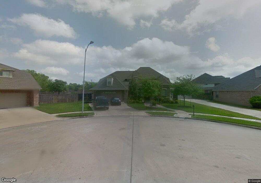
3903 Grovesnor Ct Pearland, TX 77584
Estimated Value: $517,860 - $557,000
--
Bed
6
Baths
4,109
Sq Ft
$131/Sq Ft
Est. Value
About This Home
This home is located at 3903 Grovesnor Ct, Pearland, TX 77584 and is currently estimated at $537,965, approximately $130 per square foot. 3903 Grovesnor Ct is a home located in Brazoria County with nearby schools including H.C. Carleston Elementary School, Pearland Junior High School South, and Sam Jamison Middle School.
Ownership History
Date
Name
Owned For
Owner Type
Purchase Details
Closed on
Aug 25, 2006
Sold by
David Powers Homes S T Ltd
Bought by
Mcclung William D and Mcclung Julianne M
Current Estimated Value
Home Financials for this Owner
Home Financials are based on the most recent Mortgage that was taken out on this home.
Original Mortgage
$320,000
Outstanding Balance
$191,858
Interest Rate
6.64%
Mortgage Type
Purchase Money Mortgage
Estimated Equity
$346,107
Purchase Details
Closed on
Aug 17, 2005
Sold by
Kirby Run Associates Lp
Bought by
David Powers Homes S T Ltd
Home Financials for this Owner
Home Financials are based on the most recent Mortgage that was taken out on this home.
Original Mortgage
$307,152
Interest Rate
5.61%
Mortgage Type
Purchase Money Mortgage
Create a Home Valuation Report for This Property
The Home Valuation Report is an in-depth analysis detailing your home's value as well as a comparison with similar homes in the area
Home Values in the Area
Average Home Value in this Area
Purchase History
| Date | Buyer | Sale Price | Title Company |
|---|---|---|---|
| Mcclung William D | -- | Powers Title Co | |
| David Powers Homes S T Ltd | -- | Powers Title Company Llc |
Source: Public Records
Mortgage History
| Date | Status | Borrower | Loan Amount |
|---|---|---|---|
| Open | Mcclung William D | $320,000 | |
| Previous Owner | David Powers Homes S T Ltd | $307,152 |
Source: Public Records
Tax History Compared to Growth
Tax History
| Year | Tax Paid | Tax Assessment Tax Assessment Total Assessment is a certain percentage of the fair market value that is determined by local assessors to be the total taxable value of land and additions on the property. | Land | Improvement |
|---|---|---|---|---|
| 2025 | $8,913 | $529,536 | $39,550 | $495,630 |
| 2023 | $8,913 | $437,633 | $39,550 | $498,240 |
| 2022 | $10,466 | $397,848 | $39,550 | $386,380 |
| 2021 | $10,295 | $361,680 | $39,550 | $322,130 |
| 2020 | $10,769 | $360,400 | $34,390 | $326,010 |
| 2019 | $10,638 | $353,580 | $34,390 | $319,190 |
| 2018 | $11,012 | $367,460 | $34,390 | $333,070 |
| 2017 | $11,423 | $374,490 | $34,390 | $340,100 |
| 2016 | $10,804 | $354,280 | $34,390 | $319,890 |
| 2015 | $8,923 | $322,000 | $34,390 | $287,610 |
| 2014 | $8,923 | $305,600 | $34,390 | $271,210 |
Source: Public Records
Map
Nearby Homes
- 3902 Basil Ct
- 5806 Wilton St
- 4009 Ravencrest Ct
- 3834 Aubrell Rd
- 3730 Aubrell Rd
- 16708 N Wayne Ln
- 6112 Tomorrow Cir
- 6406 Patridge Dr
- 6301 Larrycrest Dr
- 6504 Patridge Dr
- 6436 Grace Ln
- 6618 Heron Ln
- 3610 Kale St
- 3510 Dorsey Ln
- 3902 Bluebird Way
- 6407 Hillock Ln
- 6302 Amie Ln
- 3602 Lindhaven Dr
- 5205 Spring Branch Dr
- 5101 Big Spring Dr
- 3905 Grovesnor Ct
- 3901 Grovesnor Ct
- 5909 Grovesnor St
- 5907 Grovesnor St
- 3902 Grovesnor Ct
- 6002 Raza Rd
- 6104 Raza Rd
- 3906 Grovesnor Ct
- 5940 Raza Rd
- 3904 Grovesnor Ct
- 5910 Grovesnor St
- 5905 Grovesnor St
- 6014 Raza Rd
- 5906 Grovesnor St
- 5922 Raza Rd
- 5903 Grovesnor St
- 5914 Raza Rd
- 3904 Basil Ct
- 5901 Grovesnor St
- 6025 Ravenwood Dr