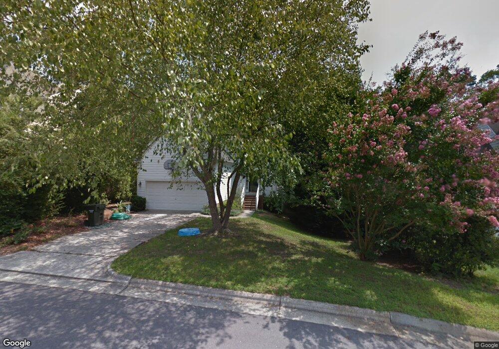
3903 Kettering Dr Durham, NC 27713
Woodcroft NeighborhoodEstimated Value: $566,000 - $637,000
4
Beds
3
Baths
3,065
Sq Ft
$197/Sq Ft
Est. Value
About This Home
This home is located at 3903 Kettering Dr, Durham, NC 27713 and is currently estimated at $604,627, approximately $197 per square foot. 3903 Kettering Dr is a home located in Durham County with nearby schools including Southwest Elementary School, Morehead Montessori, and Sherwood Githens Middle.
Ownership History
Date
Name
Owned For
Owner Type
Purchase Details
Closed on
Nov 19, 2010
Sold by
Mulligan Peter J
Bought by
Ross Glenn T and Bean Michelle L
Current Estimated Value
Home Financials for this Owner
Home Financials are based on the most recent Mortgage that was taken out on this home.
Original Mortgage
$212,500
Outstanding Balance
$141,272
Interest Rate
4.42%
Mortgage Type
New Conventional
Estimated Equity
$463,355
Create a Home Valuation Report for This Property
The Home Valuation Report is an in-depth analysis detailing your home's value as well as a comparison with similar homes in the area
Home Values in the Area
Average Home Value in this Area
Purchase History
| Date | Buyer | Sale Price | Title Company |
|---|---|---|---|
| Ross Glenn T | $267,500 | None Available |
Source: Public Records
Mortgage History
| Date | Status | Borrower | Loan Amount |
|---|---|---|---|
| Open | Ross Glenn T | $212,500 |
Source: Public Records
Tax History
| Year | Tax Paid | Tax Assessment Tax Assessment Total Assessment is a certain percentage of the fair market value that is determined by local assessors to be the total taxable value of land and additions on the property. | Land | Improvement |
|---|---|---|---|---|
| 2025 | $5,764 | $581,444 | $135,300 | $446,144 |
| 2024 | $4,971 | $356,357 | $55,215 | $301,142 |
| 2023 | $4,668 | $356,357 | $55,215 | $301,142 |
| 2022 | $4,561 | $356,357 | $55,215 | $301,142 |
| 2021 | $4,540 | $356,357 | $55,215 | $301,142 |
| 2020 | $4,433 | $356,357 | $55,215 | $301,142 |
| 2019 | $4,433 | $356,357 | $55,215 | $301,142 |
| 2018 | $4,273 | $314,967 | $42,945 | $272,022 |
| 2017 | $4,241 | $314,967 | $42,945 | $272,022 |
| 2016 | $4,098 | $314,967 | $42,945 | $272,022 |
| 2015 | $3,586 | $259,021 | $43,800 | $215,221 |
| 2014 | $3,586 | $259,021 | $43,800 | $215,221 |
Source: Public Records
Map
Nearby Homes
- 4904 Victoria Dr
- 4908 Victoria Dr
- 4727 Alderbrook Ln
- 4731 Alderbrook Ln
- 5004 Tapestry Terrace
- 4908 Tapestry Terrace
- 806 Clearview Ln
- 5017 Tapestry Terrace
- 64 Citation Dr
- 12 Citation Dr
- 5015 Silhouette Dr
- 25 Kissimee Ct
- 4907 Fortunes Ridge Dr
- 3805 Chimney Ridge Place Unit 104
- 5219 Oakbrook Dr
- 4419 Nightfall Ct
- 5500 Fortunes Ridge Dr Unit 80b
- 5500 Fortunes Ridge Dr Unit 89B
- 10 Hickorywood Square
- 4 Applewood Square
- 3901 Kettering Dr
- 3905 Kettering Dr
- 4802 Glendarion Dr
- 3907 Kettering Dr
- 4 Shady Ridge Ct
- 5 Shady Ridge Ct
- 3909 Kettering Dr
- 4804 Glendarion Dr
- 310 Kinney Glenn Ct
- 306 Kinney Glenn Ct
- 3908 Kettering Dr
- 312 Kinney Glenn Ct
- 304 Kinney Glenn Ct
- 4806 Glendarion Dr
- 3911 Kettering Dr
- 3910 Kettering Dr
- 3 Shady Ridge Ct
- 4807 Glendarion Dr
- 314 Kinney Glenn Ct
- 18 Barnsdale Ct
Your Personal Tour Guide
Ask me questions while you tour the home.