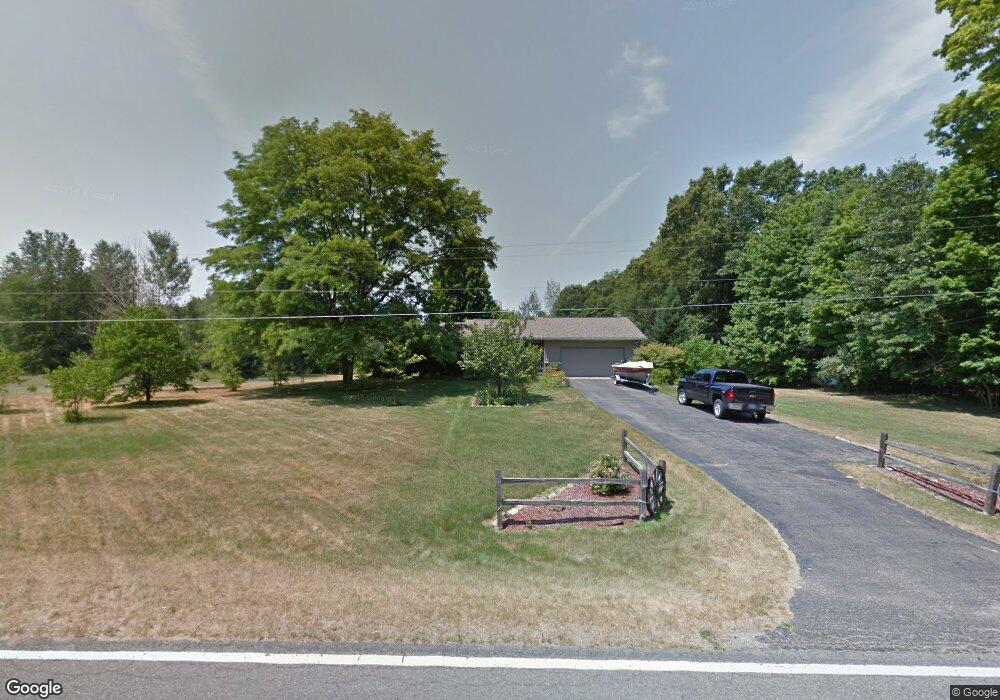
39042 County Road 653 Paw Paw, MI 49079
Estimated Value: $304,000 - $377,000
3
Beds
2
Baths
1,380
Sq Ft
$245/Sq Ft
Est. Value
About This Home
This home is located at 39042 County Road 653, Paw Paw, MI 49079 and is currently estimated at $337,458, approximately $244 per square foot. 39042 County Road 653 is a home located in Van Buren County with nearby schools including Paw Paw Early Elementary School, Paw Paw Later Elementary School, and Paw Paw Middle School.
Ownership History
Date
Name
Owned For
Owner Type
Purchase Details
Closed on
Dec 2, 2024
Sold by
Marvin Judith K
Bought by
Judith K Marvin Trust and Marvin
Current Estimated Value
Purchase Details
Closed on
Apr 25, 2007
Sold by
Marvin V Ronald E V and Marvin Judith K
Bought by
Ronald Edward Marvin Trust and Judith K Marvin Trust
Purchase Details
Closed on
Jul 8, 1997
Sold by
Sleeman Dorothy
Bought by
Marvin Ronald E and Marvin Judith K
Create a Home Valuation Report for This Property
The Home Valuation Report is an in-depth analysis detailing your home's value as well as a comparison with similar homes in the area
Home Values in the Area
Average Home Value in this Area
Purchase History
| Date | Buyer | Sale Price | Title Company |
|---|---|---|---|
| Judith K Marvin Trust | -- | None Listed On Document | |
| Marvin Judith K | -- | None Listed On Document | |
| Ronald Edward Marvin Trust | -- | None Listed On Document | |
| Marvin Ronald E | $108,000 | -- |
Source: Public Records
Tax History Compared to Growth
Tax History
| Year | Tax Paid | Tax Assessment Tax Assessment Total Assessment is a certain percentage of the fair market value that is determined by local assessors to be the total taxable value of land and additions on the property. | Land | Improvement |
|---|---|---|---|---|
| 2025 | $890 | $137,600 | $0 | $0 |
| 2024 | $890 | $120,200 | $0 | $0 |
| 2023 | $847 | $112,400 | $0 | $0 |
| 2022 | $2,649 | $100,400 | $0 | $0 |
| 2021 | $2,608 | $83,100 | $13,000 | $70,100 |
| 2020 | $2,463 | $83,100 | $13,000 | $70,100 |
| 2019 | $2,347 | $79,900 | $79,900 | $0 |
| 2018 | $2,293 | $76,000 | $76,000 | $0 |
| 2017 | $2,248 | $70,700 | $0 | $0 |
| 2016 | $2,234 | $67,800 | $0 | $0 |
| 2015 | $2,005 | $67,800 | $0 | $0 |
| 2014 | $1,971 | $68,400 | $0 | $0 |
| 2013 | -- | $65,800 | $65,800 | $0 |
Source: Public Records
Map
Nearby Homes
- 37137 30th St
- 41692 30th St
- 41240 County Road 652
- 27090 M 43 Hwy
- 31715 30th St
- 26321 Trestle Creek Ave
- 24108 Cr 375
- 32846 32nd St
- 48265 Silver Oaks W
- 36561 M 40
- 24402 Thousand Oaks Dr
- 58927 Norton St
- 58418 Norton St
- 48522 Meadow Oak Trail
- Integrity 1830 Plan at Silver Oaks
- Elements 2070 Plan at Silver Oaks - Elements
- Integrity 1610 Plan at Silver Oaks
- Traditions 3400 V8.0b Plan at Silver Oaks - Traditions
- Elements 2090 Plan at Silver Oaks - Elements
- Traditions 2350 V8.0b Plan at Silver Oaks - Traditions
- 38945 County Road 653
- 39177 County Road 653
- 39177 County Road 653
- 38841 County Road 653
- 38841 County Road 653
- 39300 County Road 653
- 39463 County Road 653
- 39578 County Road 653
- 39778 County Road 653
- 28600 40th Ave
- 28600 40th Ave
- 39882 County Road 653
- 28503 38th Ave
- 28760 40th Ave
- 28381 40th Ave
- 28469 40th Ave
- 28575 40th Ave
- 28928 40th Ave
- 37903 County Road 653
- 37903 County Road 653