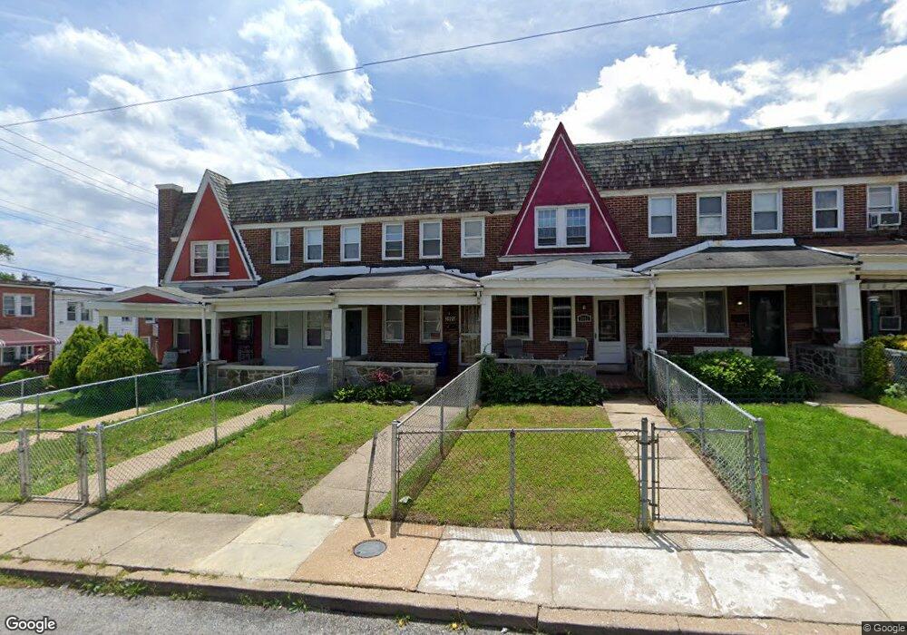
3905 Cranston Ave Baltimore, MD 21229
Edmondson Villiage NeighborhoodEstimated Value: $141,523 - $256,000
--
Bed
1
Bath
1,200
Sq Ft
$166/Sq Ft
Est. Value
About This Home
This home is located at 3905 Cranston Ave, Baltimore, MD 21229 and is currently estimated at $198,762, approximately $165 per square foot. 3905 Cranston Ave is a home located in Baltimore City with nearby schools including Booker T. Washington Middle School, Edmondson Westside High School, and Frederick Douglass High School.
Ownership History
Date
Name
Owned For
Owner Type
Purchase Details
Closed on
Nov 6, 2025
Sold by
Bel-Park Commercial Llc
Bought by
Chantes Flipping Llc
Current Estimated Value
Purchase Details
Closed on
Mar 14, 2025
Sold by
Ward Carrie M and Bierman Howard N
Bought by
Motion Properties Llc
Home Financials for this Owner
Home Financials are based on the most recent Mortgage that was taken out on this home.
Original Mortgage
$195,000
Interest Rate
6.87%
Mortgage Type
New Conventional
Purchase Details
Closed on
Mar 30, 2023
Sold by
Mannone Russell
Bought by
Bel-Park Commercial Llc
Create a Home Valuation Report for This Property
The Home Valuation Report is an in-depth analysis detailing your home's value as well as a comparison with similar homes in the area
Home Values in the Area
Average Home Value in this Area
Purchase History
| Date | Buyer | Sale Price | Title Company |
|---|---|---|---|
| Chantes Flipping Llc | $1,600 | Ktl Title | |
| Motion Properties Llc | $135,000 | New World Title | |
| Motion Properties Llc | $135,000 | New World Title | |
| Bel-Park Commercial Llc | -- | None Listed On Document |
Source: Public Records
Mortgage History
| Date | Status | Borrower | Loan Amount |
|---|---|---|---|
| Previous Owner | Motion Properties Llc | $195,000 |
Source: Public Records
Tax History Compared to Growth
Tax History
| Year | Tax Paid | Tax Assessment Tax Assessment Total Assessment is a certain percentage of the fair market value that is determined by local assessors to be the total taxable value of land and additions on the property. | Land | Improvement |
|---|---|---|---|---|
| 2025 | $2,211 | $116,933 | -- | -- |
| 2024 | $2,211 | $108,967 | $0 | $0 |
| 2023 | $2,167 | $101,000 | $25,000 | $76,000 |
| 2022 | $2,079 | $97,233 | $0 | $0 |
| 2021 | $2,206 | $93,467 | $0 | $0 |
| 2020 | $1,934 | $89,700 | $25,000 | $64,700 |
| 2019 | $1,886 | $88,933 | $0 | $0 |
| 2018 | $1,840 | $88,167 | $0 | $0 |
| 2017 | $1,791 | $87,400 | $0 | $0 |
| 2016 | $1,555 | $83,633 | $0 | $0 |
| 2015 | $1,555 | $79,867 | $0 | $0 |
| 2014 | $1,555 | $76,100 | $0 | $0 |
Source: Public Records
Map
Nearby Homes
- 733 Lyndhurst St
- 3904 Woodridge Rd
- 704 Mount Holly St
- 605 N Loudon Ave
- 3711 Cranston Ave
- 3910 Edmondson Ave
- 827 N Augusta Ave
- 622 Allendale St
- 3814 Flowerton Rd
- 3657 Gelston Dr
- 3716 Edmondson Ave
- 3608 Harlem Ave
- 3606 Harlem Ave
- 3645 Gelston Dr
- 1007 Mount Holly St
- 3604 Harlem Ave
- 514 Lyndhurst St
- 509 Normandy Ave
- 3914 Rokeby Rd
- 603 Allendale St
- 3903 Cranston Ave
- 3907 Cranston Ave
- 3901 Cranston Ave
- 3909 Cranston Ave
- 3911 Cranston Ave
- 3913 Cranston Ave
- 3915 Cranston Ave
- 728 Lyndhurst St
- 730 Lyndhurst St
- 3919 Cranston Ave
- 726 Lyndhurst St
- 732 Lyndhurst St
- 724 Lyndhurst St
- 3921 Cranston Ave
- 722 Lyndhurst St
- 3904 Gelston Dr
- 3902 Gelston Dr
- 3906 Gelston Dr
- 3900 Gelston Dr
- 3908 Gelston Dr