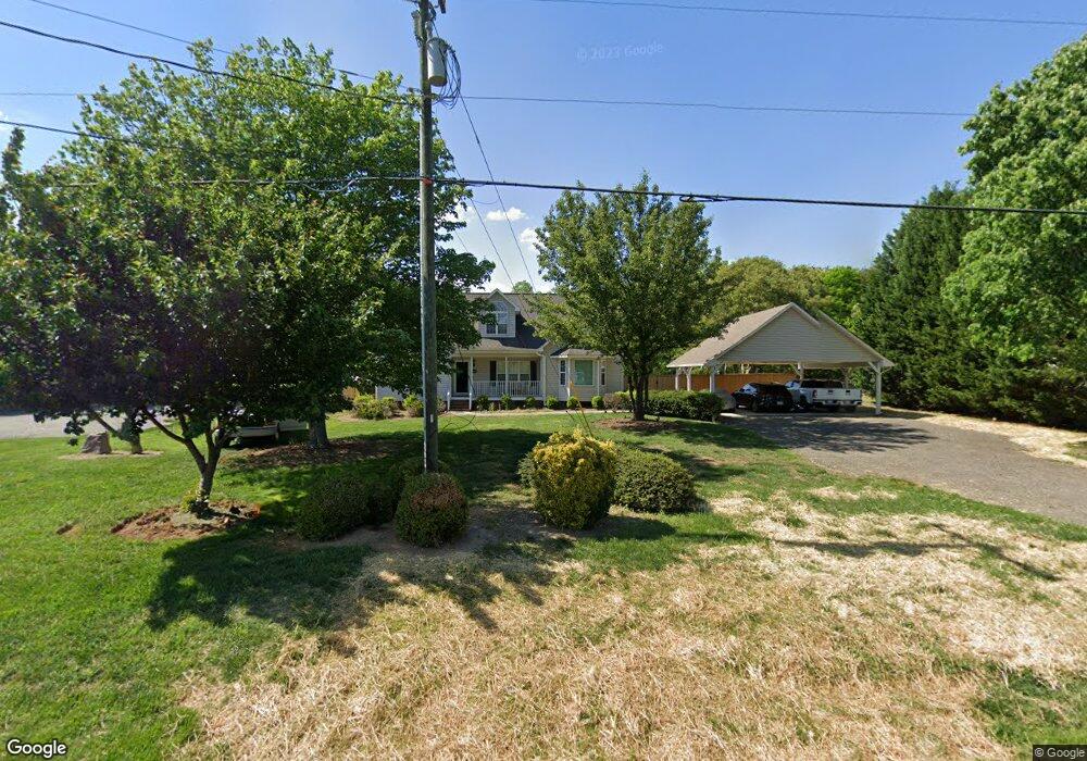
3905 E Nc Highway 150 Browns Summit, NC 27214
Estimated Value: $387,374 - $461,000
5
Beds
3
Baths
2,306
Sq Ft
$178/Sq Ft
Est. Value
About This Home
This home is located at 3905 E Nc Highway 150, Browns Summit, NC 27214 and is currently estimated at $411,094, approximately $178 per square foot. 3905 E Nc Highway 150 is a home located in Guilford County with nearby schools including Northern Elementary School, Northern Guilford Middle School, and Northern Guilford High School.
Ownership History
Date
Name
Owned For
Owner Type
Purchase Details
Closed on
Feb 17, 2012
Sold by
Gilbert Frenche G and Gilbert Jessica D
Bought by
Gilbert Frenche G
Current Estimated Value
Home Financials for this Owner
Home Financials are based on the most recent Mortgage that was taken out on this home.
Original Mortgage
$189,678
Outstanding Balance
$132,170
Interest Rate
4.25%
Mortgage Type
FHA
Estimated Equity
$278,924
Create a Home Valuation Report for This Property
The Home Valuation Report is an in-depth analysis detailing your home's value as well as a comparison with similar homes in the area
Home Values in the Area
Average Home Value in this Area
Purchase History
| Date | Buyer | Sale Price | Title Company |
|---|---|---|---|
| Gilbert Frenche G | -- | None Available |
Source: Public Records
Mortgage History
| Date | Status | Borrower | Loan Amount |
|---|---|---|---|
| Open | Gilbert Frenche G | $189,678 |
Source: Public Records
Tax History
| Year | Tax Paid | Tax Assessment Tax Assessment Total Assessment is a certain percentage of the fair market value that is determined by local assessors to be the total taxable value of land and additions on the property. | Land | Improvement |
|---|---|---|---|---|
| 2025 | $1,873 | $210,400 | $32,000 | $178,400 |
| 2024 | $1,873 | $210,400 | $32,000 | $178,400 |
| 2023 | $1,873 | $210,400 | $32,000 | $178,400 |
| 2022 | $1,831 | $210,400 | $32,000 | $178,400 |
| 2021 | $1,736 | $199,400 | $32,000 | $167,400 |
| 2020 | $1,736 | $199,400 | $32,000 | $167,400 |
| 2019 | $1,736 | $199,400 | $0 | $0 |
| 2018 | $1,707 | $199,400 | $0 | $0 |
| 2017 | $1,716 | $199,400 | $0 | $0 |
| 2016 | $1,707 | $192,900 | $0 | $0 |
| 2015 | $1,679 | $188,700 | $0 | $0 |
| 2014 | $1,698 | $188,700 | $0 | $0 |
Source: Public Records
Map
Nearby Homes
- 5509 Yanceyville Rd
- 8111 Oak Arbor Rd
- 5475 Yanceyville Rd
- 705 Gadwall Dr
- 8082 Chilcutt Dr
- 2900 Walbrook Terrace
- 2902 Spencers Way
- 3506 Wesley Point Dr
- 6098 N Church St
- 205 Burton-Farm Rd
- 2909 Spencers Grove Rd
- 406 Fairmile Dr
- 8435 Newgate Trace
- 8307 Fairgrove Church Rd
- 8413 Fairgrove Church Rd
- 8323/8327 Fairgrove Church Rd
- 8305 Fairgrove Church Rd
- 8301 Fairgrove Church Rd
- 8331 Fairgrove Church Rd
- 3905 N Carolina 150
- 3903 E Nc Highway 150
- 3903 N Carolina 150
- 3907 E Nc Highway 150
- 8104 Shamarli Ct
- 8106 Shamarli Ct
- 1700 John Glenn Dr
- 8102 Shamarli Ct
- 1702 John Glenn Dr
- 1701 John Glenn Dr
- 8007 Neil Armstrong Ct
- 8107 Shamarli Ct
- 3919 Nc Highway 150 E
- 8100 Shamarli Ct
- 1703 John Glenn Dr
- 8105 Shamarli Ct
- 8005 Neil Armstrong Ct
- 8008 Neil Armstrong Ct
- 8101 Shamarli Ct
- 3920 E Nc Highway 150
Your Personal Tour Guide
Ask me questions while you tour the home.