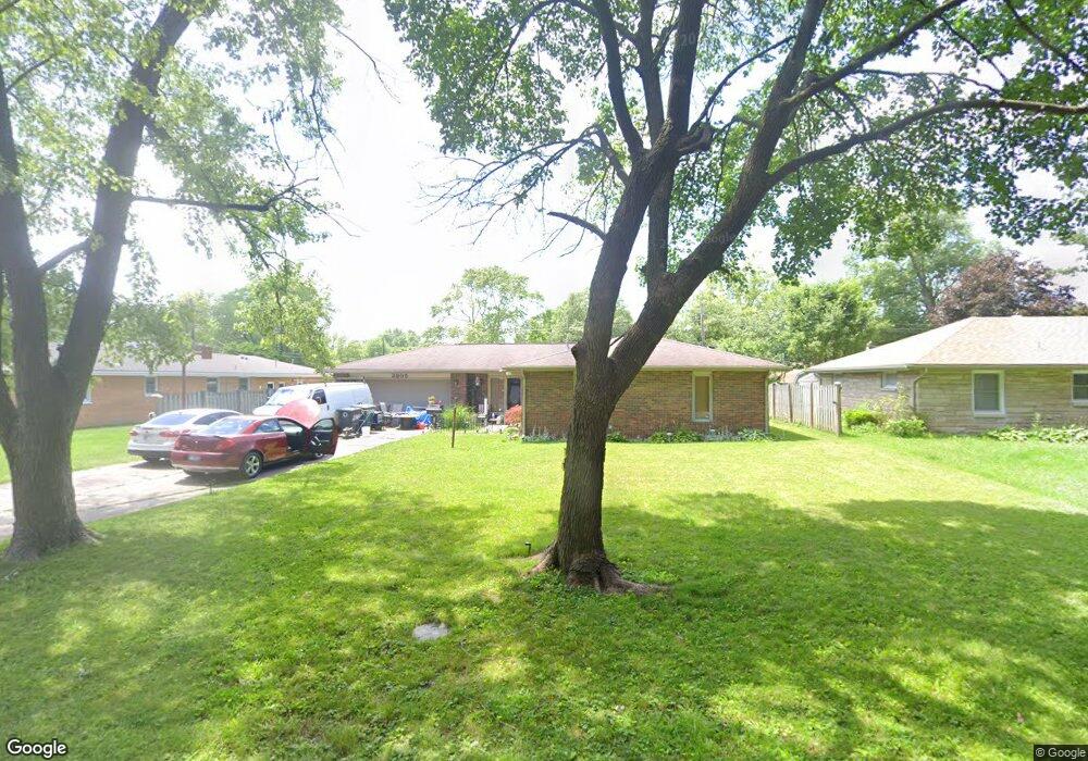
3905 N Locust St Muncie, IN 47304
Northview NeighborhoodEstimated Value: $160,000 - $189,000
3
Beds
2
Baths
1,429
Sq Ft
$122/Sq Ft
Est. Value
About This Home
This home is located at 3905 N Locust St, Muncie, IN 47304 and is currently estimated at $174,171, approximately $121 per square foot. 3905 N Locust St is a home located in Delaware County with nearby schools including North View Elementary School, Muncie Central High School, and Northside Middle School.
Ownership History
Date
Name
Owned For
Owner Type
Purchase Details
Closed on
Nov 2, 2011
Sold by
Federal Home Loan Mortgage Corporation
Bought by
Foster Brian E and Eldridge Linda M
Current Estimated Value
Purchase Details
Closed on
Sep 14, 2011
Sold by
Garrett Misty D and Ring Robie J
Bought by
Federal Home Loan Mortgage Corporation
Purchase Details
Closed on
Nov 16, 2006
Sold by
Wilmore Homer Jerry
Bought by
Garrett Misty D and Ring Robie J
Home Financials for this Owner
Home Financials are based on the most recent Mortgage that was taken out on this home.
Original Mortgage
$67,900
Interest Rate
6.41%
Mortgage Type
New Conventional
Purchase Details
Closed on
May 31, 2006
Sold by
Wilmore Kristopher T
Bought by
Wilmore Homer Jerry
Create a Home Valuation Report for This Property
The Home Valuation Report is an in-depth analysis detailing your home's value as well as a comparison with similar homes in the area
Home Values in the Area
Average Home Value in this Area
Purchase History
| Date | Buyer | Sale Price | Title Company |
|---|---|---|---|
| Foster Brian E | -- | Statewide Title Company Inc | |
| Federal Home Loan Mortgage Corporation | $62,250 | None Available | |
| Garrett Misty D | -- | None Available | |
| Wilmore Homer Jerry | -- | None Available |
Source: Public Records
Mortgage History
| Date | Status | Borrower | Loan Amount |
|---|---|---|---|
| Previous Owner | Garrett Misty D | $67,900 |
Source: Public Records
Tax History Compared to Growth
Tax History
| Year | Tax Paid | Tax Assessment Tax Assessment Total Assessment is a certain percentage of the fair market value that is determined by local assessors to be the total taxable value of land and additions on the property. | Land | Improvement |
|---|---|---|---|---|
| 2024 | $1,435 | $131,700 | $17,100 | $114,600 |
| 2023 | $1,370 | $125,000 | $11,400 | $113,600 |
| 2022 | $2,983 | $119,700 | $11,400 | $108,300 |
| 2021 | $1,153 | $103,300 | $14,700 | $88,600 |
| 2020 | $988 | $86,800 | $13,000 | $73,800 |
| 2019 | $910 | $79,000 | $11,800 | $67,200 |
| 2018 | $974 | $85,600 | $11,300 | $74,300 |
| 2017 | $895 | $77,700 | $11,400 | $66,300 |
| 2016 | $876 | $75,800 | $11,400 | $64,400 |
| 2014 | $845 | $79,200 | $12,300 | $66,900 |
| 2013 | -- | $84,200 | $12,300 | $71,900 |
Source: Public Records
Map
Nearby Homes
- 3613 N Locust St
- 3609 N Locust St
- 3705 N New York Ave
- 3509 N Lanewood Dr
- 3501 N Lanewood Dr
- 69 Falcon Point Ct
- 67 Falcon Point Ct
- 66 Falcon Point Ct
- 70 Falcon Point Ct
- 68 Falcon Point Ct
- 3417 N Milton St
- 400 W Skyway Dr
- 300 W Horizon Rd
- 0 Emerald Pointe Way Unit 202508714
- 73 Emerald Pointe Way
- 72 Emerald Pointe Way
- 900 W Elsie Ave
- 4210 N Oakwood Ave
- 4304 N Oakwood Ave
- 107 E Berkley Ave
- 3909 N Locust St
- 1100 W Yale Ave
- 3906 N Virginia Ave
- 3910 N Virginia Ave
- 1120 W Yale Ave
- 3904 N Locust St
- 4001 N Locust St
- 1020 W Yale Ave
- 3910 N Locust St
- 3914 N Virginia Ave
- 1101 W Yale Ave
- 3914 N Locust St
- 1121 W Yale Ave
- 4000 N Virginia Ave
- 1021 W Yale Ave
- 4005 N Locust St
- 3810 N Virginia Ave
- 3905 N Linden St
- 3905 N Virginia Ave
- 1000 W Yale Ave