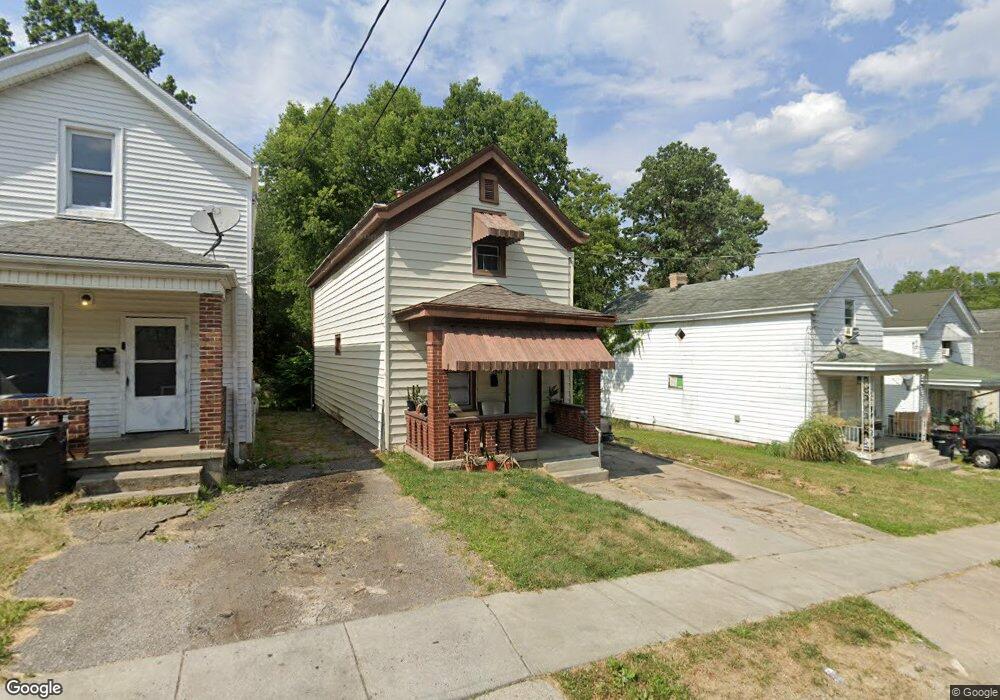
3906 Latham Ave Cincinnati, OH 45205
West Price Hill NeighborhoodEstimated Value: $120,563
2
Beds
1
Bath
1,280
Sq Ft
$94/Sq Ft
Est. Value
About This Home
This home is located at 3906 Latham Ave, Cincinnati, OH 45205 and is currently estimated at $120,563, approximately $94 per square foot. 3906 Latham Ave is a home located in Hamilton County with nearby schools including Carson School, Gilbert A. Dater High School, and Western Hills High School.
Ownership History
Date
Name
Owned For
Owner Type
Purchase Details
Closed on
Mar 8, 2017
Sold by
Rhodes Dusty
Bought by
Hamilton County Land Reutilization Corp
Current Estimated Value
Purchase Details
Closed on
Mar 7, 2007
Sold by
Renew Real Estate Ventures Llc
Bought by
Clement Rex B
Home Financials for this Owner
Home Financials are based on the most recent Mortgage that was taken out on this home.
Original Mortgage
$48,900
Outstanding Balance
$30,143
Interest Rate
6.97%
Mortgage Type
Purchase Money Mortgage
Estimated Equity
$91,055
Purchase Details
Closed on
Nov 14, 2006
Sold by
Lasalle Bank Na
Bought by
Renew Real Estate Ventures Llc
Purchase Details
Closed on
Mar 28, 2006
Sold by
Kirkendall Cassandra and Howard William
Bought by
Lasalle Bank Na and Bear Stearns Asset Backed Securities I L
Purchase Details
Closed on
Aug 9, 2004
Sold by
Trunick Jeff
Bought by
Kirkendall Cassandra
Home Financials for this Owner
Home Financials are based on the most recent Mortgage that was taken out on this home.
Original Mortgage
$58,500
Interest Rate
8.05%
Mortgage Type
Fannie Mae Freddie Mac
Purchase Details
Closed on
Sep 12, 2003
Sold by
Howard William L
Bought by
Trunick Jeff and The 3906 Latham Avenue Land Trust Ii
Purchase Details
Closed on
Dec 19, 1994
Sold by
Clayton Steven H and Clayton Marsha L
Bought by
Hounshell Robin E
Home Financials for this Owner
Home Financials are based on the most recent Mortgage that was taken out on this home.
Original Mortgage
$53,100
Interest Rate
9.27%
Mortgage Type
Purchase Money Mortgage
Create a Home Valuation Report for This Property
The Home Valuation Report is an in-depth analysis detailing your home's value as well as a comparison with similar homes in the area
Home Values in the Area
Average Home Value in this Area
Purchase History
| Date | Buyer | Sale Price | Title Company |
|---|---|---|---|
| Hamilton County Land Reutilization Corp | -- | -- | |
| Clement Rex B | $61,200 | None Available | |
| Renew Real Estate Ventures Llc | $21,000 | Fidelity Land Title Agency O | |
| Lasalle Bank Na | $44,000 | None Available | |
| Kirkendall Cassandra | $65,000 | -- | |
| Trunick Jeff | $25,000 | -- | |
| Hounshell Robin E | -- | -- |
Source: Public Records
Mortgage History
| Date | Status | Borrower | Loan Amount |
|---|---|---|---|
| Open | Clement Rex B | $48,900 | |
| Previous Owner | Kirkendall Cassandra | $58,500 | |
| Previous Owner | Hounshell Robin E | $53,100 | |
| Closed | Kirkendall Cassandra | $3,250 |
Source: Public Records
Tax History
| Year | Tax Paid | Tax Assessment Tax Assessment Total Assessment is a certain percentage of the fair market value that is determined by local assessors to be the total taxable value of land and additions on the property. | Land | Improvement |
|---|---|---|---|---|
| 2025 | -- | $2,415 | $2,415 | -- |
| 2024 | -- | $2,415 | $2,415 | -- |
| 2023 | $0 | $2,415 | $2,415 | $0 |
| 2022 | $0 | $2,492 | $2,492 | $0 |
| 2021 | $0 | $2,492 | $2,492 | $0 |
| 2020 | $0 | $2,492 | $2,492 | $0 |
| 2019 | $7 | $10,822 | $2,492 | $8,330 |
| 2018 | $5 | $10,822 | $2,492 | $8,330 |
| 2017 | $5 | $10,822 | $2,492 | $8,330 |
| 2016 | $2,136 | $14,550 | $2,331 | $12,219 |
| 2015 | $1,438 | $14,550 | $2,331 | $12,219 |
| 2014 | $990 | $14,550 | $2,331 | $12,219 |
| 2013 | $1,143 | $16,535 | $2,650 | $13,885 |
Source: Public Records
Map
Nearby Homes
- 1440 Manss Ave
- 1700 Minion Ave
- 4000 Akochia Ave
- 1318 Beech Ave
- 1626 Iliff Ave
- 1613 Wyoming Ave
- 1634 Dewey Ave
- 1647 Dewey Ave
- 4033 W Liberty St
- 1812 Quebec Rd
- 3744 Mayfield Ave
- 3742 Mayfield Ave
- 1261 Dewey Ave
- 1231 Ridlen Ave
- 1222 Dewey Ave
- 2403 Glenway Ave
- 1136 Gilsey Ave
- 3719 Laclede Ave
- 1104 Seton Ave
- 2245 Quebec Rd
- 3904 Latham Ave
- 3908 Latham Ave
- 3902 Latham Ave
- 3910 Latham Ave
- 3900 Latham Ave
- 3912 Latham Ave
- 1503 Beech Ave
- 3914 Latham Ave
- 1510 Manss Ave
- 1442 Manss Ave
- 1507 Beech Ave
- 1512 Manss Ave
- 1509 Beech Ave
- 1438 Manss Ave
- 1500 Beech Ave
- 1504 Beech Ave
- 1514 Manss Ave
- 1513 Beech Ave
- 1505 Manss Ave
- 1538 Beech Ave
Your Personal Tour Guide
Ask me questions while you tour the home.