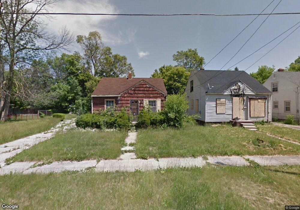
3906 Leerda St Flint, MI 48504
Merill NeighborhoodEstimated Value: $49,000 - $59,000
3
Beds
1
Bath
974
Sq Ft
$55/Sq Ft
Est. Value
About This Home
This home is located at 3906 Leerda St, Flint, MI 48504 and is currently estimated at $54,000, approximately $55 per square foot. 3906 Leerda St is a home located in Genesee County with nearby schools including Brownell STEM Academy, Greater Heights Academy, and Eagle's Nest Academy.
Ownership History
Date
Name
Owned For
Owner Type
Purchase Details
Closed on
Jan 14, 2014
Sold by
State Of Michigan
Bought by
Genesee County Land Bank Authority
Current Estimated Value
Purchase Details
Closed on
Dec 9, 2013
Sold by
Genesse County Land Bank Authority
Bought by
State Of Michigan and Land Bank Fast Track Authority
Purchase Details
Closed on
Dec 20, 2012
Sold by
Cherry Deborah L
Bought by
Genesee County Land Bank
Purchase Details
Closed on
Aug 7, 2007
Sold by
Nationscredit Financial Services Corp
Bought by
Corder Edward
Purchase Details
Closed on
Jan 25, 2000
Sold by
Grinage Syidah and Corder Syidah
Bought by
Corder Edward
Home Financials for this Owner
Home Financials are based on the most recent Mortgage that was taken out on this home.
Original Mortgage
$28,500
Interest Rate
8.21%
Mortgage Type
Purchase Money Mortgage
Create a Home Valuation Report for This Property
The Home Valuation Report is an in-depth analysis detailing your home's value as well as a comparison with similar homes in the area
Home Values in the Area
Average Home Value in this Area
Purchase History
| Date | Buyer | Sale Price | Title Company |
|---|---|---|---|
| Genesee County Land Bank Authority | -- | None Available | |
| State Of Michigan | -- | None Available | |
| Genesee County Land Bank | -- | None Available | |
| Corder Edward | $27,900 | Tri County Title Agency Inc | |
| Corder Edward | -- | Tri County Title Agency Inc |
Source: Public Records
Mortgage History
| Date | Status | Borrower | Loan Amount |
|---|---|---|---|
| Previous Owner | Corder Edward | $28,500 |
Source: Public Records
Tax History
| Year | Tax Paid | Tax Assessment Tax Assessment Total Assessment is a certain percentage of the fair market value that is determined by local assessors to be the total taxable value of land and additions on the property. | Land | Improvement |
|---|---|---|---|---|
| 2025 | -- | $0 | $0 | $0 |
| 2024 | -- | $0 | $0 | $0 |
| 2023 | -- | $0 | $0 | $0 |
| 2022 | $0 | $0 | $0 | $0 |
| 2021 | $0 | $0 | $0 | $0 |
| 2020 | $0 | $0 | $0 | $0 |
| 2019 | $0 | $0 | $0 | $0 |
| 2018 | $0 | $0 | $0 | $0 |
| 2017 | $0 | $0 | $0 | $0 |
| 2016 | $0 | $0 | $0 | $0 |
| 2015 | -- | $0 | $0 | $0 |
| 2014 | -- | $0 | $0 | $0 |
| 2012 | -- | $12,700 | $0 | $0 |
Source: Public Records
Map
Nearby Homes
- 3808 Comstock Ave
- 1315 W Myrtle Ave
- 3517 Leerda St
- 3505 Leerda St
- 3419 Leerda St
- 3722 Sterling St
- 3413 Leerda St
- 3420 Fleming Rd
- 3506 Brownell Blvd
- 3710 Kellar Ave
- 3617 Kellar Ave
- 3218 Trumbull Ave
- 3221 Burgess St
- 4306 Berger Dr
- 3802 Milbourne Ave
- 4539 Trumbull Dr
- 2006 W Mcclellan St
- 2013 Canniff St
- 2907 Trumbull Ave
- 3207 Milbourne Ave
- 3902 Leerda St
- 3914 Leerda St Unit Bldg-Unit
- 3914 Leerda St
- 3905 Trumbull Ave
- 3909 Trumbull Ave
- 3915 Trumbull Ave
- 3818 Leerda St
- 3909 Leerda St
- 3905 Leerda St
- 3817 Trumbull Ave
- 3814 Leerda St
- 3901 Leerda St
- 3913 Leerda St
- 3817 Leerda St
- 3813 Trumbull Ave
- 3810 Leerda St
- 4002 Leerda St
- 3813 Leerda St
- 3910 Trumbull Ave
- 3902 Trumbull Ave
Your Personal Tour Guide
Ask me questions while you tour the home.