Estimated Value: $476,000 - $528,000
4
Beds
3
Baths
2,300
Sq Ft
$215/Sq Ft
Est. Value
About This Home
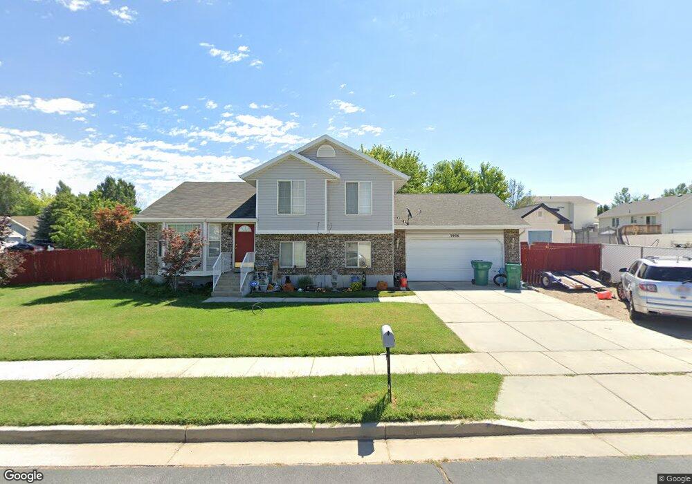
This home is located at 3906 S 2600 W, Roy, UT 84067 and is currently estimated at $494,908, approximately $215 per square foot. 3906 S 2600 W is a home located in Weber County with nearby schools including North Park School, Sand Ridge Junior High School, and Roy High School.
Ownership History
Date
Name
Owned For
Owner Type
Purchase Details
Closed on
Dec 9, 2014
Sold by
Randolph Charles L and Randolph Rhonda L
Bought by
Child Kent David and Child Elizabeth Ann
Current Estimated Value
Home Financials for this Owner
Home Financials are based on the most recent Mortgage that was taken out on this home.
Original Mortgage
$201,286
Outstanding Balance
$153,210
Interest Rate
3.75%
Mortgage Type
FHA
Estimated Equity
$341,698
Purchase Details
Closed on
Dec 19, 2008
Sold by
Lanew Matthew L and Lanew Jannen N
Bought by
Randolph Charles L and Randolph Rhonda L
Home Financials for this Owner
Home Financials are based on the most recent Mortgage that was taken out on this home.
Original Mortgage
$196,650
Interest Rate
6.16%
Mortgage Type
Purchase Money Mortgage
Purchase Details
Closed on
May 18, 2005
Sold by
Lanew Mathew L
Bought by
Lanew Matthew L and Byrum Jannen N
Home Financials for this Owner
Home Financials are based on the most recent Mortgage that was taken out on this home.
Original Mortgage
$153,628
Interest Rate
5.87%
Mortgage Type
VA
Purchase Details
Closed on
May 17, 2005
Sold by
Lanew Jody M
Bought by
Lanew Matthew L
Home Financials for this Owner
Home Financials are based on the most recent Mortgage that was taken out on this home.
Original Mortgage
$153,628
Interest Rate
5.87%
Mortgage Type
VA
Purchase Details
Closed on
Oct 23, 2003
Sold by
Townsend Robert F and Townsend Bonnie R
Bought by
Lanew Matthew L and Lanew Jody M
Home Financials for this Owner
Home Financials are based on the most recent Mortgage that was taken out on this home.
Original Mortgage
$151,470
Interest Rate
6.14%
Mortgage Type
VA
Purchase Details
Closed on
May 1, 2001
Sold by
Federal National Mortgage Association
Bought by
Townsend Robert F and Townsend Bonnie R
Home Financials for this Owner
Home Financials are based on the most recent Mortgage that was taken out on this home.
Original Mortgage
$137,598
Interest Rate
6.92%
Mortgage Type
VA
Purchase Details
Closed on
Feb 13, 2001
Sold by
Alvey Lex A and Vanderford Center Inc
Bought by
Federal National Mortgage Association
Purchase Details
Closed on
Mar 3, 1999
Sold by
Castle Homes Llc
Bought by
Alvey Lex A
Home Financials for this Owner
Home Financials are based on the most recent Mortgage that was taken out on this home.
Original Mortgage
$126,400
Interest Rate
6.7%
Create a Home Valuation Report for This Property
The Home Valuation Report is an in-depth analysis detailing your home's value as well as a comparison with similar homes in the area
Home Values in the Area
Average Home Value in this Area
Purchase History
| Date | Buyer | Sale Price | Title Company |
|---|---|---|---|
| Child Kent David | -- | Us Title Insurance Agency | |
| Randolph Charles L | -- | Lincoln Title Insurance Agen | |
| Lanew Matthew L | -- | First American Title | |
| Lanew Matthew L | -- | First American Title | |
| Lanew Matthew L | -- | First American Title | |
| Townsend Robert F | -- | U S Title | |
| Federal National Mortgage Association | $106,541 | First American Title | |
| Alvey Lex A | -- | Security Title |
Source: Public Records
Mortgage History
| Date | Status | Borrower | Loan Amount |
|---|---|---|---|
| Open | Child Kent David | $201,286 | |
| Previous Owner | Randolph Charles L | $196,650 | |
| Previous Owner | Lanew Matthew L | $153,628 | |
| Previous Owner | Lanew Matthew L | $151,470 | |
| Previous Owner | Townsend Robert F | $137,598 | |
| Previous Owner | Alvey Lex A | $126,400 | |
| Closed | Alvey Lex A | $50,500 |
Source: Public Records
Tax History Compared to Growth
Tax History
| Year | Tax Paid | Tax Assessment Tax Assessment Total Assessment is a certain percentage of the fair market value that is determined by local assessors to be the total taxable value of land and additions on the property. | Land | Improvement |
|---|---|---|---|---|
| 2025 | $2,920 | $468,273 | $140,308 | $327,965 |
| 2024 | $2,791 | $247,499 | $77,169 | $170,330 |
| 2023 | $2,526 | $222,750 | $72,635 | $150,115 |
| 2022 | $2,876 | $264,000 | $61,766 | $202,234 |
| 2021 | $2,246 | $337,000 | $77,323 | $259,677 |
| 2020 | $2,172 | $300,000 | $77,323 | $222,677 |
| 2019 | $2,197 | $287,000 | $51,830 | $235,170 |
| 2018 | $2,047 | $251,000 | $46,848 | $204,152 |
| 2017 | $1,886 | $216,000 | $44,899 | $171,101 |
| 2016 | $1,781 | $109,374 | $25,468 | $83,906 |
| 2015 | $1,645 | $103,317 | $25,468 | $77,849 |
| 2014 | $1,516 | $93,252 | $22,658 | $70,594 |
Source: Public Records
Map
Nearby Homes
- 2608 W 3900 S
- 3860 Midland Dr Unit C10
- 3860 Midland Dr Unit A18
- 3860 Midland Dr Unit B32
- 3860 S Midland Dr Unit B97
- 3860 S Midland Dr Unit B59
- 3860 S Midland Dr Unit B 51
- 4118 Westlake Dr
- 3750 S Midland Dr Unit 80
- 3750 S Midland Dr Unit 189
- 3750 S Midland Dr
- 3750 Midland Dr Unit 169
- 4110 S 2275 W
- 3928 S 2225 W
- 4269 S 2350 W
- 2777 W 4175 S Unit 229
- 3963 S 2925 W
- 2835 W 4200 S
- 3891 S 2940 W
- 3866 S 2970 W
- 2587 W 3900 S
- 2598 W 3950 S
- 2590 W 3950 S
- 3907 S 2600 W
- 2579 W 3900 S
- 2596 W 3900 S
- 2596 W 3900 S Unit lot54
- 3921 S 2600 W
- 2582 W 3950 S
- 2602 W 3900 S
- 2602 W 3900 S Unit lot53
- 2588 W 3900 S
- 3933 S 2600 W
- 2571 W 3900 S
- 2580 W 3900 S
- 2608 W 3900 S Unit L-52
- 2574 W 3950 S
- 2613 W 3900 S
- 3947 S 2600 W
- 3918 S 2625 W