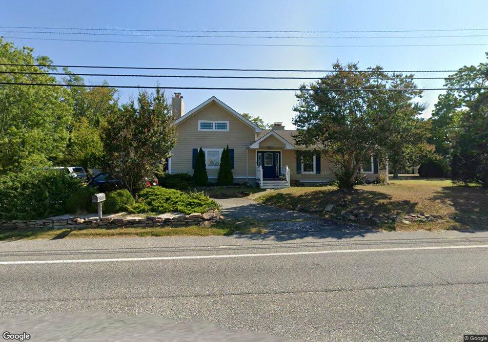
3907 Bayshore Rd Cape May, NJ 08204
Estimated Value: $609,362 - $870,000
--
Bed
--
Bath
1,800
Sq Ft
$399/Sq Ft
Est. Value
About This Home
This home is located at 3907 Bayshore Rd, Cape May, NJ 08204 and is currently estimated at $717,341, approximately $398 per square foot. 3907 Bayshore Rd is a home located in Cape May County with nearby schools including Carl T. Mitnick School, David C. Douglass Veterans Memorial School, and Maud Abrams School.
Ownership History
Date
Name
Owned For
Owner Type
Purchase Details
Closed on
Aug 8, 2022
Sold by
Vansplinter John S and Vansplinter Patricia A
Bought by
Vansplinter John S and Morgan Patricia A
Current Estimated Value
Purchase Details
Closed on
Nov 16, 2012
Sold by
Lund Jean and Nash Elizabeth M
Bought by
Vansplinter John S and Moran Patricia A
Create a Home Valuation Report for This Property
The Home Valuation Report is an in-depth analysis detailing your home's value as well as a comparison with similar homes in the area
Home Values in the Area
Average Home Value in this Area
Purchase History
| Date | Buyer | Sale Price | Title Company |
|---|---|---|---|
| Vansplinter John S | -- | Keywood Thomas D | |
| Vansplinter John S | -- | Keywood Thomas D | |
| Vansplinter John S | $140,000 | The Title Company Of Jersey |
Source: Public Records
Tax History Compared to Growth
Tax History
| Year | Tax Paid | Tax Assessment Tax Assessment Total Assessment is a certain percentage of the fair market value that is determined by local assessors to be the total taxable value of land and additions on the property. | Land | Improvement |
|---|---|---|---|---|
| 2025 | $5,476 | $270,000 | $119,000 | $151,000 |
| 2024 | $5,476 | $270,000 | $119,000 | $151,000 |
| 2023 | $5,397 | $270,000 | $119,000 | $151,000 |
| 2022 | $5,171 | $266,800 | $115,800 | $151,000 |
| 2021 | $5,014 | $266,800 | $115,800 | $151,000 |
| 2020 | $4,936 | $266,800 | $115,800 | $151,000 |
| 2019 | $4,813 | $266,800 | $115,800 | $151,000 |
| 2018 | $4,698 | $266,800 | $115,800 | $151,000 |
| 2017 | $4,704 | $266,800 | $115,800 | $151,000 |
| 2016 | $4,632 | $266,800 | $115,800 | $151,000 |
| 2015 | $4,482 | $266,800 | $115,800 | $151,000 |
| 2014 | $4,215 | $259,400 | $115,800 | $143,600 |
Source: Public Records
Map
Nearby Homes
- 3911 Bayshore Rd
- 712 Gorham Ave
- 3941 Bayshore Rd
- 602 Gorham Ave
- 402 Whildam Ave
- 305 Whildam Ave
- 507 Scotty Blvd Unit 12
- 105 Orchard Dr
- 712 Indian Ave
- 118 Old Mill Dr
- 1024 Shunpike Rd
- 702 Gordon Terrace
- 207 Old Mill Dr
- 54 Heron Way
- 818 Shunpike Rd
- 1400 Franklin Ave
- 508 Adriatic Ave
- 1500 Franklin Ave
- 668 Crawford Rd
- 113 Beachhurst Dr
- 3909 Bayshore Rd
- 3903 Bayshore Rd
- 3874 Bayshore Rd
- 600 Jonathan Hoffman Rd
- 3921 Bayshore Rd
- 604 Jonathan Hoffman Rd
- 720 Gorham Ave
- 3923 Bayshore Rd
- 3860 Bayshore Rd
- 608 Jonathan Hoffman Rd
- 718 Gorham Ave
- 606 Jonathan Hoffman Rd
- 721 Whildam Ave
- 714 Gorham Ave
- 3927 Bayshore Rd
- 719 Whildam Ave
- 717 Whildam Ave
- 710 Gorham Ave
- 715 Whildam Ave
- 610 Jonathan Hoffman Rd