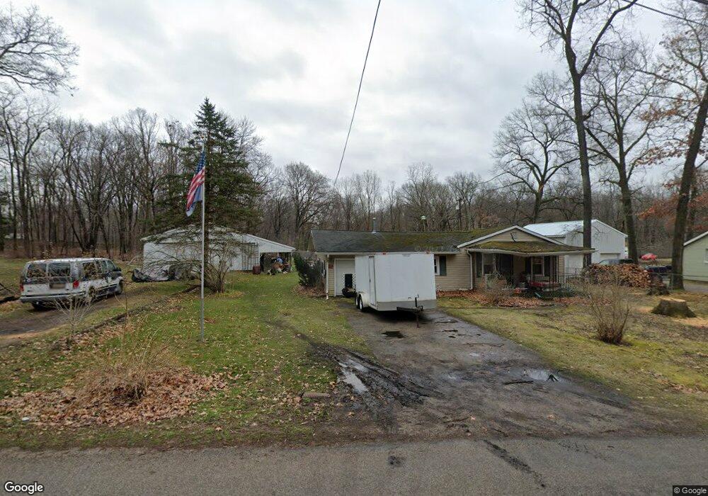
3909 Black Hwy Adrian, MI 49221
Estimated Value: $148,425 - $209,000
Studio
1
Bath
1,107
Sq Ft
$172/Sq Ft
Est. Value
About This Home
This home is located at 3909 Black Hwy, Adrian, MI 49221 and is currently estimated at $190,606, approximately $172 per square foot. 3909 Black Hwy is a home located in Lenawee County with nearby schools including Adrian High School, St. Joseph Academy, and St. Joseph's Academy.
Ownership History
Date
Name
Owned For
Owner Type
Purchase Details
Closed on
Oct 21, 2005
Sold by
Cook Junellar and Cook William Cary
Bought by
Cook Stevie and Cook Debra L
Current Estimated Value
Home Financials for this Owner
Home Financials are based on the most recent Mortgage that was taken out on this home.
Original Mortgage
$84,000
Outstanding Balance
$45,074
Interest Rate
5.8%
Mortgage Type
Purchase Money Mortgage
Estimated Equity
$145,532
Purchase Details
Closed on
Oct 19, 2005
Sold by
Household Finance Corp Iii and Ortega Maria I
Bought by
Cook Steven and Cook Debra
Home Financials for this Owner
Home Financials are based on the most recent Mortgage that was taken out on this home.
Original Mortgage
$84,000
Outstanding Balance
$45,074
Interest Rate
5.8%
Mortgage Type
Purchase Money Mortgage
Estimated Equity
$145,532
Create a Home Valuation Report for This Property
The Home Valuation Report is an in-depth analysis detailing your home's value as well as a comparison with similar homes in the area
Home Values in the Area
Average Home Value in this Area
Purchase History
| Date | Buyer | Sale Price | Title Company |
|---|---|---|---|
| Cook Stevie | -- | Prestige Title Insurance Age | |
| Cook Steven | $75,000 | None Available |
Source: Public Records
Mortgage History
| Date | Status | Borrower | Loan Amount |
|---|---|---|---|
| Open | Cook Stevie | $84,000 | |
| Closed | Cook Steven | $84,000 |
Source: Public Records
Tax History
| Year | Tax Paid | Tax Assessment Tax Assessment Total Assessment is a certain percentage of the fair market value that is determined by local assessors to be the total taxable value of land and additions on the property. | Land | Improvement |
|---|---|---|---|---|
| 2025 | $1,151 | $64,400 | $0 | $0 |
| 2024 | $7 | $60,600 | $0 | $0 |
| 2023 | $1,069 | $54,700 | $0 | $0 |
| 2022 | $1,061 | $49,600 | $0 | $0 |
| 2021 | $1,050 | $46,500 | $0 | $0 |
| 2020 | $1,049 | $43,700 | $0 | $0 |
| 2019 | $95,852 | $39,400 | $0 | $0 |
| 2018 | $1,113 | $39,377 | $0 | $0 |
| 2017 | $1,076 | $37,809 | $0 | $0 |
| 2016 | $1,069 | $34,744 | $0 | $0 |
| 2014 | -- | $32,186 | $0 | $0 |
Source: Public Records
Map
Nearby Homes
- 4126 Mckenna Dr
- 4194 Sauk Trail
- 2000 blk Sutton Rd Unit Parcel B
- 2600 Blk Sutton Rd Unit Parcel C
- 2082 Friar Tuck Cir
- 2829 Sutton Rd
- 2571 E Valley Rd
- 2573 E Valley Rd
- 2577 E Valley Rd
- 1084 Loren Rd
- 4729 Basin St
- 6000 Occidental Hwy Unit 6000 Blk Occidental
- 3811 Torin Ln Unit Parcel G
- 3311 N Adrian Hwy
- 3508 N Wilmoth Hwy
- 2771 Gady Rd
- 2775 Gady Rd
- 2901 Gady Rd
- 3284 Sutton Rd
- 3324 Sutton Rd
- 3900 Black Hwy Unit BLK
- 3901 Black Hwy
- 3887 Black Hwy
- 3855 Black Hwy
- 3971 Black Hwy
- 3847 Black Hwy
- 1763 Sutton Rd
- 1795 Sutton Rd
- 1766 Sutton Rd
- 1806 Sutton Rd
- 4126 Kelsey Ave
- 3767 Black Hwy
- 3755 Black Hwy
- 1820 Sutton Rd
- 3754 Black Hwy
- 1823 Sutton Rd
- 1848 Sutton Rd
- 1850 Sutton Rd
- 4044 Kelsey Ave
- 4120 Kelsey Ave
Your Personal Tour Guide
Ask me questions while you tour the home.