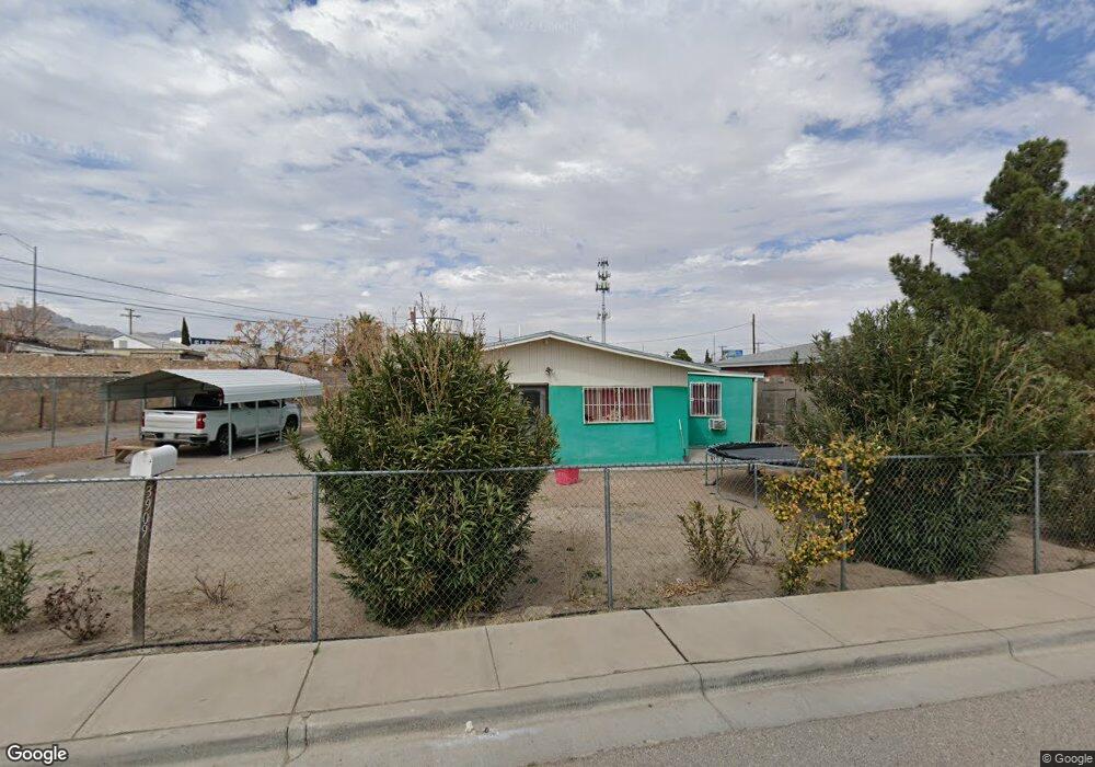
3909 Manchester Ave El Paso, TX 79903
Five Points NeighborhoodEstimated Value: $184,000 - $220,000
3
Beds
2
Baths
1,235
Sq Ft
$163/Sq Ft
Est. Value
About This Home
This home is located at 3909 Manchester Ave, El Paso, TX 79903 and is currently estimated at $201,110, approximately $162 per square foot. 3909 Manchester Ave is a home located in El Paso County with nearby schools including Coldwell Elementary School, Armendariz Middle School, and Middle School-5 NW Middle.
Ownership History
Date
Name
Owned For
Owner Type
Purchase Details
Closed on
Oct 23, 2024
Sold by
Montoya Maria L S D
Bought by
Montoya Maria L S D and Montoya Ana Gabriela
Current Estimated Value
Purchase Details
Closed on
Jun 2, 2010
Sold by
Sierra Manuela and Gonzalez Manuela Palacio
Bought by
Demontoya Maria Lourdes Sierra
Home Financials for this Owner
Home Financials are based on the most recent Mortgage that was taken out on this home.
Original Mortgage
$75,665
Interest Rate
5.37%
Mortgage Type
FHA
Create a Home Valuation Report for This Property
The Home Valuation Report is an in-depth analysis detailing your home's value as well as a comparison with similar homes in the area
Home Values in the Area
Average Home Value in this Area
Purchase History
| Date | Buyer | Sale Price | Title Company |
|---|---|---|---|
| Montoya Maria L S D | -- | None Listed On Document | |
| Demontoya Maria Lourdes Sierra | -- | None Available |
Source: Public Records
Mortgage History
| Date | Status | Borrower | Loan Amount |
|---|---|---|---|
| Previous Owner | Demontoya Maria Lourdes Sierra | $75,665 |
Source: Public Records
Tax History Compared to Growth
Tax History
| Year | Tax Paid | Tax Assessment Tax Assessment Total Assessment is a certain percentage of the fair market value that is determined by local assessors to be the total taxable value of land and additions on the property. | Land | Improvement |
|---|---|---|---|---|
| 2025 | $2,751 | $164,901 | -- | -- |
| 2024 | $2,751 | $149,910 | -- | -- |
| 2023 | $2,569 | $136,282 | $0 | $0 |
| 2022 | $3,667 | $123,893 | $0 | $0 |
| 2021 | $3,517 | $112,630 | $20,567 | $92,063 |
| 2020 | $3,367 | $109,549 | $17,245 | $92,304 |
| 2018 | $3,093 | $108,843 | $17,245 | $91,598 |
| 2017 | $2,676 | $95,000 | $17,245 | $77,755 |
| 2016 | $2,676 | $95,000 | $17,245 | $77,755 |
| 2015 | $2,357 | $95,000 | $17,245 | $77,755 |
| 2014 | $2,357 | $95,000 | $17,245 | $77,755 |
Source: Public Records
Map
Nearby Homes
- 2518 Partello St
- 3816 Hastings Dr
- 3817 Frankfort Ave
- 3919 Cumberland Ave
- 3905 Nashville Ave
- 3625 Richmond Ave
- 4122 Cumberland Ave
- 3921 Mobile Ave
- 4405 Cumberland Ave
- 4327 Chester Ave
- 4000 Oxford Ave
- 19 Cumberland Cir
- 4504 Nashville Ave
- 4101 Trowbridge Dr
- 4325 Oxford Ave
- 4308 Oxford Ave
- 4620 Frankfort Ave
- 3524 Mobile Ave
- 1401 N Boone St
- 3408 Lebanon Ave
- 3911 Manchester Ave
- 4610 Pershing Dr
- 4604 Pershing Dr
- 3913 Manchester Ave
- 4614 Pershing Dr
- 4600 Pershing Dr
- 4616 Pershing Dr
- 4010 Leeds Ave Unit 4012
- 3904 Manchester Ave
- 3908 Manchester Ave
- 3910 Manchester Ave
- 3900 Manchester Ave
- 4528 Pershing Dr
- 2131 N Boone St
- 4506 Pershing Dr
- 4526 Pershing Dr
- 2129 N Boone St
- 4611 Pershing Dr
- 4601 Pershing Dr
- 4524 Pershing Dr