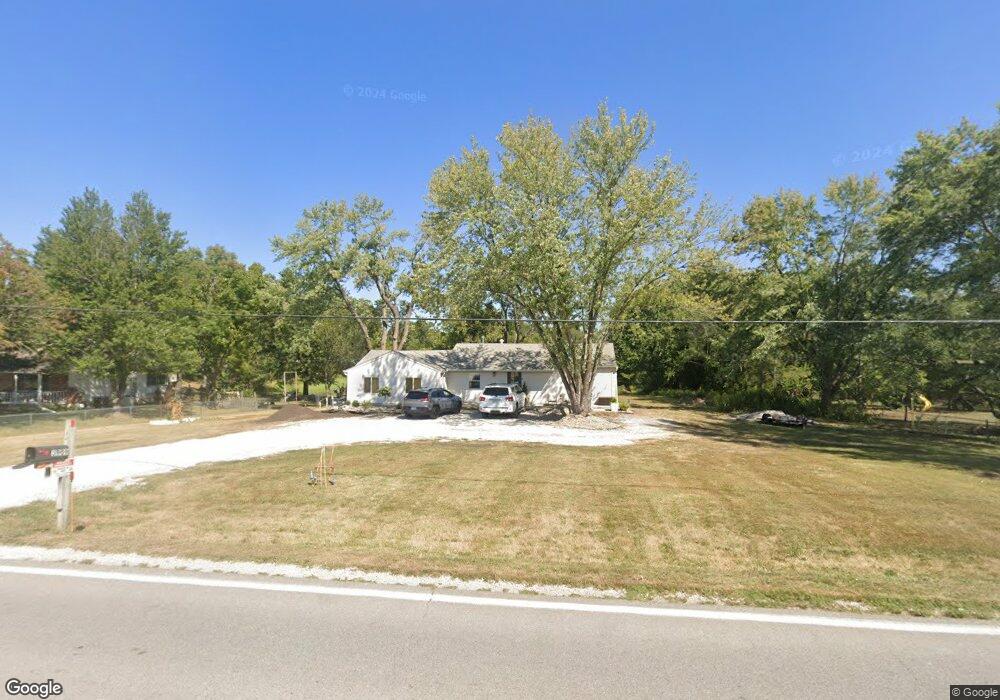
3909 S Buckner Tarsney Rd Grain Valley, MO 64029
Estimated Value: $322,000 - $383,000
3
Beds
1
Bath
1,444
Sq Ft
$240/Sq Ft
Est. Value
About This Home
This home is located at 3909 S Buckner Tarsney Rd, Grain Valley, MO 64029 and is currently estimated at $347,101, approximately $240 per square foot. 3909 S Buckner Tarsney Rd is a home located in Jackson County with nearby schools including Grain Valley High School.
Ownership History
Date
Name
Owned For
Owner Type
Purchase Details
Closed on
Apr 27, 2021
Sold by
House Fox Llc
Bought by
Michael J Carpio Consturction Llc
Current Estimated Value
Home Financials for this Owner
Home Financials are based on the most recent Mortgage that was taken out on this home.
Original Mortgage
$220,800
Outstanding Balance
$198,819
Interest Rate
3.1%
Mortgage Type
Future Advance Clause Open End Mortgage
Estimated Equity
$148,282
Purchase Details
Closed on
Mar 29, 2021
Sold by
Schoen Trisha
Bought by
House Fox Llc
Home Financials for this Owner
Home Financials are based on the most recent Mortgage that was taken out on this home.
Original Mortgage
$220,800
Outstanding Balance
$198,819
Interest Rate
3.1%
Mortgage Type
Future Advance Clause Open End Mortgage
Estimated Equity
$148,282
Purchase Details
Closed on
Sep 15, 1998
Sold by
Thompson Franklin E
Bought by
Thompson Franklin E and Schoen Trisha
Create a Home Valuation Report for This Property
The Home Valuation Report is an in-depth analysis detailing your home's value as well as a comparison with similar homes in the area
Purchase History
| Date | Buyer | Sale Price | Title Company |
|---|---|---|---|
| Michael J Carpio Consturction Llc | -- | Clear Title Nationwide Inc | |
| House Fox Llc | -- | Clear Title Nationwide Inc | |
| House Fox Llc | -- | None Listed On Document | |
| Thompson Franklin E | -- | -- |
Source: Public Records
Mortgage History
| Date | Status | Borrower | Loan Amount |
|---|---|---|---|
| Open | Michael J Carpio Consturction Llc | $220,800 | |
| Closed | House Fox Llc | $130,000 |
Source: Public Records
Tax History
| Year | Tax Paid | Tax Assessment Tax Assessment Total Assessment is a certain percentage of the fair market value that is determined by local assessors to be the total taxable value of land and additions on the property. | Land | Improvement |
|---|---|---|---|---|
| 2025 | $3,567 | $30,905 | $17,385 | $13,520 |
| 2024 | $3,567 | $49,907 | $32,729 | $17,178 |
| 2023 | $3,419 | $49,908 | $26,285 | $23,623 |
| 2022 | $1,780 | $23,370 | $9,405 | $13,965 |
| 2021 | $3,696 | $23,370 | $9,405 | $13,965 |
| 2020 | $3,448 | $20,574 | $9,405 | $11,169 |
| 2019 | $1,480 | $20,574 | $9,405 | $11,169 |
| 2018 | $1,518 | $19,760 | $7,321 | $12,439 |
| 2017 | $1,518 | $19,760 | $7,321 | $12,439 |
| 2016 | $1,479 | $19,265 | $8,208 | $11,057 |
| 2014 | $1,491 | $19,265 | $8,208 | $11,057 |
Source: Public Records
Map
Nearby Homes
- 3826 S Sweeney Rd
- TBD E Duncan Rd
- 1806 NW Mya Ct
- 1809 NW Madi Ct
- 904 NW Lindenwood Dr
- 803 NW Redbud Dr
- 950 NW Maplewood Ct
- 952 NW Maplewood Ct
- 205 NE Hoot Owl St
- 913 NW Hickorywood Dr
- 1716 NW Nicholas Dr
- 2304 NW Rymeg Dr
- 1810 NW Bradford Ct
- 1701 NW Helen Ct
- 816 NW Cedar Ln
- 2109 NW Sweetgum Ct
- 1451 S Buckner Tarsney Rd
- 801 NW Hickory Ridge Dr
- 216 NE Greystone Way
- 803 NW Hickory Ridge Dr
- 3917 S Buckner Tarsney Rd
- 3903 S Buckner Tarsney Rd
- 3904 S Buckner Tarsney Rd
- 3900 S Buckner Tarsney Rd
- 4000 S Buckner Tarsney Rd
- 4011 S Buckner Tarsney Rd
- 4005 S Buckner Tarsney Rd
- 4001 S Buckner Tarsney Rd
- 4019 S Buckner Tarsney Rd
- 4014 S Buckner Tarsney Rd
- 3911 S Rust Rd
- 3919 S Rust Rd
- 4108 S Buckner Tarsney Rd
- 3905 S Rust Rd
- 3823 S Rust Rd
- 4003 S Rust Rd
- 4009 S Rust Rd
- 4015 S Rust Rd
- 3811 S Rust Rd
- 3817 S Rust Rd
Your Personal Tour Guide
Ask me questions while you tour the home.