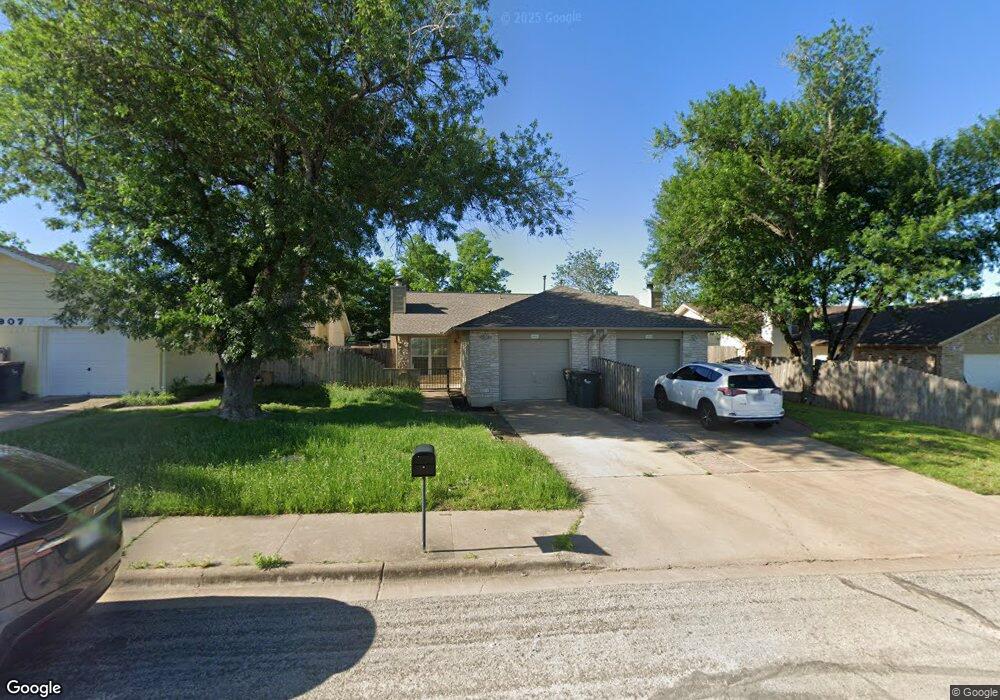
3909 Stonebridge Dr Unit A Round Rock, TX 78681
Brushy Creek NeighborhoodEstimated Value: $419,000 - $494,000
--
Bed
4
Baths
1,884
Sq Ft
$239/Sq Ft
Est. Value
About This Home
This home is located at 3909 Stonebridge Dr Unit A, Round Rock, TX 78681 and is currently estimated at $450,298, approximately $239 per square foot. 3909 Stonebridge Dr Unit A is a home located in Williamson County with nearby schools including Brushy Creek Elementary School, Cedar Valley Middle School, and McNeil High School.
Ownership History
Date
Name
Owned For
Owner Type
Purchase Details
Closed on
Mar 18, 2024
Sold by
Patschke Milton E
Bought by
Svoboda Andrew Nicholas and Nie Shan
Current Estimated Value
Home Financials for this Owner
Home Financials are based on the most recent Mortgage that was taken out on this home.
Original Mortgage
$364,500
Outstanding Balance
$358,437
Interest Rate
6.63%
Mortgage Type
New Conventional
Estimated Equity
$91,861
Create a Home Valuation Report for This Property
The Home Valuation Report is an in-depth analysis detailing your home's value as well as a comparison with similar homes in the area
Home Values in the Area
Average Home Value in this Area
Purchase History
| Date | Buyer | Sale Price | Title Company |
|---|---|---|---|
| Svoboda Andrew Nicholas | -- | Austin Title Company |
Source: Public Records
Mortgage History
| Date | Status | Borrower | Loan Amount |
|---|---|---|---|
| Open | Svoboda Andrew Nicholas | $364,500 |
Source: Public Records
Tax History Compared to Growth
Tax History
| Year | Tax Paid | Tax Assessment Tax Assessment Total Assessment is a certain percentage of the fair market value that is determined by local assessors to be the total taxable value of land and additions on the property. | Land | Improvement |
|---|---|---|---|---|
| 2025 | $8,348 | $464,443 | $79,500 | $384,943 |
| 2024 | $8,348 | $436,754 | $79,500 | $357,254 |
| 2023 | $4,923 | $371,905 | $0 | $0 |
| 2022 | $7,898 | $381,590 | $0 | $0 |
| 2021 | $7,135 | $301,595 | $60,000 | $264,450 |
| 2020 | $6,220 | $261,523 | $55,181 | $214,467 |
| 2019 | $6,350 | $259,343 | $51,500 | $236,823 |
| 2018 | $4,775 | $230,254 | $45,154 | $205,932 |
| 2017 | $5,259 | $210,721 | $42,200 | $188,859 |
| 2016 | $4,320 | $173,075 | $42,200 | $130,875 |
| 2015 | $3,860 | $164,219 | $35,100 | $129,119 |
| 2014 | $3,860 | $161,495 | $0 | $0 |
Source: Public Records
Map
Nearby Homes
- 3917 Rolling Hill
- 4011 Hillside Dr
- 3915 Hillside Dr
- 9108 Cessna Ln
- 3912 Hillside Dr
- 9201 Cessna Ln
- 3702 Cornerstone St
- 1400 Hargis Creek Trail
- 506 Conservation Dr Unit 506
- 8900 Brushygate Cove
- 8602 Bobcat Dr
- 8507 Chat Ln
- 809 Stillhouse Spring
- 407 Hillside Dr
- 9405 Billingham Trail
- 16914 Dorman Dr
- 9400 Graceland Trail
- 16911 Dorman Dr
- 913 Spring Tree St
- 16600 Barrhead Cove
- 3909 Stonebridge Dr
- 3907 Stonebridge Dr Unit B
- 3907 Stonebridge Dr Unit A
- 3907 Stonebridge Dr
- 4001 Stonebridge Dr
- 4001 Stonebridge Dr Unit B
- 3905 Stonebridge Dr
- 16912 Village Oak Loop
- 16914 Village Oak Loop
- 16910 Village Oak Loop
- 4003 Stonebridge Dr Unit B
- 4003 Stonebridge Dr Unit A
- 4003 Stonebridge Dr
- 16908 Village Oak Loop
- 16916 Village Oak Loop
- 16918 Village Oak Loop
- 4005 Stonebridge Dr Unit A
- 4005 Stonebridge Dr
- 4007 Stonebridge Dr
- 16914 Pocono Dr