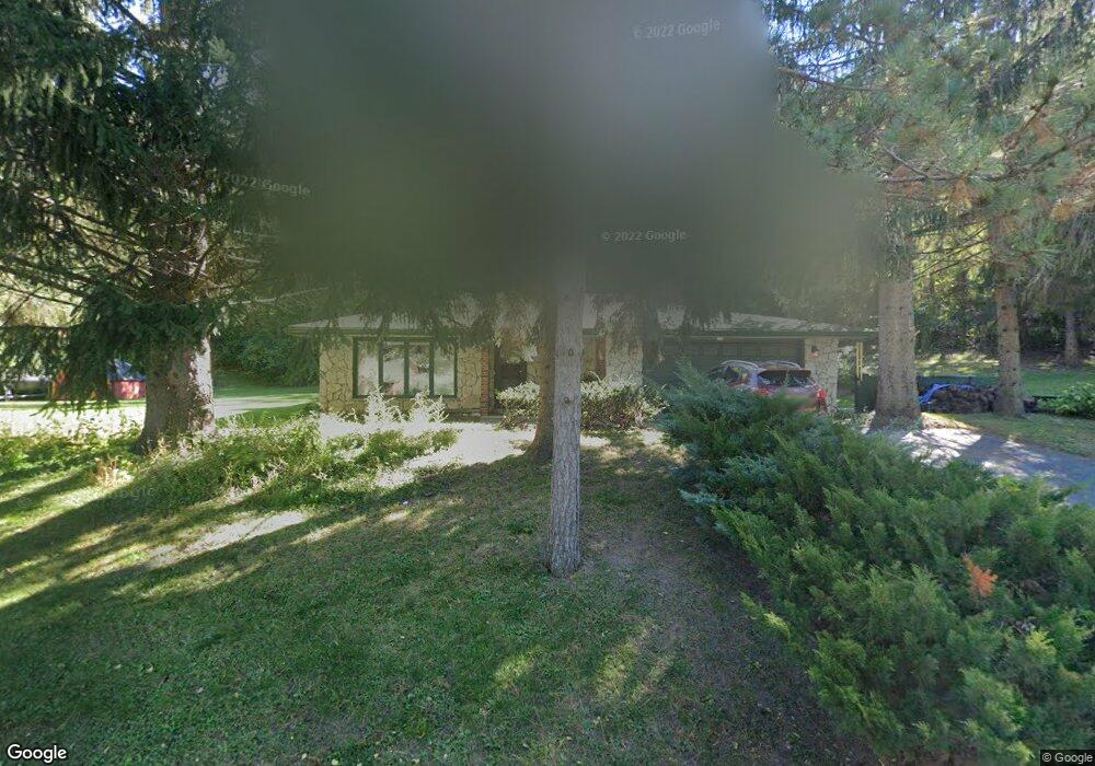
39095 N West End Dr Spring Grove, IL 60081
Northeast Fox Lake NeighborhoodEstimated Value: $305,330 - $373,000
3
Beds
2
Baths
1,748
Sq Ft
$193/Sq Ft
Est. Value
About This Home
This home is located at 39095 N West End Dr, Spring Grove, IL 60081 and is currently estimated at $337,083, approximately $192 per square foot. 39095 N West End Dr is a home located in Lake County with nearby schools including Lotus Elementary School, Stanton Middle School, and Grant Community High School.
Ownership History
Date
Name
Owned For
Owner Type
Purchase Details
Closed on
May 1, 2020
Sold by
Otto Karolin
Bought by
Otto Karloin and Otto Jacob B
Current Estimated Value
Home Financials for this Owner
Home Financials are based on the most recent Mortgage that was taken out on this home.
Original Mortgage
$145,800
Interest Rate
3.2%
Mortgage Type
New Conventional
Create a Home Valuation Report for This Property
The Home Valuation Report is an in-depth analysis detailing your home's value as well as a comparison with similar homes in the area
Home Values in the Area
Average Home Value in this Area
Purchase History
| Date | Buyer | Sale Price | Title Company |
|---|---|---|---|
| Otto Karloin | -- | Attorney |
Source: Public Records
Mortgage History
| Date | Status | Borrower | Loan Amount |
|---|---|---|---|
| Closed | Otto Karloin | $145,800 |
Source: Public Records
Tax History Compared to Growth
Tax History
| Year | Tax Paid | Tax Assessment Tax Assessment Total Assessment is a certain percentage of the fair market value that is determined by local assessors to be the total taxable value of land and additions on the property. | Land | Improvement |
|---|---|---|---|---|
| 2024 | $4,977 | $78,343 | $4,354 | $73,989 |
| 2023 | $5,155 | $70,150 | $3,899 | $66,251 |
| 2022 | $5,155 | $68,197 | $4,561 | $63,636 |
| 2021 | $4,917 | $63,635 | $4,256 | $59,379 |
| 2020 | $4,827 | $61,877 | $4,138 | $57,739 |
| 2019 | $4,546 | $59,173 | $3,957 | $55,216 |
| 2018 | $4,731 | $60,219 | $3,250 | $56,969 |
| 2017 | $4,675 | $57,318 | $3,093 | $54,225 |
| 2016 | $4,982 | $55,316 | $2,985 | $52,331 |
| 2015 | $5,017 | $54,968 | $2,909 | $52,059 |
| 2014 | $5,174 | $57,483 | $6,476 | $51,007 |
| 2012 | $5,160 | $60,168 | $6,476 | $53,692 |
Source: Public Records
Map
Nearby Homes
- 39175 NW End Dr
- 27726 Hill Dr
- Lots 8 & 9 W Ravine Dr
- Lots 11 & 12 W Ravine Dr
- 39091 N Mound Ave
- 39080 N Jackson Dr
- 8300 Reva Bay Ln Unit SLIP4
- 8300 Reva Bay Ln Unit SLIP5
- 7215 Viscaya Dr
- 7108 Granada Ln Unit 280
- 7314 Chevy Chase Ct Unit 55
- 7415 Clarendon Ct Unit 69
- 38581 N Hillandale Dr
- 8566 Cedar St
- 7216 Oxford Cir Unit 230
- 7411 Leisure Village Ave Unit 198
- 38480 N 6th Ave
- 38227 N 3rd Ave
- 1126 N Oakwood Dr
- 27849 W Lake Shore Dr
- 27787 W Hill Dr
- 27763 W Hill Dr
- 39118 N West End Dr
- 39087 N West End Dr
- 8238 Goldenrod Ct Unit T2G
- 39123 N West End Dr
- 27726, 27718 & 27710 Hill Dr
- 8236 Goldenrod Ct Unit T2F
- 39078 N Mound Ave
- 27763 W Ravine Dr
- 8234 Goldenrod Ct Unit T2E
- 27764 W Ravine Dr
- 27741 W Hill Dr
- 8230 Goldenrod Ct Unit T2C
- 39149 N West End Dr
- 27764 W Grass Lake Dr
- 39152 N West End Dr
- 39157 N West End Dr
- 8228 Goldenrod Ct Unit T2B
- 27754 W Grass Lake Dr