Estimated Value: $295,477 - $334,000
--
Bed
1
Bath
2,555
Sq Ft
$123/Sq Ft
Est. Value
About This Home
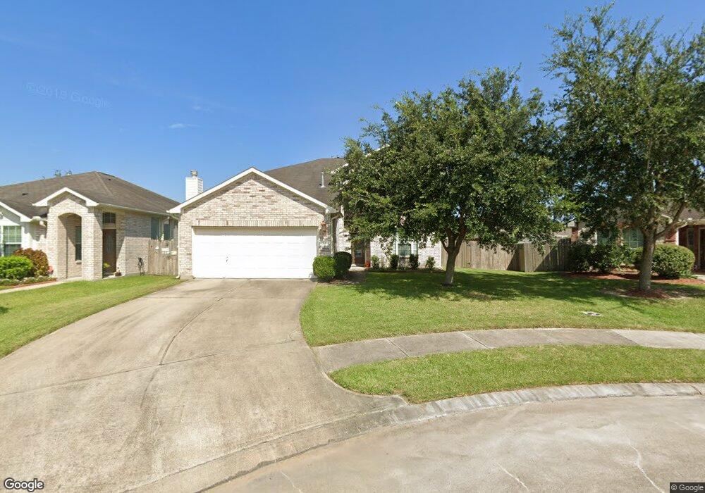
This home is located at 391 Hannah Ln, Alvin, TX 77511 and is currently estimated at $313,869, approximately $122 per square foot. 391 Hannah Ln is a home located in Brazoria County with nearby schools including G.W. Harby Junior High School, Alvin High School, and Living Stones Christian School.
Ownership History
Date
Name
Owned For
Owner Type
Purchase Details
Closed on
Nov 16, 2007
Sold by
Choice Homes Inc
Bought by
Anderson Rod Joseph and Anderson Shana Lee
Current Estimated Value
Home Financials for this Owner
Home Financials are based on the most recent Mortgage that was taken out on this home.
Original Mortgage
$100,000
Interest Rate
6.43%
Mortgage Type
Purchase Money Mortgage
Create a Home Valuation Report for This Property
The Home Valuation Report is an in-depth analysis detailing your home's value as well as a comparison with similar homes in the area
Home Values in the Area
Average Home Value in this Area
Purchase History
| Date | Buyer | Sale Price | Title Company |
|---|---|---|---|
| Anderson Rod Joseph | -- | First American Title |
Source: Public Records
Mortgage History
| Date | Status | Borrower | Loan Amount |
|---|---|---|---|
| Closed | Anderson Rod Joseph | $100,000 |
Source: Public Records
Tax History Compared to Growth
Tax History
| Year | Tax Paid | Tax Assessment Tax Assessment Total Assessment is a certain percentage of the fair market value that is determined by local assessors to be the total taxable value of land and additions on the property. | Land | Improvement |
|---|---|---|---|---|
| 2025 | $5,108 | $308,792 | $26,210 | $298,070 |
| 2023 | $5,108 | $255,200 | $26,210 | $318,430 |
| 2022 | $6,810 | $232,000 | $25,160 | $206,840 |
| 2021 | $6,516 | $225,700 | $25,160 | $200,540 |
| 2020 | $6,597 | $225,400 | $25,160 | $200,240 |
| 2019 | $6,368 | $212,000 | $20,970 | $191,030 |
| 2018 | $6,345 | $218,690 | $20,970 | $197,720 |
| 2017 | $5,841 | $191,700 | $19,920 | $171,780 |
| 2016 | $5,454 | $179,000 | $19,920 | $159,080 |
| 2014 | $4,303 | $153,070 | $19,920 | $133,150 |
Source: Public Records
Map
Nearby Homes
- 394 De Coster Blvd
- 417 De Coster Blvd
- 5323 Latigo Ct
- 5321 Latigo Ct
- The Princeton II Plan at Kendall Lakes
- The Crawford Plan at Kendall Lakes
- The Davenport II Plan at Kendall Lakes
- The Georgetown II Plan at Kendall Lakes
- The Pearson Plan at Kendall Lakes
- The James Plan at Kendall Lakes
- The McGinnis Plan at Kendall Lakes
- 5318 Latigo Ct
- 5330 Latigo Ct
- Elias Plan at Skyview
- Rev Plan at Skyview
- 5320 Latigo Ct
- Cleo Plan at Skyview
- Zara Plan at Skyview
- 5690 Highway 35 Bypass
- 5307 Cascade Ct
- 389 Hannah Ln
- 393 Hannah Ln
- 390 De Coster Blvd
- 388 De Coster Blvd
- 387 Hannah Ln
- 392 De Coster Blvd
- 5220 Everts Ave
- 386 De Coster Blvd
- 386 Decoster Blvd
- 385 Hannah Ln
- 5218 Everts Ave
- 384 De Coster Blvd
- 388 Hannah Ln
- 386 Hannah Ln
- 5216 Everts Ave
- 5225 Mcgrath Dr
- 383 Hannah Ln
- 5227 Mcgrath Dr
- 382 De Coster Blvd
- 5223 Mcgrath Dr