Estimated Value: $251,545 - $646,000
--
Bed
--
Bath
--
Sq Ft
5,097
Sq Ft Lot
About This Home
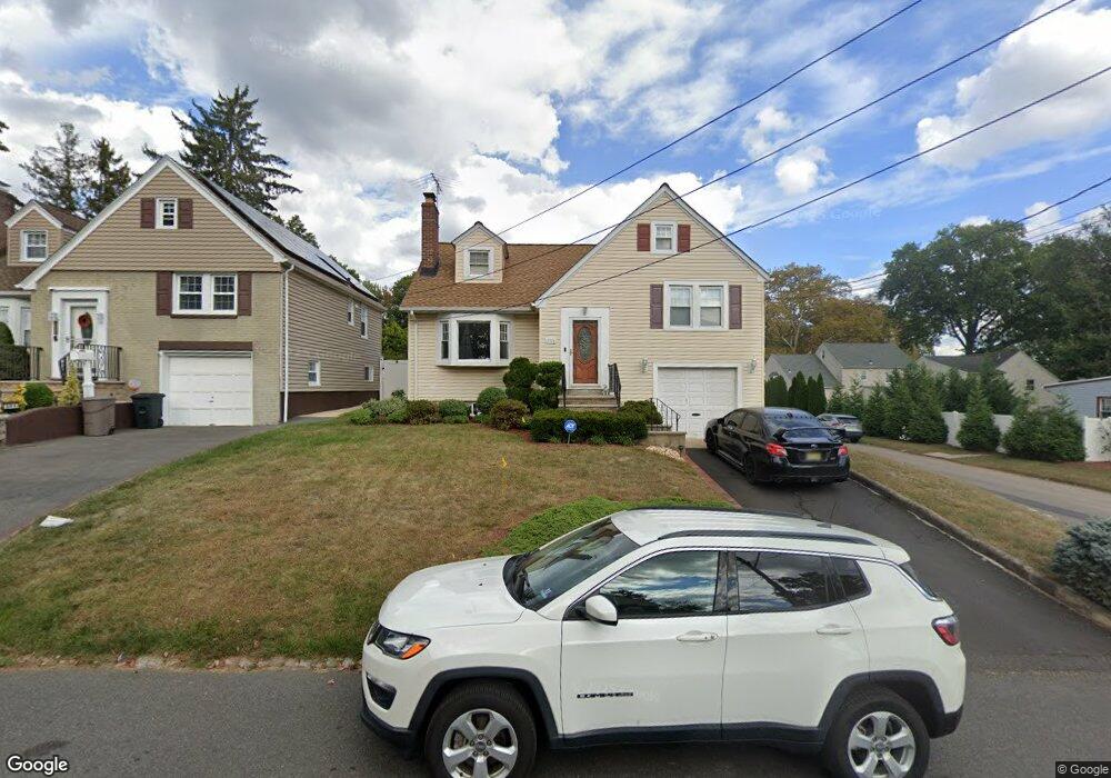
This home is located at 391 Lum Ave, Union, NJ 07083 and is currently estimated at $534,636. 391 Lum Ave is a home located in Union County with nearby schools including Livingston Elementary School, Union High School, and KIPP TEAM Academy.
Ownership History
Date
Name
Owned For
Owner Type
Purchase Details
Closed on
Jan 5, 1998
Sold by
Adamkowski Michael and Adamkowski Nicole
Bought by
Barbosa Francisco X and Barbosa Maria S
Current Estimated Value
Home Financials for this Owner
Home Financials are based on the most recent Mortgage that was taken out on this home.
Original Mortgage
$120,000
Interest Rate
7.09%
Purchase Details
Closed on
Feb 24, 1996
Sold by
Damicone Matthew A and Damicone Monica S
Bought by
Adamkowski Michael
Purchase Details
Closed on
Oct 14, 1994
Sold by
Corato Louis C and Corato Wendi C
Bought by
Damicone Matthew A and Damicone Monica S
Create a Home Valuation Report for This Property
The Home Valuation Report is an in-depth analysis detailing your home's value as well as a comparison with similar homes in the area
Home Values in the Area
Average Home Value in this Area
Purchase History
| Date | Buyer | Sale Price | Title Company |
|---|---|---|---|
| Barbosa Francisco X | $182,000 | Lawyers Title Insurance Corp | |
| Adamkowski Michael | $170,000 | -- | |
| Damicone Matthew A | $172,500 | -- |
Source: Public Records
Mortgage History
| Date | Status | Borrower | Loan Amount |
|---|---|---|---|
| Closed | Barbosa Francisco X | $120,000 |
Source: Public Records
Tax History Compared to Growth
Tax History
| Year | Tax Paid | Tax Assessment Tax Assessment Total Assessment is a certain percentage of the fair market value that is determined by local assessors to be the total taxable value of land and additions on the property. | Land | Improvement |
|---|---|---|---|---|
| 2025 | $10,661 | $47,700 | $18,700 | $29,000 |
| 2024 | $10,336 | $47,700 | $18,700 | $29,000 |
| 2023 | $10,336 | $47,700 | $18,700 | $29,000 |
| 2022 | $9,977 | $47,700 | $18,700 | $29,000 |
| 2021 | $9,735 | $47,700 | $18,700 | $29,000 |
| 2020 | $9,541 | $47,700 | $18,700 | $29,000 |
| 2019 | $9,413 | $47,700 | $18,700 | $29,000 |
| 2018 | $9,252 | $47,700 | $18,700 | $29,000 |
| 2017 | $9,115 | $47,700 | $18,700 | $29,000 |
| 2016 | $8,893 | $47,700 | $18,700 | $29,000 |
| 2015 | $8,746 | $47,700 | $18,700 | $29,000 |
| 2014 | $8,550 | $47,700 | $18,700 | $29,000 |
Source: Public Records
Map
Nearby Homes
- 1370 Beverly Rd
- 365 Broadwell Ave
- 875 Salem Rd
- 328 Minute Arms Rd
- 969 Arnet Ave
- 795 Colonial Arms Rd
- 1040 Cranbrook Rd
- 717 Winchester Ave
- 790 Green Ln Unit A1
- 1322 Marcella Dr
- 631 Golf Terrace
- 1393 Cornell Place
- 169 Valley View Rd
- 1084 Woodland Ave
- 1267 Erhardt St
- 1031 Lowden Ave
- 578 Winchester Ave
- 314 Fitzpatrick St
- 292 Crann St
- 507 Locust Ave