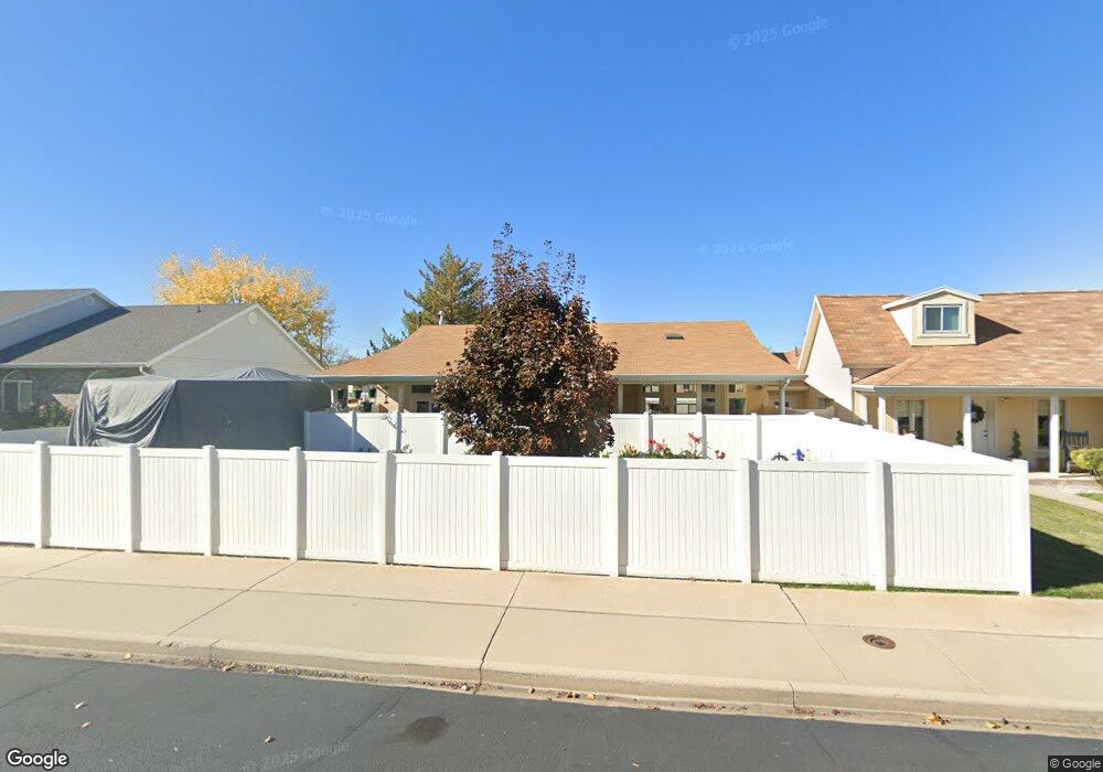
391 N 100 W Spanish Fork, UT 84660
Estimated Value: $432,000 - $571,000
4
Beds
2
Baths
2,194
Sq Ft
$226/Sq Ft
Est. Value
About This Home
This home is located at 391 N 100 W, Spanish Fork, UT 84660 and is currently estimated at $495,063, approximately $225 per square foot. 391 N 100 W is a home located in Utah County with nearby schools including Brockbank Elementary School, Spanish Fork Jr High School, and Spanish Fork High School.
Ownership History
Date
Name
Owned For
Owner Type
Purchase Details
Closed on
Nov 13, 2018
Sold by
Wilson Steven Loring and Edenfield Wilson Suzan
Bought by
Rocky S Enterprises Llc
Current Estimated Value
Purchase Details
Closed on
Jul 18, 2012
Sold by
Franklin Research Llc
Bought by
Wilson Steven Loring and Edenfield Wilson Suzan
Home Financials for this Owner
Home Financials are based on the most recent Mortgage that was taken out on this home.
Original Mortgage
$116,250
Interest Rate
3.63%
Mortgage Type
New Conventional
Purchase Details
Closed on
Jul 19, 2010
Sold by
Jones Marcia N
Bought by
Franklin Research Llc
Purchase Details
Closed on
Dec 4, 2007
Sold by
Red Point Land & Development Llc
Bought by
Newline Development Llc
Purchase Details
Closed on
Feb 9, 2006
Sold by
Jones Marcia N
Bought by
Red Point Land & Development Llc
Home Financials for this Owner
Home Financials are based on the most recent Mortgage that was taken out on this home.
Original Mortgage
$15,652
Interest Rate
6.2%
Mortgage Type
Purchase Money Mortgage
Purchase Details
Closed on
Jan 23, 2006
Sold by
Jones Marcia N
Bought by
Red Point Land & Development
Home Financials for this Owner
Home Financials are based on the most recent Mortgage that was taken out on this home.
Original Mortgage
$15,652
Interest Rate
6.2%
Mortgage Type
Purchase Money Mortgage
Purchase Details
Closed on
Jul 18, 2001
Sold by
Jones Marsha and Jones Marcia K
Bought by
Jones Victor K and Jones Roshelle
Purchase Details
Closed on
Apr 30, 1999
Sold by
Jones Marsha
Bought by
Jones Marcia Kay
Home Financials for this Owner
Home Financials are based on the most recent Mortgage that was taken out on this home.
Original Mortgage
$40,250
Interest Rate
6.98%
Create a Home Valuation Report for This Property
The Home Valuation Report is an in-depth analysis detailing your home's value as well as a comparison with similar homes in the area
Home Values in the Area
Average Home Value in this Area
Purchase History
| Date | Buyer | Sale Price | Title Company |
|---|---|---|---|
| Rocky S Enterprises Llc | -- | Key Land Title | |
| Wilson Steven Loring | -- | Invest Title Services Inc | |
| Franklin Research Llc | -- | None Available | |
| Newline Development Llc | -- | None Available | |
| Red Point Land & Development Llc | -- | None Available | |
| Jones Marcia N | -- | None Available | |
| Red Point Land & Development | -- | None Available | |
| Jones Victor K | -- | First American Title Insuran | |
| Jones Marcia Kay | -- | -- |
Source: Public Records
Mortgage History
| Date | Status | Borrower | Loan Amount |
|---|---|---|---|
| Previous Owner | Wilson Steven Loring | $116,250 | |
| Previous Owner | Jones Marcia N | $15,652 | |
| Previous Owner | Red Point Land & Development | $14,400 | |
| Previous Owner | Jones Marcia Kay | $40,250 |
Source: Public Records
Tax History Compared to Growth
Tax History
| Year | Tax Paid | Tax Assessment Tax Assessment Total Assessment is a certain percentage of the fair market value that is determined by local assessors to be the total taxable value of land and additions on the property. | Land | Improvement |
|---|---|---|---|---|
| 2025 | $1,918 | $213,565 | $68,200 | $320,100 |
| 2024 | $1,918 | $197,670 | $0 | $0 |
| 2023 | $1,982 | $204,490 | $0 | $0 |
| 2022 | $2,062 | $208,725 | $0 | $0 |
| 2021 | $1,957 | $316,800 | $39,600 | $277,200 |
| 2020 | $1,796 | $282,700 | $33,000 | $249,700 |
| 2019 | $1,254 | $207,700 | $33,000 | $174,700 |
| 2018 | $1,155 | $184,900 | $33,000 | $151,900 |
| 2017 | $1,146 | $98,615 | $0 | $0 |
| 2016 | $1,108 | $94,050 | $0 | $0 |
| 2015 | $1,119 | $93,885 | $0 | $0 |
| 2014 | $1,512 | $127,270 | $0 | $0 |
Source: Public Records
Map
Nearby Homes