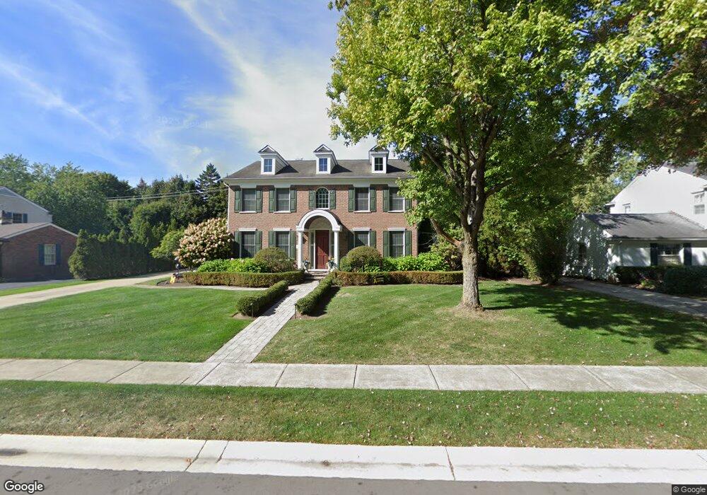
391 N Glenhurst Dr Bloomfield Hills, MI 48301
Estimated Value: $1,633,000 - $2,462,000
4
Beds
5
Baths
4,303
Sq Ft
$472/Sq Ft
Est. Value
About This Home
This home is located at 391 N Glenhurst Dr, Bloomfield Hills, MI 48301 and is currently estimated at $2,029,768, approximately $471 per square foot. 391 N Glenhurst Dr is a home located in Oakland County with nearby schools including Quarton Elementary, Derby Middle School, and Ernest W. Seaholm High School.
Ownership History
Date
Name
Owned For
Owner Type
Purchase Details
Closed on
Nov 16, 2007
Sold by
Guckelberg William H and Kingma Kenneth W
Bought by
Young Carlito and Young Esther
Current Estimated Value
Create a Home Valuation Report for This Property
The Home Valuation Report is an in-depth analysis detailing your home's value as well as a comparison with similar homes in the area
Home Values in the Area
Average Home Value in this Area
Purchase History
| Date | Buyer | Sale Price | Title Company |
|---|---|---|---|
| Young Carlito | $410,000 | None Available |
Source: Public Records
Tax History Compared to Growth
Tax History
| Year | Tax Paid | Tax Assessment Tax Assessment Total Assessment is a certain percentage of the fair market value that is determined by local assessors to be the total taxable value of land and additions on the property. | Land | Improvement |
|---|---|---|---|---|
| 2024 | $12,252 | $1,015,840 | $0 | $0 |
| 2023 | $11,758 | $896,170 | $0 | $0 |
| 2022 | $20,730 | $786,160 | $0 | $0 |
| 2021 | $20,594 | $825,530 | $0 | $0 |
| 2020 | $11,128 | $803,850 | $0 | $0 |
| 2019 | $20,531 | $782,800 | $0 | $0 |
| 2018 | $20,312 | $730,640 | $0 | $0 |
| 2017 | $20,312 | $667,600 | $0 | $0 |
| 2016 | $20,642 | $600,350 | $0 | $0 |
| 2015 | -- | $564,490 | $0 | $0 |
| 2014 | -- | $565,500 | $0 | $0 |
| 2011 | -- | $466,670 | $0 | $0 |
Source: Public Records
Map
Nearby Homes
- 345 Kimberly St
- 1834 Fairview St
- 1882 Melbourne St
- 120 Westchester Way
- 586 Fairfax St
- 956 Westwood Dr
- 394 S Glenhurst Dr
- 1019 N Cranbrook Rd
- 2579 Amberly Rd
- 222 Arlington St
- 1120 Lyonhurst St
- 397 S Cranbrook Rd
- 520 Pleasant St
- 1260 Lyonhurst St
- 695 Westchester Way
- 1056 Pilgrim Ave
- 329 Linden Rd
- 592 Lakeside Dr
- 999 Pleasant Ave
- 417 Baldwin Rd
- 365 N Glenhurst Dr
- 441 N Glenhurst Dr
- 450 Westwood Dr Unit Bldg-Unit
- 450 Westwood Dr
- 400 Westwood Dr
- 372 Westwood Dr
- 343 N Glenhurst Dr
- 366 N Glenhurst Dr
- 420 N Glenhurst Dr
- 485 N Glenhurst Dr
- 480 N Glenhurst Dr
- 482 Westwood Dr
- 344 N Glenhurst Dr
- 350 Westwood Dr
- 453 Kimberly St
- 321 N Glenhurst Dr
- 407 Kimberly St
- 393 Kimberly St
- 431 Kimberly St
- 369 Kimberly St