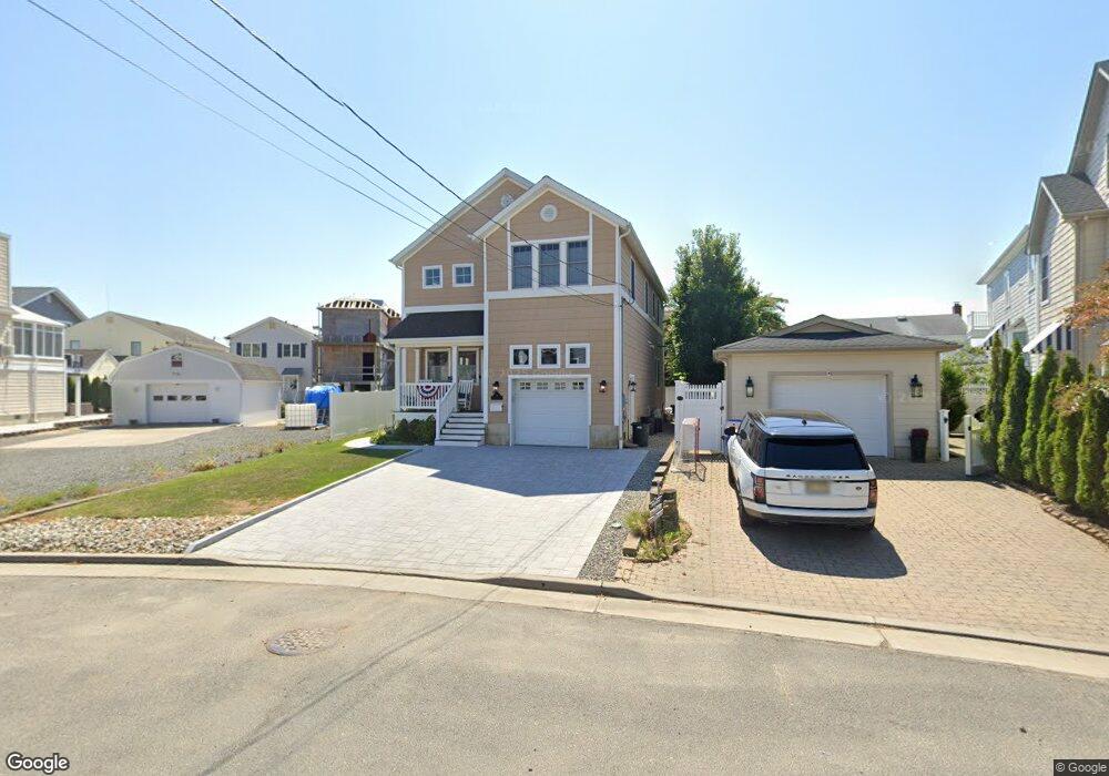
391 River Place Manasquan, NJ 08736
Estimated Value: $772,000 - $2,043,000
4
Beds
4
Baths
2,008
Sq Ft
$733/Sq Ft
Est. Value
About This Home
This home is located at 391 River Place, Manasquan, NJ 08736 and is currently estimated at $1,472,589, approximately $733 per square foot. 391 River Place is a home located in Monmouth County with nearby schools including Manasquan Elementary School, Manasquan High School, and The Brookside School.
Ownership History
Date
Name
Owned For
Owner Type
Purchase Details
Closed on
Sep 25, 2024
Sold by
Ranieri Giacomo and Jaroszewski Laura
Bought by
Harvey Robert P and Harvey Diane E
Current Estimated Value
Purchase Details
Closed on
Jan 7, 2021
Sold by
Ranieri Paula Carmella and Harvey Robert P
Bought by
Ranieri Giacomo and Harvey Robert P
Create a Home Valuation Report for This Property
The Home Valuation Report is an in-depth analysis detailing your home's value as well as a comparison with similar homes in the area
Home Values in the Area
Average Home Value in this Area
Purchase History
| Date | Buyer | Sale Price | Title Company |
|---|---|---|---|
| Harvey Robert P | $766,666 | Prestige Title | |
| Harvey Robert P | $766,666 | Prestige Title | |
| Ranieri Giacomo | -- | None Listed On Document | |
| Ranieri Paula Carmella | -- | None Listed On Document | |
| Ranieri Giacomo | -- | None Available | |
| Harvey Robert P | -- | None Available |
Source: Public Records
Tax History Compared to Growth
Tax History
| Year | Tax Paid | Tax Assessment Tax Assessment Total Assessment is a certain percentage of the fair market value that is determined by local assessors to be the total taxable value of land and additions on the property. | Land | Improvement |
|---|---|---|---|---|
| 2025 | $11,171 | $628,300 | $331,000 | $297,300 |
| 2024 | $10,750 | $628,300 | $331,000 | $297,300 |
| 2023 | $10,750 | $628,300 | $331,000 | $297,300 |
| 2022 | $10,348 | $628,300 | $331,000 | $297,300 |
| 2021 | $10,348 | $628,300 | $331,000 | $297,300 |
| 2020 | $10,204 | $628,300 | $331,000 | $297,300 |
| 2019 | $9,820 | $628,300 | $331,000 | $297,300 |
| 2018 | $9,600 | $628,300 | $331,000 | $297,300 |
| 2017 | $9,236 | $628,300 | $331,000 | $297,300 |
| 2016 | $8,991 | $628,300 | $331,000 | $297,300 |
| 2015 | $10,545 | $617,000 | $297,000 | $320,000 |
| 2014 | $10,532 | $617,000 | $297,000 | $320,000 |
Source: Public Records
Map
Nearby Homes
- 386 Perrine Blvd
- 320 Cedar Ave
- 22 Crescent Dr
- 329 Fisk Ave
- 17 Crescent Dr
- 323-325 Fisk Ave
- 507 Magnolia Ave
- 504 Fisk Ave
- 207 4th Ave
- 105 Mount Ln Unit 3
- 521 Brielle Rd
- 198 3rd Ave
- 504 Green Ave
- 116 Curtis Ave
- 226 3rd Ave
- 75 2nd Ave
- 508 Harris Ave
- 580 E Main St Unit 4
- 85 Virginia Ave
- 549 Woodland Ave
- 395 River Place
- 92 S Jackson Ave
- 96 S Jackson Ave
- 402 Perrine Blvd
- 400 Perrine Blvd
- 404 Perrine Blvd
- 394 Perrine Blvd
- 408 Perrine Blvd
- 390 River Place
- 396 River Place
- 403 River Place
- 390 Perrine Blvd
- 84 S Jackson Ave
- 414 Perrine Blvd
- 407 River Place
- 82 S Jackson Ave
- 97 S Jackson Ave
- 386 & 387 Perrine Blvd
- 395 E Virginia Ave
- 393 E Virginia Ave