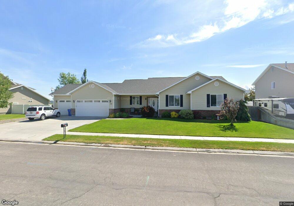
391 S Pine Ave Sugar City, ID 83448
Estimated Value: $424,000 - $464,000
4
Beds
2
Baths
2,372
Sq Ft
$189/Sq Ft
Est. Value
About This Home
This home is located at 391 S Pine Ave, Sugar City, ID 83448 and is currently estimated at $449,226, approximately $189 per square foot. 391 S Pine Ave is a home located in Madison County with nearby schools including Central Elementary School, Kershaw Intermediate School, and Sugar-Salem Junior High School.
Ownership History
Date
Name
Owned For
Owner Type
Purchase Details
Closed on
Jan 6, 2017
Sold by
Fleming Nathan W
Bought by
Yates Jerry and Yates Karen
Current Estimated Value
Purchase Details
Closed on
Nov 3, 2014
Sold by
Fleming Amy and Fleming Nathan W
Bought by
Fleming Nathan W
Home Financials for this Owner
Home Financials are based on the most recent Mortgage that was taken out on this home.
Original Mortgage
$163,400
Interest Rate
4.17%
Mortgage Type
New Conventional
Create a Home Valuation Report for This Property
The Home Valuation Report is an in-depth analysis detailing your home's value as well as a comparison with similar homes in the area
Home Values in the Area
Average Home Value in this Area
Purchase History
| Date | Buyer | Sale Price | Title Company |
|---|---|---|---|
| Yates Jerry | -- | Alliance Title | |
| Fleming Nathan W | -- | First American Title | |
| Fleming Nathan W | -- | First American Title |
Source: Public Records
Mortgage History
| Date | Status | Borrower | Loan Amount |
|---|---|---|---|
| Previous Owner | Fleming Nathan W | $163,400 |
Source: Public Records
Tax History Compared to Growth
Tax History
| Year | Tax Paid | Tax Assessment Tax Assessment Total Assessment is a certain percentage of the fair market value that is determined by local assessors to be the total taxable value of land and additions on the property. | Land | Improvement |
|---|---|---|---|---|
| 2025 | $1,526 | $390,261 | $65,000 | $325,261 |
| 2024 | $1,526 | $385,261 | $60,000 | $325,261 |
| 2023 | $1,526 | $374,684 | $60,000 | $314,684 |
| 2022 | $2,032 | $336,462 | $35,000 | $301,462 |
| 2021 | $2,037 | $302,084 | $35,000 | $267,084 |
| 2020 | $1,978 | $254,485 | $35,000 | $219,485 |
| 2019 | $1,970 | $233,330 | $35,000 | $198,330 |
| 2018 | $1,916 | $233,330 | $35,000 | $198,330 |
| 2017 | $1,748 | $220,108 | $35,000 | $185,108 |
| 2016 | $1,825 | $212,598 | $35,000 | $177,598 |
| 2015 | $2,895 | $191,455 | $0 | $0 |
| 2013 | -- | $193,809 | $0 | $0 |
Source: Public Records
Map
Nearby Homes
- 286 Camas St
- 423 Camas St
- Foxhill Plan at Teton Island Estates
- Kensington Plan at Teton Island Estates
- Hallwood Plan at Teton Island Estates
- Hyland Plan at Teton Island Estates
- Knighton Plan at Teton Island Estates
- Pembroke Plan at Teton Island Estates
- Hadleigh Plan at Teton Island Estates
- Overton Plan at Teton Island Estates
- Norfolk Plan at Teton Island Estates
- Milton Plan at Teton Island Estates
- Northfield Plan at Teton Island Estates
- Oakfield Plan at Teton Island Estates
- Winfield Plan at Teton Island Estates
- Leighton Plan at Teton Island Estates
- Townsend Plan at Teton Island Estates
- Scottsford Plan at Teton Island Estates
- Somerley Plan at Teton Island Estates
- Everley Plan at Teton Island Estates
- 415 S Pine Ave
- 378 S Pine Ave
- 418 S Pine Ave
- 443 S Pine Ave
- 339 S Pine Ave
- 358 S Pine Ave
- 456 E Appaloosa Dr
- 430 E Palomino Dr
- 433 E Palomino Dr
- 321 S Pine Ave
- 433 Buckskin Ct
- 432 E Appaloosa Dr
- 458 Buckskin Ct
- 475 S Pine Ave
- 405 E Palomino Dr
- 400 E Palomino Dr
- 457 Appaloosa St
- 432 Buckskin Ct
- 457 E Appaloosa Dr
- 406 E Appaloosa Dr