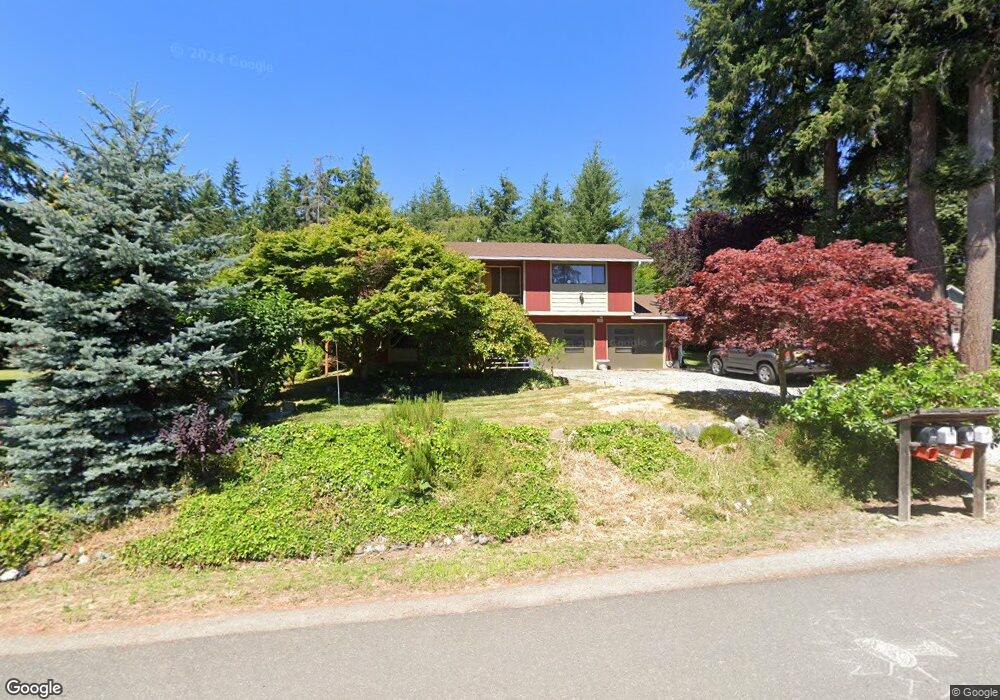
391 Selkirk Dr Camano Island, WA 98282
Estimated Value: $544,966 - $614,000
2
Beds
3
Baths
1,646
Sq Ft
$352/Sq Ft
Est. Value
About This Home
This home is located at 391 Selkirk Dr, Camano Island, WA 98282 and is currently estimated at $579,742, approximately $352 per square foot. 391 Selkirk Dr is a home located in Island County with nearby schools including Utsalady Elementary School, Port Susan Middle School, and Stanwood High School.
Ownership History
Date
Name
Owned For
Owner Type
Purchase Details
Closed on
Jul 13, 2022
Sold by
Andrew Curry M and Andrew Theodora A
Bought by
Rlt Taf-Mac
Current Estimated Value
Purchase Details
Closed on
May 29, 2009
Sold by
Roaldson Paul T and Roaldson Catherine S
Bought by
Curry M Andrew and Fogarty Theodora Ann
Home Financials for this Owner
Home Financials are based on the most recent Mortgage that was taken out on this home.
Original Mortgage
$182,000
Interest Rate
4.8%
Mortgage Type
Purchase Money Mortgage
Create a Home Valuation Report for This Property
The Home Valuation Report is an in-depth analysis detailing your home's value as well as a comparison with similar homes in the area
Home Values in the Area
Average Home Value in this Area
Purchase History
| Date | Buyer | Sale Price | Title Company |
|---|---|---|---|
| Rlt Taf-Mac | -- | William M Zingarelli Ps | |
| Curry M Andrew | $227,500 | Chicago Title Company-Island |
Source: Public Records
Mortgage History
| Date | Status | Borrower | Loan Amount |
|---|---|---|---|
| Previous Owner | Curry M Andrew | $182,000 |
Source: Public Records
Tax History Compared to Growth
Tax History
| Year | Tax Paid | Tax Assessment Tax Assessment Total Assessment is a certain percentage of the fair market value that is determined by local assessors to be the total taxable value of land and additions on the property. | Land | Improvement |
|---|---|---|---|---|
| 2024 | $3,702 | $468,813 | $250,000 | $218,813 |
| 2023 | $3,702 | $471,926 | $250,000 | $221,926 |
| 2022 | $3,181 | $413,787 | $210,000 | $203,787 |
| 2021 | $2,956 | $334,838 | $165,000 | $169,838 |
| 2020 | $2,953 | $300,945 | $135,000 | $165,945 |
| 2019 | $2,660 | $296,899 | $175,000 | $121,899 |
| 2018 | $2,405 | $267,327 | $145,000 | $122,327 |
| 2017 | $2,049 | $223,181 | $100,000 | $123,181 |
| 2016 | $1,843 | $209,894 | $85,000 | $124,894 |
| 2015 | -- | $180,652 | $65,000 | $115,652 |
| 2013 | -- | $174,157 | $55,000 | $119,157 |
Source: Public Records
Map
Nearby Homes
- 355 Selkirk Dr
- 335 Heather Dr
- 302 Melrose Dr
- 474 Stirling Dr
- 269 E Lochwood Dr
- 105 N Sunrise Blvd
- 362 N Sunrise Blvd
- 230 Heather Dr
- 251 Goodrich Rd
- 0 E Shumway Rd
- 245 David St
- 0 Dodge Rd Unit NWM2434437
- 0 Dodge Rd Unit NWM2434435
- 244 David St
- 563 Waynes Ridge Cir
- 828 State Highway 532
- 221 Baker View Ln
- 185 Chick Rd
- 1015 Aqua Vista Ln
- 78 Vista Del Mar St
- 397 E Selkirk Dr
- 385 Selkirk Dr
- 397 Selkirk Dr
- 379 Selkirk Dr
- 390 Selkirk Dr
- 384 Selkirk Dr
- 396 Selkirk Dr
- 373 Selkirk Dr
- 378 Selkirk Dr
- 423 Grace Ct
- 0 L17 E Selkirk Dr
- 0 L14 E Selkirk Dr
- 372 Selkirk Dr
- 367 Selkirk Dr
- 391 Glengarry Dr
- 385 Glengarry Dr
- 366 E Selkirk Dr
- 379 Glengarry Dr
- 363 Selkirk Dr
- 359 Selkirk Dr