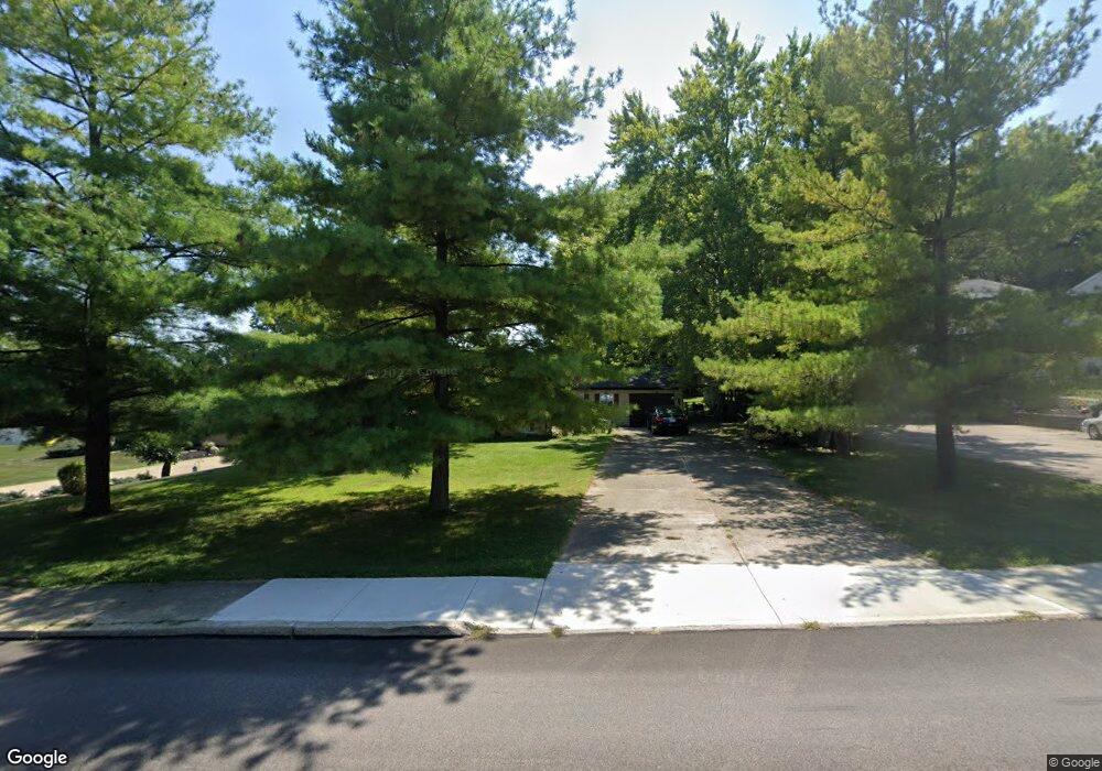
391 State Route 725 W Camden, OH 45311
Estimated Value: $162,000 - $218,000
3
Beds
1
Bath
1,684
Sq Ft
$110/Sq Ft
Est. Value
About This Home
This home is located at 391 State Route 725 W, Camden, OH 45311 and is currently estimated at $184,518, approximately $109 per square foot. 391 State Route 725 W is a home located in Preble County with nearby schools including Preble Shawnee Elementary School, West Elkton Intermediate School, and Preble Shawnee Junior/Senior High School.
Ownership History
Date
Name
Owned For
Owner Type
Purchase Details
Closed on
Mar 19, 2012
Sold by
Secretary Of Housing & Urban Development
Bought by
Groh Andrew and Groh Amanda
Current Estimated Value
Purchase Details
Closed on
Sep 23, 2011
Sold by
Gmac Mortgage Llc
Bought by
Secretary Of Housing & Urban Development
Purchase Details
Closed on
Feb 15, 2011
Sold by
Gmac Mortgage Llc
Bought by
Secretary Of Housing & Urban Development
Purchase Details
Closed on
Feb 11, 2010
Sold by
Crank Roy R
Bought by
Gmac Mortgage Llc
Purchase Details
Closed on
Jun 27, 2005
Sold by
Via Brian E and Via Jeanne S
Bought by
Crank Roy R
Home Financials for this Owner
Home Financials are based on the most recent Mortgage that was taken out on this home.
Original Mortgage
$95,600
Interest Rate
8.45%
Mortgage Type
Purchase Money Mortgage
Create a Home Valuation Report for This Property
The Home Valuation Report is an in-depth analysis detailing your home's value as well as a comparison with similar homes in the area
Home Values in the Area
Average Home Value in this Area
Purchase History
| Date | Buyer | Sale Price | Title Company |
|---|---|---|---|
| Groh Andrew | $30,000 | Home Services Title Llc | |
| Secretary Of Housing & Urban Development | -- | None Available | |
| Secretary Of Housing & Urban Development | -- | Attorney | |
| Gmac Mortgage Llc | $120,427 | None Available | |
| Crank Roy R | $119,500 | Southwest Equity Title Agenc |
Source: Public Records
Mortgage History
| Date | Status | Borrower | Loan Amount |
|---|---|---|---|
| Previous Owner | Crank Roy R | $95,600 |
Source: Public Records
Tax History Compared to Growth
Tax History
| Year | Tax Paid | Tax Assessment Tax Assessment Total Assessment is a certain percentage of the fair market value that is determined by local assessors to be the total taxable value of land and additions on the property. | Land | Improvement |
|---|---|---|---|---|
| 2024 | $1,389 | $34,310 | $6,970 | $27,340 |
| 2023 | $1,389 | $34,310 | $6,970 | $27,340 |
| 2022 | $1,189 | $27,660 | $6,410 | $21,250 |
| 2021 | $1,318 | $27,660 | $6,410 | $21,250 |
| 2020 | $1,270 | $27,660 | $6,410 | $21,250 |
| 2019 | $1,348 | $28,390 | $6,410 | $21,980 |
| 2018 | $1,388 | $28,390 | $6,410 | $21,980 |
| 2017 | $1,388 | $28,390 | $6,410 | $21,980 |
| 2016 | $1,121 | $24,020 | $6,200 | $17,820 |
| 2014 | $1,336 | $24,020 | $6,200 | $17,820 |
| 2013 | $1,336 | $27,020 | $6,195 | $20,825 |
Source: Public Records
Map
Nearby Homes
- 388 W Hendricks St
- 407 W Central Ave
- 131 S Lafayette St
- 103 Katherine Ct
- 471 Camden West Elkton Rd
- 725 Sr
- 759 Barnetts Mill Rd
- 679 Oxford Germantown Rd
- 1246 Oxford Germantown Rd
- 1222 Oxford Germantown Rd
- 314 Lakengren Dr
- 0 Oxford Germantown Rd
- 820 Lars Cove
- 817 Old Norse Dr
- 0 Lars Cove Unit 1745954
- 805 Brande Dr
- 787 Baltic Dr
- 250 Lakengren Dr
- 0 Valhalla Cove Unit 941078
- 127 Voyage Dr
- 391 W Central Ave
- 389 State Route 725 W
- 393 State Route 725 W
- 395 State Route 725 W
- 395 W Central Ave
- 397 State Route 725 W
- 397 W Central Ave
- 328 W Hendricks St
- 387 State Route 725 W
- 357 State Route 725 W
- 338 W Hendricks St
- 399 State Route 725 W
- 364 W Hendricks St
- 356 State Route 725 W
- 356 W Hendricks St
- 401 State Route 725 W
- 401 W Central Ave
- 323 State Route 725 W
- 326 State Route 725 W
- 49 Douglas St