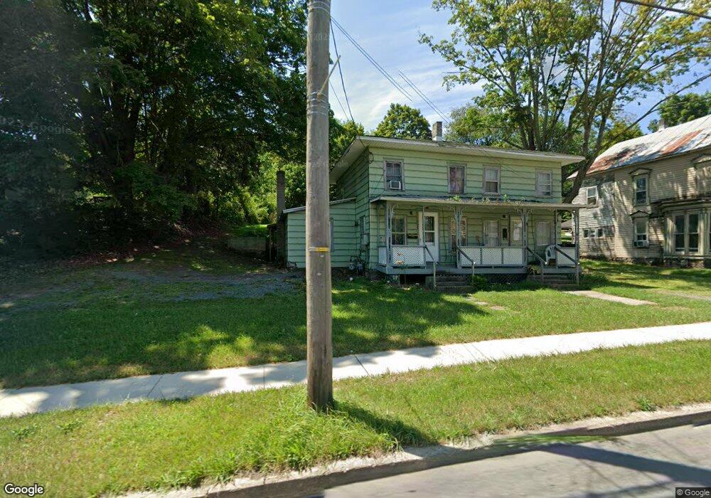
391 Troy St Unit 393 Canton, PA 17724
Estimated Value: $66,000 - $110,000
6
Beds
6
Baths
--
Sq Ft
0.45
Acres
About This Home
This home is located at 391 Troy St Unit 393, Canton, PA 17724 and is currently estimated at $85,522. 391 Troy St Unit 393 is a home located in Bradford County with nearby schools including Canton Area Elementary School and Canton Junior/Senior High School.
Ownership History
Date
Name
Owned For
Owner Type
Purchase Details
Closed on
Mar 9, 2012
Sold by
Hertel Janice M and Hertel Richard C
Bought by
Hoover David A and Hoover Andrea R
Current Estimated Value
Home Financials for this Owner
Home Financials are based on the most recent Mortgage that was taken out on this home.
Original Mortgage
$20,000
Outstanding Balance
$13,817
Interest Rate
3.99%
Mortgage Type
New Conventional
Estimated Equity
$71,705
Purchase Details
Closed on
Dec 12, 2005
Sold by
Hertel Janice M
Bought by
Hertel Janice M
Create a Home Valuation Report for This Property
The Home Valuation Report is an in-depth analysis detailing your home's value as well as a comparison with similar homes in the area
Home Values in the Area
Average Home Value in this Area
Purchase History
| Date | Buyer | Sale Price | Title Company |
|---|---|---|---|
| Hoover David A | $40,000 | None Available | |
| Hertel Janice M | $12,000 | None Available |
Source: Public Records
Mortgage History
| Date | Status | Borrower | Loan Amount |
|---|---|---|---|
| Open | Hoover David A | $20,000 |
Source: Public Records
Tax History Compared to Growth
Tax History
| Year | Tax Paid | Tax Assessment Tax Assessment Total Assessment is a certain percentage of the fair market value that is determined by local assessors to be the total taxable value of land and additions on the property. | Land | Improvement |
|---|---|---|---|---|
| 2025 | $1,414 | $20,600 | $0 | $0 |
| 2024 | $1,328 | $20,600 | $0 | $0 |
| 2023 | $1,328 | $20,600 | $0 | $0 |
| 2022 | $1,326 | $20,600 | $0 | $0 |
| 2021 | $1,321 | $20,600 | $0 | $0 |
| 2020 | $1,309 | $20,600 | $0 | $0 |
| 2019 | $1,308 | $20,600 | $0 | $0 |
| 2018 | $1,272 | $20,600 | $0 | $0 |
| 2017 | $1,258 | $20,600 | $0 | $0 |
| 2016 | -- | $20,600 | $0 | $0 |
| 2015 | -- | $20,600 | $0 | $0 |
| 2014 | $644 | $20,600 | $0 | $0 |
Source: Public Records
Map
Nearby Homes
- 386 Troy St
- 290 Troy St
- 127 Troy St
- 0 Upper Mountain Rd
- 94 N Center St
- 85 N Minnequa Ave
- 55 Clinton St
- 49-51 T-329
- Upper Mountain Rd Lot Unit WP001
- 108 S Washington St
- 19 Lovell Ln
- 63 Brann St
- 374 S Minnequa Ave
- 118 E South Ave
- 1616 W Union St
- 1616 W Union Rd
- 417 Furman Rd
- 14751 Route 14
- 7129 Route 14
- 1909 Mill Hill Rd
- 373 Troy St
- 403 Troy St Unit 407
- 359 Troy St
- 427 Troy St
- 55 Alexander Ln
- Lot #7 Pennsylvania 14
- Lot #8 Pennsylvania 14
- Lot #3 Pennsylvania 14
- Lot #6 Pennsylvania 14
- Lot #9 Pennsylvania 14
- Lot #4 Pennsylvania 14
- Lot #5 Pennsylvania 14
- Lot #2 Pennsylvania 14
- 00 Pennsylvania 14
- 14 Crooks Terrace
- 68 W Carson St Unit 64
- 3572 Lower Mountain Rd
- 126 Alexander Ln
- 48 W Carson St
- 19 Crooks Terrace