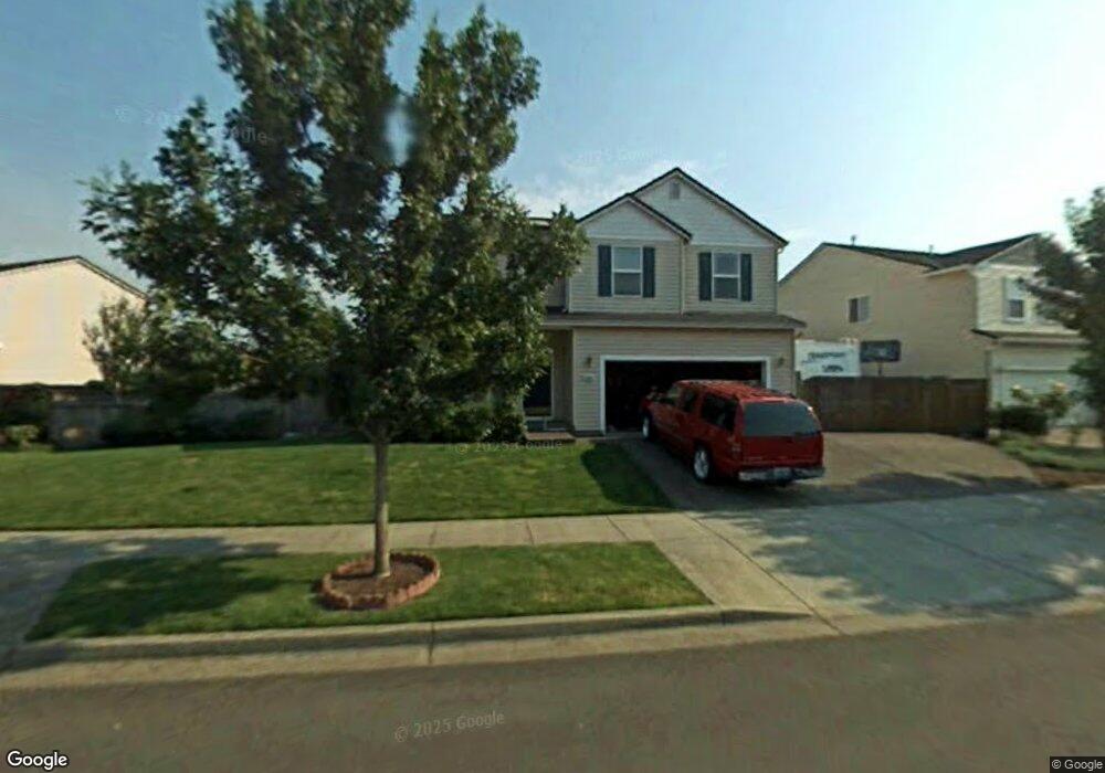
3910 Aerial Way Eugene, OR 97402
Bethel NeighborhoodEstimated Value: $497,253 - $533,000
4
Beds
3
Baths
2,303
Sq Ft
$223/Sq Ft
Est. Value
About This Home
This home is located at 3910 Aerial Way, Eugene, OR 97402 and is currently estimated at $514,063, approximately $223 per square foot. 3910 Aerial Way is a home located in Lane County with nearby schools including Malabon Elementary School, Cascade Middle School, and Willamette High School.
Ownership History
Date
Name
Owned For
Owner Type
Purchase Details
Closed on
Nov 12, 2009
Sold by
Lane Steven C
Bought by
Shaffer Kathy
Current Estimated Value
Home Financials for this Owner
Home Financials are based on the most recent Mortgage that was taken out on this home.
Original Mortgage
$237,616
Outstanding Balance
$153,887
Interest Rate
4.92%
Mortgage Type
FHA
Estimated Equity
$360,176
Purchase Details
Closed on
Dec 20, 2006
Sold by
Lane Linda J
Bought by
Lane Steven C
Home Financials for this Owner
Home Financials are based on the most recent Mortgage that was taken out on this home.
Original Mortgage
$199,500
Interest Rate
6%
Mortgage Type
VA
Purchase Details
Closed on
Jul 28, 1999
Sold by
Centex Homes
Bought by
Lane Steve C and Lane Linda J
Home Financials for this Owner
Home Financials are based on the most recent Mortgage that was taken out on this home.
Original Mortgage
$140,000
Interest Rate
7.64%
Create a Home Valuation Report for This Property
The Home Valuation Report is an in-depth analysis detailing your home's value as well as a comparison with similar homes in the area
Home Values in the Area
Average Home Value in this Area
Purchase History
| Date | Buyer | Sale Price | Title Company |
|---|---|---|---|
| Shaffer Kathy | $242,000 | Fidelity National Title Insu | |
| Lane Steven C | -- | Western Title & Escrow Compa | |
| Lane Steve C | $185,759 | Fidelity National Title Ins |
Source: Public Records
Mortgage History
| Date | Status | Borrower | Loan Amount |
|---|---|---|---|
| Open | Shaffer Kathy | $237,616 | |
| Previous Owner | Lane Steven C | $199,500 | |
| Previous Owner | Lane Steve C | $140,000 |
Source: Public Records
Tax History
| Year | Tax Paid | Tax Assessment Tax Assessment Total Assessment is a certain percentage of the fair market value that is determined by local assessors to be the total taxable value of land and additions on the property. | Land | Improvement |
|---|---|---|---|---|
| 2025 | $5,416 | $311,342 | -- | -- |
| 2024 | $5,279 | $302,274 | -- | -- |
| 2023 | $5,279 | $293,470 | -- | -- |
| 2022 | $4,914 | $284,923 | $0 | $0 |
| 2021 | $4,810 | $276,625 | $0 | $0 |
| 2020 | $4,670 | $268,568 | $0 | $0 |
| 2019 | $4,440 | $260,746 | $0 | $0 |
| 2018 | $4,316 | $245,779 | $0 | $0 |
| 2017 | $4,125 | $245,779 | $0 | $0 |
| 2016 | $4,020 | $238,620 | $0 | $0 |
| 2015 | $3,941 | $231,670 | $0 | $0 |
| 2014 | $3,881 | $224,922 | $0 | $0 |
Source: Public Records
Map
Nearby Homes
- 3906 Century Dr
- 3717 Riviera
- 0 Pacific Hwy W
- 4070 Barger Dr
- 3820 Dove Ln
- 4114 Jessen Dr
- 1800 Lakewood Ct Unit 24
- 1800 Lakewood Ct Unit 127
- 1800 Lakewood Ct Unit 158
- 1800 Lakewood Ct Unit 36
- 2002 Kintyre St
- 1519 Taney St
- 1385 Taney St
- 2544 Rosebay St
- 3461 Concord St
- 4280 Avalon St
- 1384 Jacobs Dr
- 1219 Waite St
- 3970 Marshall Ave
- 2418 Kalmia St
Your Personal Tour Guide
Ask me questions while you tour the home.