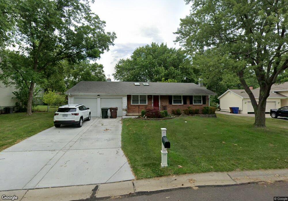
3910 Bellvue Dr Saint Peters, MO 63376
Estimated Value: $271,000 - $322,000
3
Beds
3
Baths
1,334
Sq Ft
$230/Sq Ft
Est. Value
About This Home
This home is located at 3910 Bellvue Dr, Saint Peters, MO 63376 and is currently estimated at $306,473, approximately $229 per square foot. 3910 Bellvue Dr is a home located in St. Charles County with nearby schools including Harris Elementary School, Jefferson Intermediate School, and Hardin Middle School.
Ownership History
Date
Name
Owned For
Owner Type
Purchase Details
Closed on
May 12, 2017
Sold by
Macke Mark W and Macke Laurie A
Bought by
Macke David R
Current Estimated Value
Home Financials for this Owner
Home Financials are based on the most recent Mortgage that was taken out on this home.
Original Mortgage
$137,800
Outstanding Balance
$114,598
Interest Rate
4.1%
Mortgage Type
New Conventional
Estimated Equity
$191,875
Purchase Details
Closed on
Sep 13, 2013
Sold by
Delaney Sharon D and Delaney Thomas C
Bought by
Macke Mark and Macke Laurie
Create a Home Valuation Report for This Property
The Home Valuation Report is an in-depth analysis detailing your home's value as well as a comparison with similar homes in the area
Home Values in the Area
Average Home Value in this Area
Purchase History
| Date | Buyer | Sale Price | Title Company |
|---|---|---|---|
| Macke David R | -- | Freedom Title | |
| Macke Mark | $132,400 | Ctc |
Source: Public Records
Mortgage History
| Date | Status | Borrower | Loan Amount |
|---|---|---|---|
| Open | Macke David R | $137,800 |
Source: Public Records
Tax History Compared to Growth
Tax History
| Year | Tax Paid | Tax Assessment Tax Assessment Total Assessment is a certain percentage of the fair market value that is determined by local assessors to be the total taxable value of land and additions on the property. | Land | Improvement |
|---|---|---|---|---|
| 2025 | $3,416 | $49,447 | -- | -- |
| 2024 | $3,416 | $45,692 | -- | -- |
| 2023 | $3,409 | $45,692 | $0 | $0 |
| 2022 | $2,941 | $36,818 | $0 | $0 |
| 2021 | $2,936 | $36,818 | $0 | $0 |
| 2020 | $2,651 | $32,392 | $0 | $0 |
| 2019 | $2,632 | $32,392 | $0 | $0 |
| 2018 | $2,400 | $28,350 | $0 | $0 |
| 2017 | $2,389 | $28,350 | $0 | $0 |
| 2016 | $2,290 | $27,160 | $0 | $0 |
| 2015 | $2,286 | $27,160 | $0 | $0 |
| 2014 | $2,296 | $26,933 | $0 | $0 |
Source: Public Records
Map
Nearby Homes
- 1410 Ticonderoga Dr
- 1504 Ticonderoga Dr
- 1309 Cave Springs Estate Dr
- 4035 Manhattan Ave
- 1705 Cap Au Gris Dr
- 102 Fountainview Dr
- 303 Laurel Lea Dr
- 3830 Jackson Trail
- 43 Plum Tree Dr
- 113 Berry Manor Cir
- 3713 Somerville Dr
- 17 Avocado Tree Cir
- 2221 Muegge Rd
- 2107 Golden Hills
- 132 Plum Tree Dr
- 2048 Willow Trail
- 2223 Highland Hill Dr Unit E
- 798 Delray Dr Unit K
- 2113 Seven Oaks Dr
- 897 Delray Dr Unit B
- 3906 Bellvue Dr
- 3914 Bellvue Dr
- 1342 Blue Ridge Dr
- 1346 Blue Ridge Dr
- 3918 Bellvue Dr
- 1363 Ticonderoga Dr
- 3907 Bellvue Dr
- 3911 Bellvue Dr
- 1350 Blue Ridge Dr
- 3915 Bellvue Dr
- 1355 Ticonderoga Dr
- 3903 Bellvue Dr
- 1368 Cave Springs Estate Dr
- 1372 Cave Springs Estate Dr
- 1354 Blue Ridge Dr
- 1407 Ticonderoga Dr
- 1351 Ticonderoga Dr
- 7 Kingston Ct
- 1345 Blue Ridge Dr
- 1334 Blue Ridge Dr