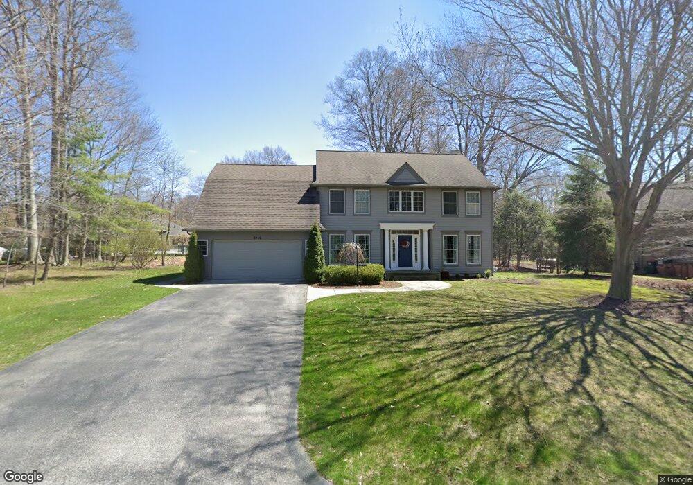
3910 Lake Point Dr Norton Shores, MI 49441
Estimated Value: $455,000 - $617,000
5
Beds
4
Baths
3,484
Sq Ft
$148/Sq Ft
Est. Value
About This Home
This home is located at 3910 Lake Point Dr, Norton Shores, MI 49441 and is currently estimated at $516,396, approximately $148 per square foot. 3910 Lake Point Dr is a home located in Muskegon County with nearby schools including Mona Shores High School, Edgewood Elementary Academy, and West Shore Lutheran School.
Ownership History
Date
Name
Owned For
Owner Type
Purchase Details
Closed on
Aug 26, 2010
Sold by
Boersma Jeffrey A and Boersma Michelle S
Bought by
Graham Brian S
Current Estimated Value
Home Financials for this Owner
Home Financials are based on the most recent Mortgage that was taken out on this home.
Original Mortgage
$202,500
Outstanding Balance
$134,394
Interest Rate
4.54%
Mortgage Type
New Conventional
Estimated Equity
$382,002
Create a Home Valuation Report for This Property
The Home Valuation Report is an in-depth analysis detailing your home's value as well as a comparison with similar homes in the area
Home Values in the Area
Average Home Value in this Area
Purchase History
| Date | Buyer | Sale Price | Title Company |
|---|---|---|---|
| Graham Brian S | $225,000 | Chicago Title |
Source: Public Records
Mortgage History
| Date | Status | Borrower | Loan Amount |
|---|---|---|---|
| Open | Graham Brian S | $202,500 |
Source: Public Records
Tax History Compared to Growth
Tax History
| Year | Tax Paid | Tax Assessment Tax Assessment Total Assessment is a certain percentage of the fair market value that is determined by local assessors to be the total taxable value of land and additions on the property. | Land | Improvement |
|---|---|---|---|---|
| 2025 | $5,341 | $203,500 | $0 | $0 |
| 2024 | $4,187 | $189,000 | $0 | $0 |
| 2023 | $3,999 | $162,600 | $0 | $0 |
| 2022 | $4,874 | $157,200 | $0 | $0 |
| 2021 | $4,736 | $147,000 | $0 | $0 |
| 2020 | $4,683 | $149,200 | $0 | $0 |
| 2019 | $4,597 | $144,300 | $0 | $0 |
| 2018 | $4,489 | $119,500 | $0 | $0 |
| 2017 | $4,385 | $119,200 | $0 | $0 |
| 2016 | $3,396 | $115,700 | $0 | $0 |
| 2015 | -- | $113,400 | $0 | $0 |
| 2014 | $4,074 | $110,400 | $0 | $0 |
| 2013 | -- | $106,400 | $0 | $0 |
Source: Public Records
Map
Nearby Homes
- 3854 Greuling Rd
- 3920 Braeburn Dr
- 3684 Harris Dr
- 1162 Elsa Ave
- 1243 Crandall Ave
- 1012 Beechtree Ct
- 4230 Braeburn Ct
- 4235 Braeburn Ct
- 740 Bridgeview Bay Dr
- 3891 Wickham Dr
- 1045 Le Roux Rd Unit 178
- 3320 Davis Rd
- 1812 Ritter Hills Dr
- 3658 Lake Harbor Rd
- 3246 Royal Oak Rd
- 1848 Forest Park Rd
- 481 Seminole Rd
- 4666 Heinicke St
- 1558 Brookwood Dr
- 1947 Spencer Dr
- 3922 Lake Point Dr
- 3925 Harbor Point Dr
- 3895 Harbor Point Dr
- 3880 Lake Point Dr
- 3925 Lake Point Dr
- 3935 Harbor Point Dr
- 3885 Lake Point Dr
- 3950 Lake Point Dr
- 3875 Lake Point Dr
- 3935 Lake Point Dr
- 3953 Harbor Point Dr
- 3880 Harbor Point Dr
- 1132 North Ln
- 3865 Lake Point Dr
- 3908 Harbor Point Dr
- 3970 Lake Point Dr
- 3961 Harbor Point Dr
- 1148 North Ln
- 1164 North Ln
- 3940 Harbor Point Dr