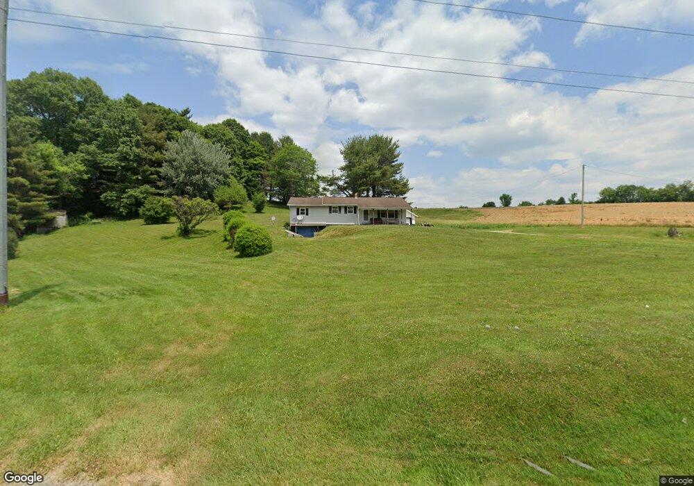
3910 State Route 13 NE New Lexington, OH 43764
Estimated Value: $134,000 - $217,371
3
Beds
1
Bath
1,484
Sq Ft
$126/Sq Ft
Est. Value
About This Home
This home is located at 3910 State Route 13 NE, New Lexington, OH 43764 and is currently estimated at $187,593, approximately $126 per square foot. 3910 State Route 13 NE is a home located in Perry County with nearby schools including New Lexington Elementary School, Junction City Elementary School, and New Lexington Middle School.
Ownership History
Date
Name
Owned For
Owner Type
Purchase Details
Closed on
Oct 3, 2008
Sold by
Potter John E and Potter John
Bought by
Potter John E and Potter Hazel L
Current Estimated Value
Create a Home Valuation Report for This Property
The Home Valuation Report is an in-depth analysis detailing your home's value as well as a comparison with similar homes in the area
Home Values in the Area
Average Home Value in this Area
Purchase History
| Date | Buyer | Sale Price | Title Company |
|---|---|---|---|
| Potter John E | -- | None Available |
Source: Public Records
Tax History Compared to Growth
Tax History
| Year | Tax Paid | Tax Assessment Tax Assessment Total Assessment is a certain percentage of the fair market value that is determined by local assessors to be the total taxable value of land and additions on the property. | Land | Improvement |
|---|---|---|---|---|
| 2024 | $1,267 | $37,270 | $5,970 | $31,300 |
| 2023 | $1,267 | $37,270 | $5,970 | $31,300 |
| 2022 | $1,114 | $29,710 | $5,240 | $24,470 |
| 2021 | $1,113 | $29,710 | $5,240 | $24,470 |
| 2020 | $1,107 | $29,710 | $5,240 | $24,470 |
| 2019 | $983 | $26,380 | $4,990 | $21,390 |
| 2018 | $982 | $26,380 | $4,990 | $21,390 |
| 2017 | $1,008 | $26,380 | $4,990 | $21,390 |
| 2016 | $1,051 | $28,150 | $6,830 | $21,320 |
| 2015 | $1,047 | $28,150 | $6,830 | $21,320 |
| 2014 | $982 | $28,150 | $6,830 | $21,320 |
| 2013 | $2,559 | $28,150 | $6,830 | $21,320 |
| 2012 | -- | $28,150 | $6,830 | $21,320 |
Source: Public Records
Map
Nearby Homes
- 6045 Township Road 173 NE
- 5353 Buckeye Valley Rd NE
- 3298 State Route 37 E
- 210 Academy St
- 418 W Broadway St Unit Rear
- 221 W Broadway St
- 3773 State Route 345 NE
- 255 Kennedy Dr
- 139 E Jefferson St
- 4890 Township Road 122 NW
- 851 Township Road 421 SE
- 318 N Pleasant St
- 200 N Main St
- 551 W Brown St
- 524 Shawnee St
- 314 W Brown St
- 603 Shawnee St
- 315 W Brown St
- 105 S Maple Heights
- 211 S High St
- 4010 State Route 13 NE
- 5066 State Route 13 NE
- 4964 State Route #13 NE
- 4964 State Route #13 NE
- 4964 State Route 13 NE
- 5171 State Route 13 NE
- 5066 State Route 13 NE
- 5030 State Route 13 NE
- 4056 State Route 13 NE
- 3927 State Route 13 NE
- 4108 State Route 13 NE
- 3853 Township Road 149 NE
- 4021 State Route 13 NE
- 4058 State Route 13 NE
- 4076 State Route 13 NE
- 4094 State Route 13 NE
- 3740 State Route 13 NE
- 4100 State Route 13 NE
- 4095 State Route 13 NE
- 3667 State Route 13 NE